Las Ovejas Creek Topo Map Texas
To zoom in, hover over the map of Las Ovejas Creek
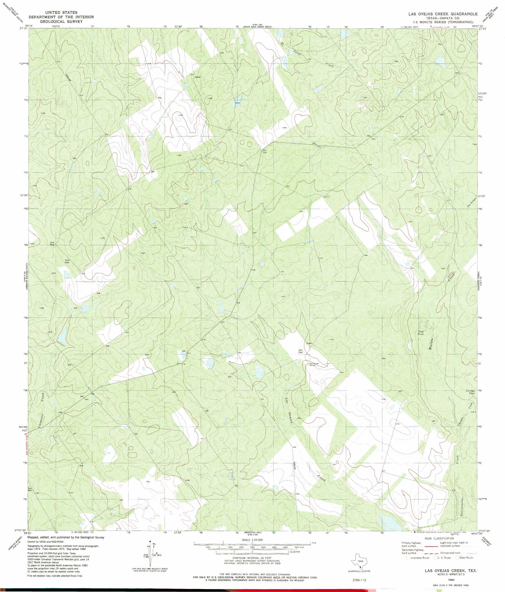
USGS Topo Quad 27099b2 - 1:24,000 scale
| Topo Map Name: | Las Ovejas Creek |
| USGS Topo Quad ID: | 27099b2 |
| Print Size: | ca. 21 1/4" wide x 27" high |
| Southeast Coordinates: | 27.125° N latitude / 99.125° W longitude |
| Map Center Coordinates: | 27.1875° N latitude / 99.1875° W longitude |
| U.S. State: | TX |
| Filename: | o27099b2.jpg |
| Download Map JPG Image: | Las Ovejas Creek topo map 1:24,000 scale |
| Map Type: | Topographic |
| Topo Series: | 7.5´ |
| Map Scale: | 1:24,000 |
| Source of Map Images: | United States Geological Survey (USGS) |
| Alternate Map Versions: |
Las Ovejas Creek TX 1980, updated 1980 Download PDF Buy paper map Las Ovejas Creek TX 2010 Download PDF Buy paper map Las Ovejas Creek TX 2013 Download PDF Buy paper map Las Ovejas Creek TX 2016 Download PDF Buy paper map |
1:24,000 Topo Quads surrounding Las Ovejas Creek
Laredo South |
Blancas Creek North |
Retama Creek |
Mirando City |
Oilton |
O'Keefe Lake |
Blancas Creek South |
Agua Azul Creek West |
Agua Azul Creek East |
Albercas Ranch |
Arroyo Salado West |
Arroyo Salado East |
Las Ovejas Creek |
Chargos Creek |
Thompsonville |
San Ygnacio |
Arroyo Burro |
Mogotes Hill |
Escobas |
Randado |
Zapata Nw |
Zapata |
Arroyo Veleno |
Arroyo Huisache |
Guerra |
> Back to 27099a1 at 1:100,000 scale
> Back to 27098a1 at 1:250,000 scale
> Back to U.S. Topo Maps home
Las Ovejas Creek topo map: Gazetteer
Las Ovejas Creek: Dams
L E Bruni Lake Number 3 Dam elevation 164m 538′Las Ovejas Creek: Reservoirs
L E Bruni Lake Number 3 elevation 164m 538′Tasa Tank elevation 134m 439′
Las Ovejas Creek: Streams
Chargos Creek elevation 131m 429′Mulato Creek elevation 131m 429′
Las Ovejas Creek: Valleys
Dos Arroyos elevation 140m 459′Las Ovejas Creek digital topo map on disk
Buy this Las Ovejas Creek topo map showing relief, roads, GPS coordinates and other geographical features, as a high-resolution digital map file on DVD: