Mirando City Topo Map Texas
To zoom in, hover over the map of Mirando City
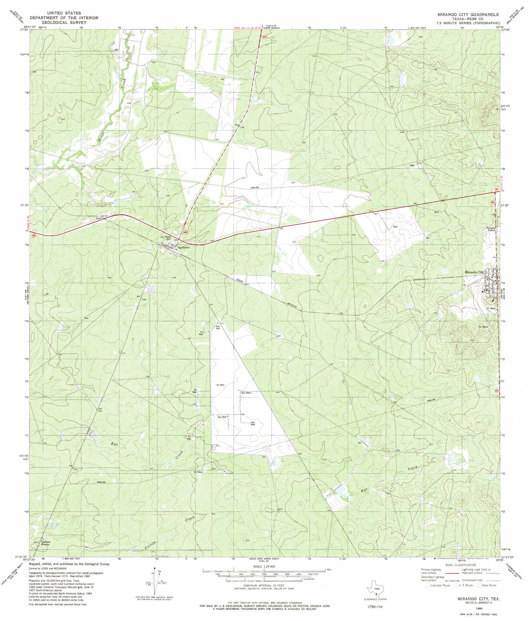
USGS Topo Quad 27099d1 - 1:24,000 scale
| Topo Map Name: | Mirando City |
| USGS Topo Quad ID: | 27099d1 |
| Print Size: | ca. 21 1/4" wide x 27" high |
| Southeast Coordinates: | 27.375° N latitude / 99° W longitude |
| Map Center Coordinates: | 27.4375° N latitude / 99.0625° W longitude |
| U.S. State: | TX |
| Filename: | o27099d1.jpg |
| Download Map JPG Image: | Mirando City topo map 1:24,000 scale |
| Map Type: | Topographic |
| Topo Series: | 7.5´ |
| Map Scale: | 1:24,000 |
| Source of Map Images: | United States Geological Survey (USGS) |
| Alternate Map Versions: |
Mirando City TX 1980, updated 1980 Download PDF Buy paper map Mirando City TX 2010 Download PDF Buy paper map Mirando City TX 2013 Download PDF Buy paper map Mirando City TX 2016 Download PDF Buy paper map |
1:24,000 Topo Quads surrounding Mirando City
Cibolo Ranch |
Piedra Parada Tank |
Piedra Parada Ranch |
Mills Bennett Nw |
Mills Bennett |
Tios Creek |
Burrito Tank |
Shipp Ranch |
Mills Bennett Sw |
San Pablo |
Blancas Creek North |
Retama Creek |
Mirando City |
Oilton |
Bruni |
Blancas Creek South |
Agua Azul Creek West |
Agua Azul Creek East |
Albercas Ranch |
Bruni Se |
Arroyo Salado East |
Las Ovejas Creek |
Chargos Creek |
Thompsonville |
Armstrong Ranch |
> Back to 27099a1 at 1:100,000 scale
> Back to 27098a1 at 1:250,000 scale
> Back to U.S. Topo Maps home
Mirando City topo map: Gazetteer
Mirando City: Populated Places
Aguilares elevation 183m 600′Aguilares Acres Colonia elevation 178m 583′
Mirando City elevation 231m 757′
Mirando City Addition Colonia elevation 241m 790′
Ranchitos los Veteranos Colonia elevation 216m 708′
Mirando City: Summits
Cerrito Prieto elevation 172m 564′Mirando City digital topo map on disk
Buy this Mirando City topo map showing relief, roads, GPS coordinates and other geographical features, as a high-resolution digital map file on DVD: