Deer Park Nw Topo Map Florida
To zoom in, hover over the map of Deer Park Nw
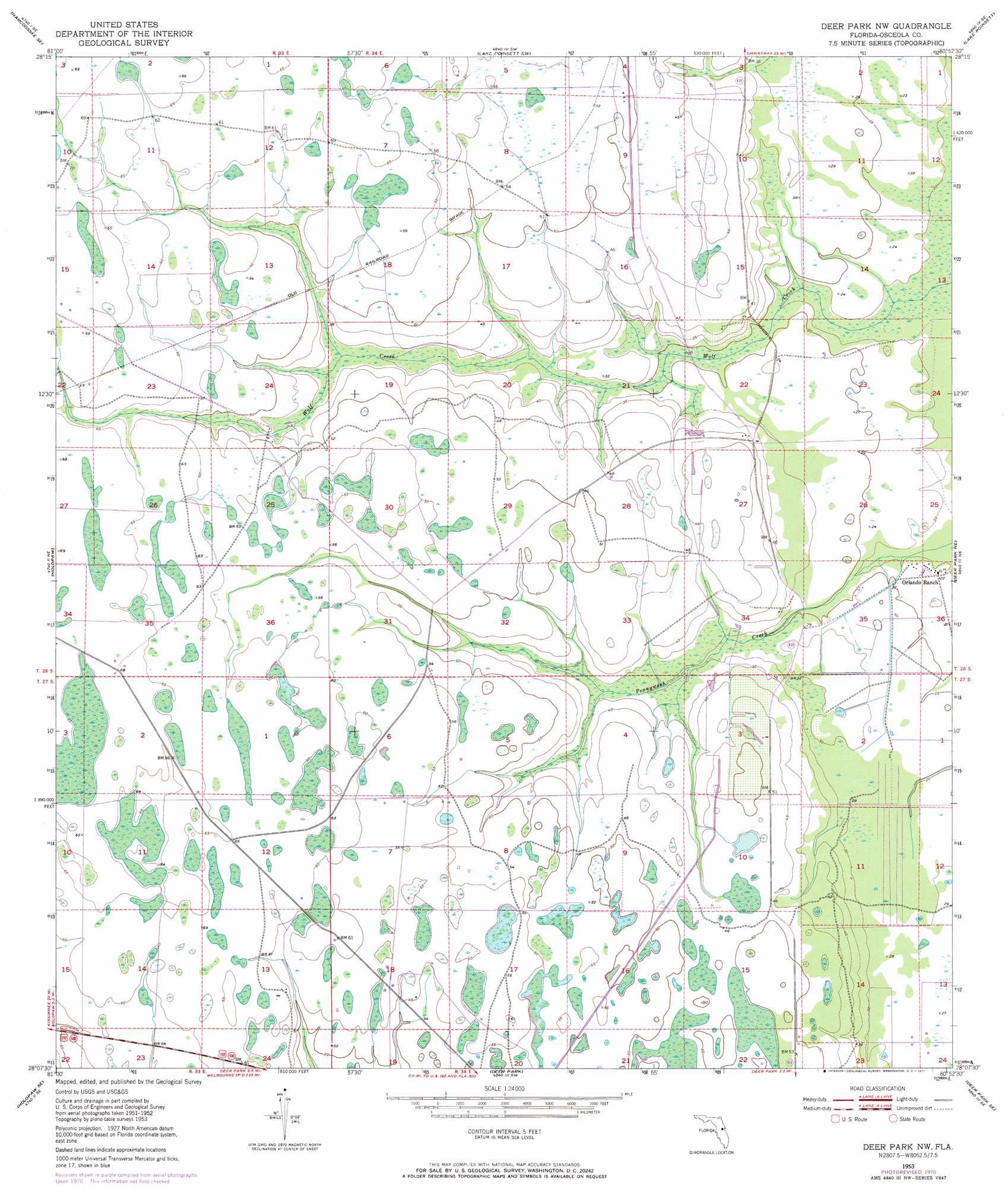
USGS Topo Quad 28080b8 - 1:24,000 scale
| Topo Map Name: | Deer Park Nw |
| USGS Topo Quad ID: | 28080b8 |
| Print Size: | ca. 21 1/4" wide x 27" high |
| Southeast Coordinates: | 28.125° N latitude / 80.875° W longitude |
| Map Center Coordinates: | 28.1875° N latitude / 80.9375° W longitude |
| U.S. State: | FL |
| Filename: | O28080B8.jpg |
| Download Map JPG Image: | Deer Park Nw topo map 1:24,000 scale |
| Map Type: | Topographic |
| Topo Series: | 7.5´ |
| Map Scale: | 1:24,000 |
| Source of Map Images: | United States Geological Survey (USGS) |
| Alternate Map Versions: |
Deer Park NW FL 1953, updated 1954 Download PDF Buy paper map Deer Park NW FL 1953, updated 1965 Download PDF Buy paper map Deer Park NW FL 1953, updated 1971 Download PDF Buy paper map Deer Park NW FL 1953, updated 1972 Download PDF Buy paper map Deer Park NW FL 2012 Download PDF Buy paper map Deer Park NW FL 2015 Download PDF Buy paper map |
1:24,000 Topo Quads surrounding Deer Park Nw
Narcoossee Nw |
Narcoossee Ne |
Lake Poinsett Nw |
Sharpes |
Courtenay |
Narcoossee |
Narcoossee Se |
Lake Poinsett Sw |
Lake Poinsett |
Cocoa |
Ashton |
Holopaw |
Deer Park Nw |
Deer Park Ne |
Eau Gallie |
Holopaw Sw |
Holopaw Se |
Deer Park |
Deer Park Se |
Melbourne West |
Lake Marian Nw |
Lake Marian Ne |
Kenansville |
Kenansville Ne |
Fellsmere Nw |
> Back to 28080a1 at 1:100,000 scale
> Back to 28080a1 at 1:250,000 scale
> Back to U.S. Topo Maps home
No gazetteer data is available for the Deer Park Nw topo map sheet.
Deer Park Nw digital topo map on disk
Buy this Deer Park Nw topo map showing relief, roads, GPS coordinates and other geographical features, as a high-resolution digital map file on DVD: