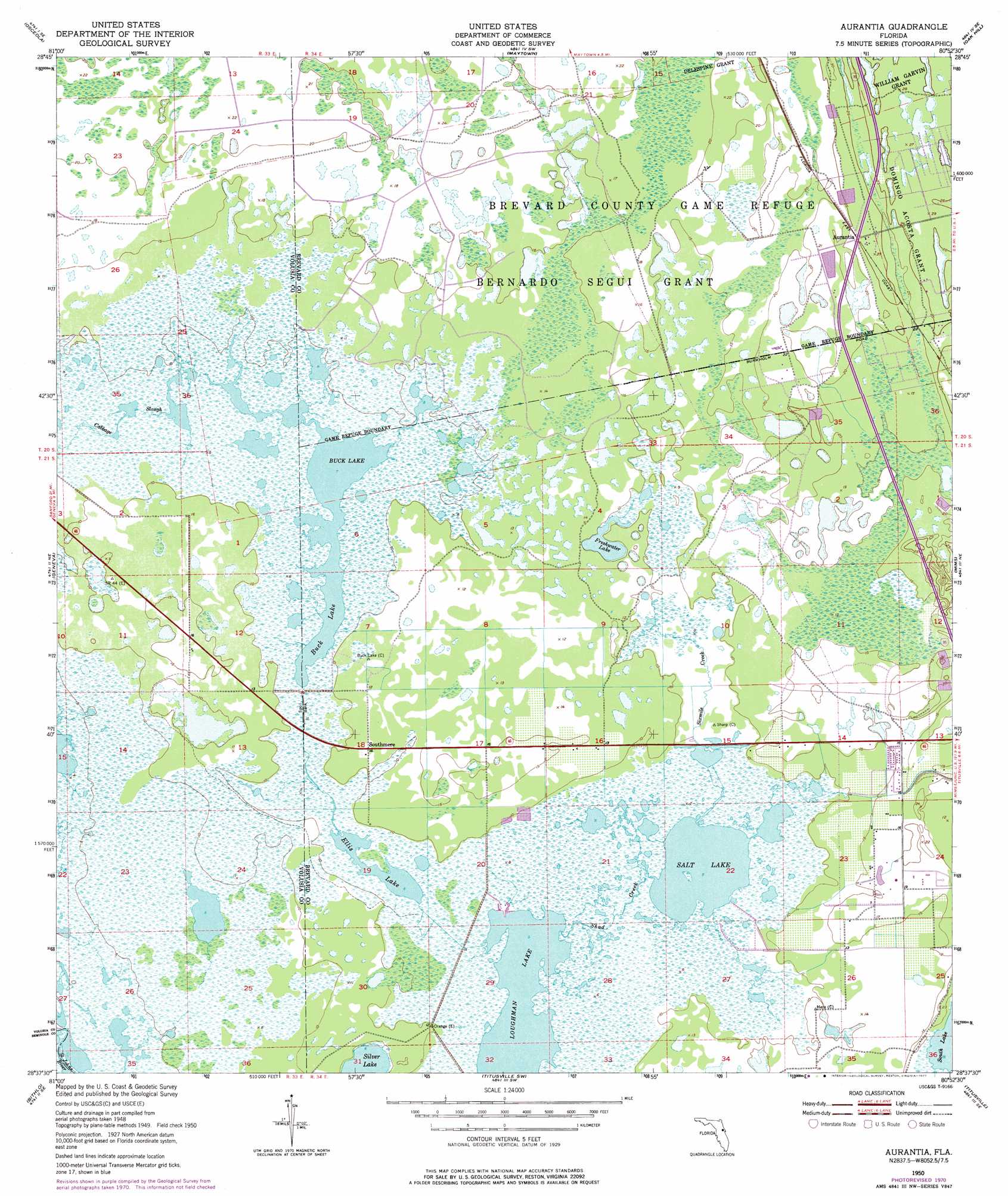
Aurantia Topo Map Florida
To zoom in, hover over the map of Aurantia
USGS Topo Quad 28080f8 - 1:24,000 scale
| Topo Map Name: | Aurantia |
| USGS Topo Quad ID: | 28080f8 |
| Print Size: | ca. 21 1/4" wide x 27" high |
| Southeast Coordinates: | 28.625° N latitude / 80.875° W longitude |
| Map Center Coordinates: | 28.6875° N latitude / 80.9375° W longitude |
| U.S. State: | FL |
| Filename: | O28080F8.jpg |
| Download Map JPG Image: | Aurantia topo map 1:24,000 scale |
| Map Type: | Topographic |
| Topo Series: | 7.5´ |
| Map Scale: | 1:24,000 |
| Source of Map Images: | United States Geological Survey (USGS) |
| Alternate Map Versions: |
Aurantia FL 1950, updated 1952 Download PDF Buy paper map Aurantia FL 1950, updated 1964 Download PDF Buy paper map Aurantia FL 1950, updated 1972 Download PDF Buy paper map Aurantia FL 1950, updated 1977 Download PDF Buy paper map Aurantia FL 1950, updated 1977 Download PDF Buy paper map Aurantia FL 2012 Download PDF Buy paper map Aurantia FL 2015 Download PDF Buy paper map |
1:24,000 Topo Quads surrounding Aurantia
Lake Helen |
Lake Ashby |
Edgewater |
Ariel |
|
Osteen |
Osceola |
Maytown |
Oak Hill |
Pardon Island |
Oviedo |
Geneva |
Aurantia |
Mims |
Wilson |
Oviedo Sw |
Bithlo |
Titusville Sw |
Titusville |
Orsino |
Narcoossee Nw |
Narcoossee Ne |
Lake Poinsett Nw |
Sharpes |
Courtenay |
> Back to 28080e1 at 1:100,000 scale
> Back to 28080a1 at 1:250,000 scale
> Back to U.S. Topo Maps home
Aurantia topo map: Gazetteer
Aurantia: Guts
Cabbage Slough elevation 2m 6′Shad Creek elevation 2m 6′
Sixmile Creek elevation 3m 9′
Aurantia: Lakes
Buck Lake elevation 2m 6′Ellis Lake elevation 1m 3′
Freshwater Lake elevation 2m 6′
Loughman Lake elevation 1m 3′
Salt Lake elevation 1m 3′
Silver Lake elevation 1m 3′
South Lake elevation 5m 16′
Aurantia: Parks
Brevard County Game Refuge elevation 5m 16′Aurantia: Populated Places
Aurantia elevation 7m 22′Southmere elevation 3m 9′
Aurantia: Post Offices
Aurantia Post Office (historical) elevation 7m 22′Aurantia digital topo map on disk
Buy this Aurantia topo map showing relief, roads, GPS coordinates and other geographical features, as a high-resolution digital map file on DVD: