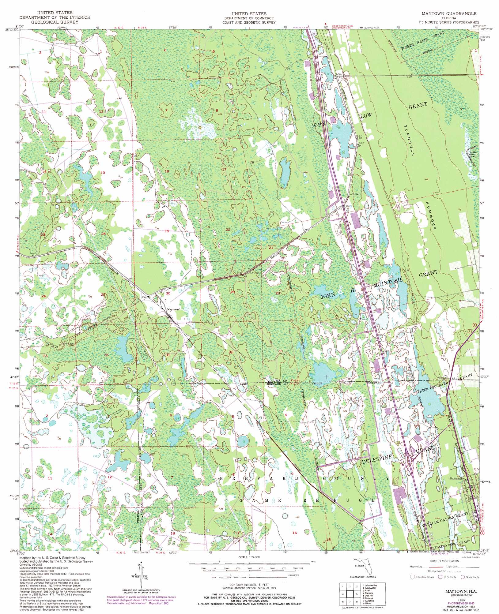
Maytown Topo Map Florida
To zoom in, hover over the map of Maytown
USGS Topo Quad 28080g8 - 1:24,000 scale
| Topo Map Name: | Maytown |
| USGS Topo Quad ID: | 28080g8 |
| Print Size: | ca. 21 1/4" wide x 27" high |
| Southeast Coordinates: | 28.75° N latitude / 80.875° W longitude |
| Map Center Coordinates: | 28.8125° N latitude / 80.9375° W longitude |
| U.S. State: | FL |
| Filename: | O28080G8.jpg |
| Download Map JPG Image: | Maytown topo map 1:24,000 scale |
| Map Type: | Topographic |
| Topo Series: | 7.5´ |
| Map Scale: | 1:24,000 |
| Source of Map Images: | United States Geological Survey (USGS) |
| Alternate Map Versions: |
Maytown FL 1950, updated 1952 Download PDF Buy paper map Maytown FL 1950, updated 1964 Download PDF Buy paper map Maytown FL 1950, updated 1972 Download PDF Buy paper map Maytown FL 1950, updated 1981 Download PDF Buy paper map Maytown FL 1950, updated 1981 Download PDF Buy paper map Maytown FL 1950, updated 1992 Download PDF Buy paper map Maytown FL 2012 Download PDF Buy paper map Maytown FL 2015 Download PDF Buy paper map |
1:24,000 Topo Quads surrounding Maytown
Daytona Beach Sw |
Samsula |
New Smyrna Beach |
||
Lake Helen |
Lake Ashby |
Edgewater |
Ariel |
|
Osteen |
Osceola |
Maytown |
Oak Hill |
Pardon Island |
Oviedo |
Geneva |
Aurantia |
Mims |
Wilson |
Oviedo Sw |
Bithlo |
Titusville Sw |
Titusville |
Orsino |
> Back to 28080e1 at 1:100,000 scale
> Back to 28080a1 at 1:250,000 scale
> Back to U.S. Topo Maps home
Maytown topo map: Gazetteer
Maytown: Airports
Blue Ridge Flightpark Airport elevation 7m 22′Maytown: Lakes
Challenger Lake elevation 7m 22′Maytown: Parks
Farmton Wildlife Management Area elevation 7m 22′Maytown: Populated Places
Maytown elevation 7m 22′Scottsmoor elevation 9m 29′
Maytown: Post Offices
Scottsmoor Post Office (historical) elevation 9m 29′Maytown: Reservoirs
Little Lake X elevation 7m 22′Maytown digital topo map on disk
Buy this Maytown topo map showing relief, roads, GPS coordinates and other geographical features, as a high-resolution digital map file on DVD: