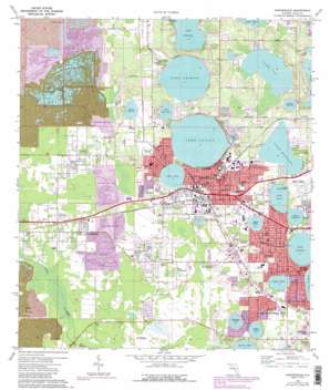
Auburndale Topo Map Florida
To zoom in, hover over the map of Auburndale
USGS Topo Quad 28081a7 - 1:24,000 scale
| Topo Map Name: | Auburndale |
| USGS Topo Quad ID: | 28081a7 |
| Print Size: | ca. 21 1/4" wide x 27" high |
| Southeast Coordinates: | 28° N latitude / 81.75° W longitude |
| Map Center Coordinates: | 28.0625° N latitude / 81.8125° W longitude |
| U.S. State: | FL |
| Filename: | O28081A7.jpg |
| Download Map JPG Image: | Auburndale topo map 1:24,000 scale |
| Map Type: | Topographic |
| Topo Series: | 7.5´ |
| Map Scale: | 1:24,000 |
| Source of Map Images: | United States Geological Survey (USGS) |
| Alternate Map Versions: |
Auburndale FL 1944, updated 1963 Download PDF Buy paper map Auburndale FL 1975, updated 1977 Download PDF Buy paper map Auburndale FL 1975, updated 1988 Download PDF Buy paper map Auburndale FL 1975, updated 1988 Download PDF Buy paper map Auburndale FL 1994, updated 2000 Download PDF Buy paper map Auburndale FL 2012 Download PDF Buy paper map Auburndale FL 2015 Download PDF Buy paper map |
1:24,000 Topo Quads surrounding Auburndale
> Back to 28081a1 at 1:100,000 scale
> Back to 28080a1 at 1:250,000 scale
> Back to U.S. Topo Maps home
Auburndale topo map: Gazetteer
Auburndale: Airports
Jack Browns Seaplane Base elevation 42m 137′King Seaaero Seaplane Base elevation 40m 131′
Market World Airport elevation 45m 147′
Scottys Incorporated Heliport elevation 43m 141′
Winter Havens Gilbert Airport elevation 44m 144′
Auburndale: Lakes
Lake Ariana elevation 41m 134′Lake Arietta elevation 43m 141′
Lake Arrowhead elevation 38m 124′
Lake Blue elevation 45m 147′
Lake Cannon elevation 40m 131′
Lake Deer elevation 42m 137′
Lake Griffin elevation 40m 131′
Lake Hart elevation 42m 137′
Lake Idylwild elevation 40m 131′
Lake Jessie elevation 40m 131′
Lake Lena elevation 41m 134′
Lake Medora elevation 42m 137′
Lake Myrtle elevation 42m 137′
Lake Sanitary elevation 41m 134′
Lake Stella elevation 43m 141′
Lake Van elevation 40m 131′
Lake Whistler elevation 42m 137′
Little Van Lake elevation 42m 137′
Sears Lake elevation 41m 134′
Thomas Lake elevation 38m 124′
Auburndale: Mines
Tenoroc Mine elevation 39m 127′Auburndale: Parks
Saddle Creek County Park elevation 33m 108′Sertoma Park elevation 41m 134′
Tenoroc State Fish Management Area elevation 40m 131′
Auburndale: Populated Places
Ariana Shores Mobile Home Park elevation 49m 160′Auburndale elevation 50m 164′
Bide A While Mobile Home Park elevation 34m 111′
Bluemoon Mobile Home Park elevation 46m 150′
Carters Corner elevation 34m 111′
Cypress Shores West Mobile Home Park elevation 43m 141′
Dawson Mobile Home Park elevation 43m 141′
Eagle Trailer Park elevation 37m 121′
Evergreen Mobile Home Estates elevation 35m 114′
Fussells Corner elevation 37m 121′
Fussels Corner elevation 35m 114′
Happy Day Trailer Park elevation 42m 137′
Inwood elevation 44m 144′
J L Sweat Estates Mobile Home Park elevation 42m 137′
Jan-Phyl Village elevation 47m 154′
Jerico Mobile Home Park elevation 44m 144′
Jones Corner elevation 41m 134′
Kossuthville elevation 37m 121′
Kris Mobile Home Park elevation 38m 124′
Lake Blue Mobile Home Park elevation 47m 154′
Lake Dale Mobile Home Park elevation 35m 114′
Lake Deer Mobile Hamlet elevation 44m 144′
Lake Haven Mobile Home Park elevation 43m 141′
Leisure Homes Mobile Park elevation 43m 141′
Lynchburg elevation 49m 160′
Palms Mobile Home Park elevation 44m 144′
Pinewood Lane Mobile Home Park elevation 43m 141′
Schalamar Creek Golf Country Club Community elevation 34m 111′
Shipp Reck Harbor Mobile Home Park elevation 42m 137′
Tower Manor Mobile Home Community elevation 38m 124′
Tropical Moon Mobile Home Park elevation 35m 114′
Twin Oaks Mobile Home Park elevation 46m 150′
Wagon Wheel Park Mobile Home Park elevation 44m 144′
Westside Ridge Mobile Home Community elevation 46m 150′
Auburndale: Post Offices
Auburndale Post Office elevation 51m 167′Auburndale digital topo map on disk
Buy this Auburndale topo map showing relief, roads, GPS coordinates and other geographical features, as a high-resolution digital map file on DVD:


