Narcoossee Topo Map Florida
To zoom in, hover over the map of Narcoossee
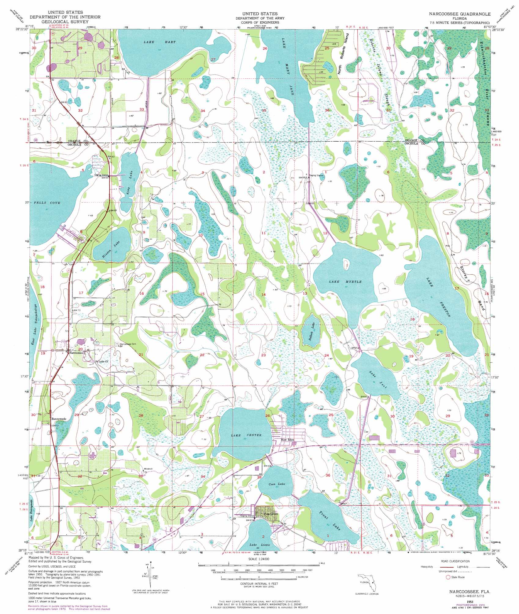
USGS Topo Quad 28081c2 - 1:24,000 scale
| Topo Map Name: | Narcoossee |
| USGS Topo Quad ID: | 28081c2 |
| Print Size: | ca. 21 1/4" wide x 27" high |
| Southeast Coordinates: | 28.25° N latitude / 81.125° W longitude |
| Map Center Coordinates: | 28.3125° N latitude / 81.1875° W longitude |
| U.S. State: | FL |
| Filename: | O28081C2.jpg |
| Download Map JPG Image: | Narcoossee topo map 1:24,000 scale |
| Map Type: | Topographic |
| Topo Series: | 7.5´ |
| Map Scale: | 1:24,000 |
| Source of Map Images: | United States Geological Survey (USGS) |
| Alternate Map Versions: |
Narcoossee FL 1953, updated 1954 Download PDF Buy paper map Narcoossee FL 1953, updated 1964 Download PDF Buy paper map Narcoossee FL 1953, updated 1972 Download PDF Buy paper map Narcoossee FL 1953, updated 1984 Download PDF Buy paper map Narcoossee FL 2012 Download PDF Buy paper map Narcoossee FL 2015 Download PDF Buy paper map |
1:24,000 Topo Quads surrounding Narcoossee
Orlando West |
Orlando East |
Oviedo Sw |
Bithlo |
Titusville Sw |
Lake Jessamine |
Pine Castle |
Narcoossee Nw |
Narcoossee Ne |
Lake Poinsett Nw |
Kissimmee |
Saint Cloud North |
Narcoossee |
Narcoossee Se |
Lake Poinsett Sw |
Lake Tohopekaliga |
Saint Cloud South |
Ashton |
Holopaw |
Deer Park Nw |
Lake Hatchineha |
Cypress Lake |
Holopaw Sw |
Holopaw Se |
Deer Park |
> Back to 28081a1 at 1:100,000 scale
> Back to 28080a1 at 1:250,000 scale
> Back to U.S. Topo Maps home
Narcoossee topo map: Gazetteer
Narcoossee: Bays
Fells Cove elevation 17m 55′Narcoossee: Islands
North Roberts Island elevation 21m 68′Narcoossee: Lakes
Ajay Lake elevation 17m 55′Bullock Lake elevation 19m 62′
Coon Lake elevation 19m 62′
Hinden Lake elevation 19m 62′
Lake Center elevation 19m 62′
Lake Joel elevation 18m 59′
Lake Mary Jane elevation 18m 59′
Lake Myrtle elevation 18m 59′
Lake Preston elevation 18m 59′
Trout Lake elevation 19m 62′
Narcoossee: Populated Places
Narcoossee elevation 24m 78′New Eden elevation 20m 65′
Pine Grove elevation 20m 65′
Runnymede elevation 22m 72′
Sandalwood Mobile Home Park elevation 23m 75′
Narcoossee digital topo map on disk
Buy this Narcoossee topo map showing relief, roads, GPS coordinates and other geographical features, as a high-resolution digital map file on DVD: