Narcoossee Ne Topo Map Florida
To zoom in, hover over the map of Narcoossee Ne
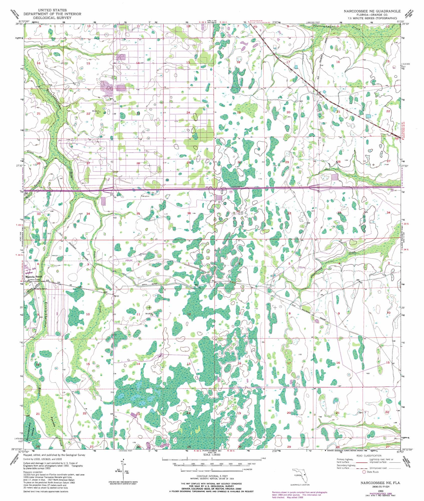
USGS Topo Quad 28081d1 - 1:24,000 scale
| Topo Map Name: | Narcoossee Ne |
| USGS Topo Quad ID: | 28081d1 |
| Print Size: | ca. 21 1/4" wide x 27" high |
| Southeast Coordinates: | 28.375° N latitude / 81° W longitude |
| Map Center Coordinates: | 28.4375° N latitude / 81.0625° W longitude |
| U.S. State: | FL |
| Filename: | O28081D1.jpg |
| Download Map JPG Image: | Narcoossee Ne topo map 1:24,000 scale |
| Map Type: | Topographic |
| Topo Series: | 7.5´ |
| Map Scale: | 1:24,000 |
| Source of Map Images: | United States Geological Survey (USGS) |
| Alternate Map Versions: |
Narcoossee NE FL 1953, updated 1954 Download PDF Buy paper map Narcoossee NE FL 1953, updated 1964 Download PDF Buy paper map Narcoossee NE FL 1953, updated 1972 Download PDF Buy paper map Narcoossee NE FL 1953, updated 1976 Download PDF Buy paper map Narcoossee NE FL 1953, updated 1981 Download PDF Buy paper map Narcoossee NE FL 1953, updated 1988 Download PDF Buy paper map Narcoossee NE FL 2012 Download PDF Buy paper map Narcoossee NE FL 2015 Download PDF Buy paper map |
1:24,000 Topo Quads surrounding Narcoossee Ne
Casselberry |
Oviedo |
Geneva |
Aurantia |
Mims |
Orlando East |
Oviedo Sw |
Bithlo |
Titusville Sw |
Titusville |
Pine Castle |
Narcoossee Nw |
Narcoossee Ne |
Lake Poinsett Nw |
Sharpes |
Saint Cloud North |
Narcoossee |
Narcoossee Se |
Lake Poinsett Sw |
Lake Poinsett |
Saint Cloud South |
Ashton |
Holopaw |
Deer Park Nw |
Deer Park Ne |
> Back to 28081a1 at 1:100,000 scale
> Back to 28080a1 at 1:250,000 scale
> Back to U.S. Topo Maps home
Narcoossee Ne topo map: Gazetteer
Narcoossee Ne: Populated Places
Wedgefield elevation 21m 68′Wewahotee elevation 21m 68′
Narcoossee Ne: Reservoirs
Sandhill Crane Lake elevation 21m 68′Narcoossee Ne: Streams
Green Branch elevation 15m 49′Little Creek elevation 16m 52′
Turkey Creek elevation 14m 45′
Narcoossee Ne digital topo map on disk
Buy this Narcoossee Ne topo map showing relief, roads, GPS coordinates and other geographical features, as a high-resolution digital map file on DVD: