Sanford Sw Topo Map Florida
To zoom in, hover over the map of Sanford Sw
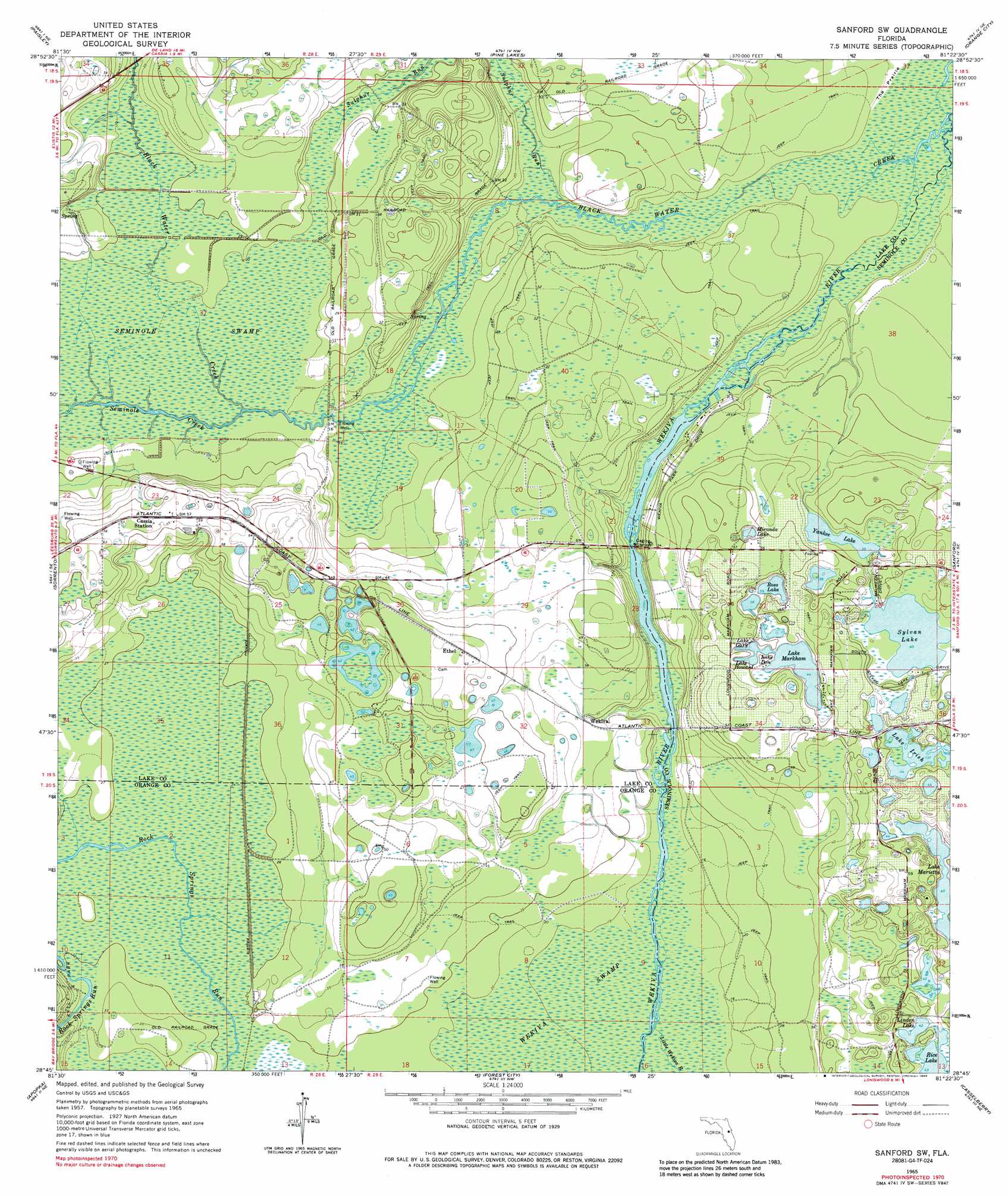
USGS Topo Quad 28081g4 - 1:24,000 scale
| Topo Map Name: | Sanford Sw |
| USGS Topo Quad ID: | 28081g4 |
| Print Size: | ca. 21 1/4" wide x 27" high |
| Southeast Coordinates: | 28.75° N latitude / 81.375° W longitude |
| Map Center Coordinates: | 28.8125° N latitude / 81.4375° W longitude |
| U.S. State: | FL |
| Filename: | O28081G4.jpg |
| Download Map JPG Image: | Sanford Sw topo map 1:24,000 scale |
| Map Type: | Topographic |
| Topo Series: | 7.5´ |
| Map Scale: | 1:24,000 |
| Source of Map Images: | United States Geological Survey (USGS) |
| Alternate Map Versions: |
Sanford SW FL 1965, updated 1967 Download PDF Buy paper map Sanford SW FL 1965, updated 1975 Download PDF Buy paper map Sanford Sw FL 1965, updated 1986 Download PDF Buy paper map Sanford Sw FL 1965, updated 1988 Download PDF Buy paper map Sanford SW FL 2012 Download PDF Buy paper map Sanford SW FL 2015 Download PDF Buy paper map |
1:24,000 Topo Quads surrounding Sanford Sw
Farles Lake |
Alexander Springs |
Lake Woodruff |
De Land |
Daytona Beach Sw |
Umatilla |
Paisley |
Pine Lakes |
Orange City |
Lake Helen |
Eustis |
Sorrento |
Sanford Sw |
Sanford |
Osteen |
Astatula |
Apopka |
Forest City |
Casselberry |
Oviedo |
Clermont East |
Winter Garden |
Orlando West |
Orlando East |
Oviedo Sw |
> Back to 28081e1 at 1:100,000 scale
> Back to 28080a1 at 1:250,000 scale
> Back to U.S. Topo Maps home
Sanford Sw topo map: Gazetteer
Sanford Sw: Flats
The Prairie elevation 1m 3′Sanford Sw: Lakes
Lake Don elevation 13m 42′Lake Gary elevation 13m 42′
Lake Howard elevation 13m 42′
Lake Irish elevation 13m 42′
Lake Marietta elevation 13m 42′
Lake Markham elevation 13m 42′
Linden Lake elevation 12m 39′
Miranda Lake elevation 11m 36′
Rice Lake elevation 13m 42′
Ross Lake elevation 12m 39′
Sylvan Lake elevation 12m 39′
Yankee Lake elevation 10m 32′
Sanford Sw: Populated Places
Alaqua Lakes elevation 10m 32′Ethel elevation 18m 59′
Markham elevation 15m 49′
Wekiva elevation 9m 29′
Sanford Sw: Streams
Black Water Creek elevation 1m 3′Black Water Creek elevation 4m 13′
Little Wekiva River elevation 4m 13′
Seminole Creek elevation 2m 6′
Sulphur Run elevation 2m 6′
Sanford Sw: Swamps
Seminole Swamp elevation 5m 16′Wekiva Swamp elevation 4m 13′
Sanford Sw digital topo map on disk
Buy this Sanford Sw topo map showing relief, roads, GPS coordinates and other geographical features, as a high-resolution digital map file on DVD: