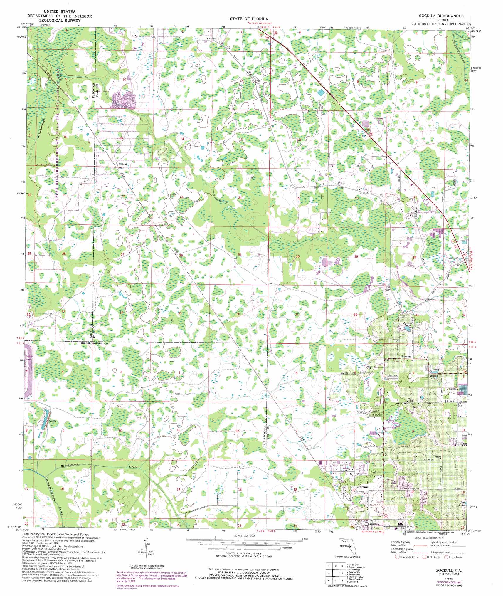
Socrum Topo Map Florida
To zoom in, hover over the map of Socrum
USGS Topo Quad 28082b1 - 1:24,000 scale
| Topo Map Name: | Socrum |
| USGS Topo Quad ID: | 28082b1 |
| Print Size: | ca. 21 1/4" wide x 27" high |
| Southeast Coordinates: | 28.125° N latitude / 82° W longitude |
| Map Center Coordinates: | 28.1875° N latitude / 82.0625° W longitude |
| U.S. State: | FL |
| Filename: | O28082B1.jpg |
| Download Map JPG Image: | Socrum topo map 1:24,000 scale |
| Map Type: | Topographic |
| Topo Series: | 7.5´ |
| Map Scale: | 1:24,000 |
| Source of Map Images: | United States Geological Survey (USGS) |
| Alternate Map Versions: |
Socrum FL 1944, updated 1963 Download PDF Buy paper map Socrum FL 1975, updated 1976 Download PDF Buy paper map Socrum FL 1975, updated 1987 Download PDF Buy paper map Socrum FL 1975, updated 1993 Download PDF Buy paper map Socrum FL 2012 Download PDF Buy paper map Socrum FL 2015 Download PDF Buy paper map |
1:24,000 Topo Quads surrounding Socrum
Spring Lake |
Lacoochee |
Clay Sink |
Bay Lake |
Lake Nellie |
San Antonio |
Dade City |
Branchborough |
Rock Ridge |
Poyner |
Wesley Chapel |
Zephyrhills |
Socrum |
Providence |
Polk City |
Thonotosassa |
Plant City West |
Plant City East |
Lakeland |
Auburndale |
Brandon |
Dover |
Nichols |
Mulberry |
Bartow |
> Back to 28082a1 at 1:100,000 scale
> Back to 28082a1 at 1:250,000 scale
> Back to U.S. Topo Maps home
Socrum topo map: Gazetteer
Socrum: Lakes
Avenue Pond elevation 37m 121′Indian Lake elevation 39m 127′
Socrum: Populated Places
Cypress Lakes Golf and Country Club Mobile Home Park elevation 37m 121′Hitchapukasse (historical) elevation 36m 118′
Socrum elevation 46m 150′
Socrum: Streams
Itchepackesassa Creek elevation 26m 85′Socrum digital topo map on disk
Buy this Socrum topo map showing relief, roads, GPS coordinates and other geographical features, as a high-resolution digital map file on DVD: