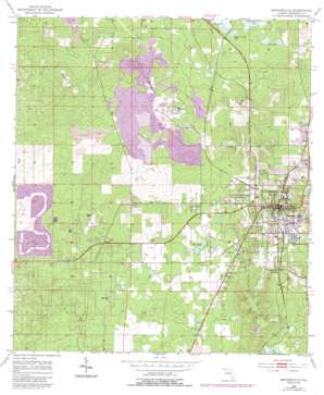
Brooksville Topo Map Florida
To zoom in, hover over the map of Brooksville
USGS Topo Quad 28082e4 - 1:24,000 scale
| Topo Map Name: | Brooksville |
| USGS Topo Quad ID: | 28082e4 |
| Print Size: | ca. 21 1/4" wide x 27" high |
| Southeast Coordinates: | 28.5° N latitude / 82.375° W longitude |
| Map Center Coordinates: | 28.5625° N latitude / 82.4375° W longitude |
| U.S. State: | FL |
| Filename: | O28082E4.jpg |
| Download Map JPG Image: | Brooksville topo map 1:24,000 scale |
| Map Type: | Topographic |
| Topo Series: | 7.5´ |
| Map Scale: | 1:24,000 |
| Source of Map Images: | United States Geological Survey (USGS) |
| Alternate Map Versions: |
Brooksville FL 1954, updated 1955 Download PDF Buy paper map Brooksville FL 1954, updated 1968 Download PDF Buy paper map Brooksville FL 1954, updated 1988 Download PDF Buy paper map Brooksville FL 1954, updated 1988 Download PDF Buy paper map Brooksville FL 1998, updated 2002 Download PDF Buy paper map Brooksville FL 2012 Download PDF Buy paper map Brooksville FL 2015 Download PDF Buy paper map |
1:24,000 Topo Quads surrounding Brooksville
> Back to 28082e1 at 1:100,000 scale
> Back to 28082a1 at 1:250,000 scale
> Back to U.S. Topo Maps home
Brooksville topo map: Gazetteer
Brooksville: Lakes
Horse Lake elevation 20m 65′Rock Pond elevation 20m 65′
Tank Lake elevation 23m 75′
Willow Prairie Lake elevation 23m 75′
Brooksville: Parks
Russell Street Park elevation 40m 131′Tom Varn Park elevation 35m 114′
Brooksville: Populated Places
Brookridge elevation 19m 62′Brooksville elevation 62m 203′
Camps elevation 35m 114′
Norman elevation 19m 62′
North Brooksville elevation 48m 157′
South Brooksville elevation 35m 114′
Tooke Lake Junction elevation 38m 124′
Wiscon elevation 27m 88′
Brooksville: Post Offices
Brooksville Post Office elevation 61m 200′Brooksville Post Office - Main Office elevation 24m 78′
Brooksville: Summits
Bailey Hill elevation 64m 209′Brooksville digital topo map on disk
Buy this Brooksville topo map showing relief, roads, GPS coordinates and other geographical features, as a high-resolution digital map file on DVD:


