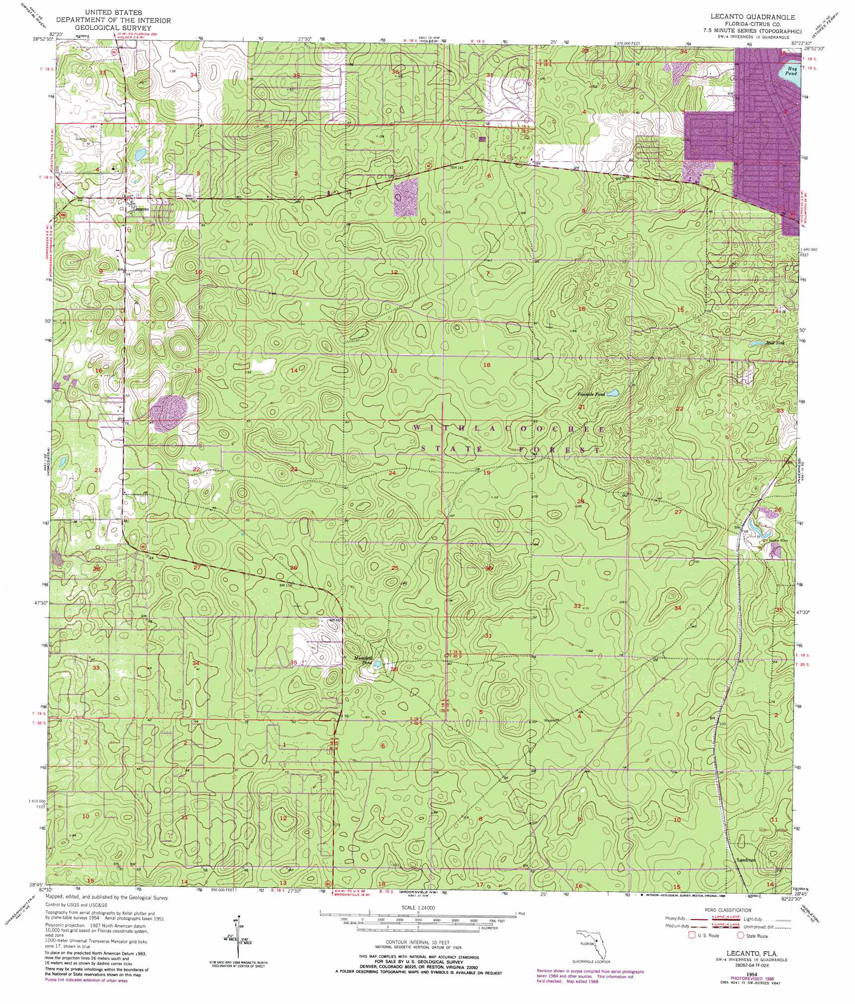
Lecanto Topo Map Florida
To zoom in, hover over the map of Lecanto
USGS Topo Quad 28082g4 - 1:24,000 scale
| Topo Map Name: | Lecanto |
| USGS Topo Quad ID: | 28082g4 |
| Print Size: | ca. 21 1/4" wide x 27" high |
| Southeast Coordinates: | 28.75° N latitude / 82.375° W longitude |
| Map Center Coordinates: | 28.8125° N latitude / 82.4375° W longitude |
| U.S. State: | FL |
| Filename: | O28082G4.jpg |
| Download Map JPG Image: | Lecanto topo map 1:24,000 scale |
| Map Type: | Topographic |
| Topo Series: | 7.5´ |
| Map Scale: | 1:24,000 |
| Source of Map Images: | United States Geological Survey (USGS) |
| Alternate Map Versions: |
Lecanto FL 1954 Download PDF Buy paper map Lecanto FL 1954, updated 1955 Download PDF Buy paper map Lecanto FL 1954, updated 1966 Download PDF Buy paper map Lecanto FL 1954, updated 1973 Download PDF Buy paper map Lecanto FL 1954, updated 1988 Download PDF Buy paper map Lecanto FL 2012 Download PDF Buy paper map Lecanto FL 2015 Download PDF Buy paper map |
1:24,000 Topo Quads surrounding Lecanto
Yankeetown |
Yankeetown Se |
Dunnellon |
Dunnellon Se |
Shady |
Red Level |
Crystal River |
Holder |
Stokes Ferry |
Lake Panasoffkee Nw |
Ozello |
Homosassa |
Lecanto |
Inverness |
Rutland |
Chassahowitzka Bay |
Chassahowitzka |
Brooksville Nw |
Nobelton |
Wahoo |
Bayport |
Weeki Wachee Spring |
Brooksville |
Brooksville Se |
Saint Catherine |
> Back to 28082e1 at 1:100,000 scale
> Back to 28082a1 at 1:250,000 scale
> Back to U.S. Topo Maps home
Lecanto topo map: Gazetteer
Lecanto: Lakes
Bull Sink elevation 7m 22′Fivemile Pond elevation 2m 6′
Hog Pond elevation 7m 22′
Mansfield Pond elevation 4m 13′
Lecanto: Mines
Holder Mine elevation 16m 52′Lecanto: Parks
Citrus Wildlife Management Area elevation 36m 118′Lecanto High School Football Stadium elevation 13m 42′
Lecanto Park elevation 15m 49′
Lecanto: Populated Places
Big Hammock (historical) elevation 18m 59′Landrum elevation 36m 118′
Lecanto elevation 14m 45′
Lecanto: Post Offices
Lecanto Florida Post Office elevation 15m 49′Lecanto digital topo map on disk
Buy this Lecanto topo map showing relief, roads, GPS coordinates and other geographical features, as a high-resolution digital map file on DVD: