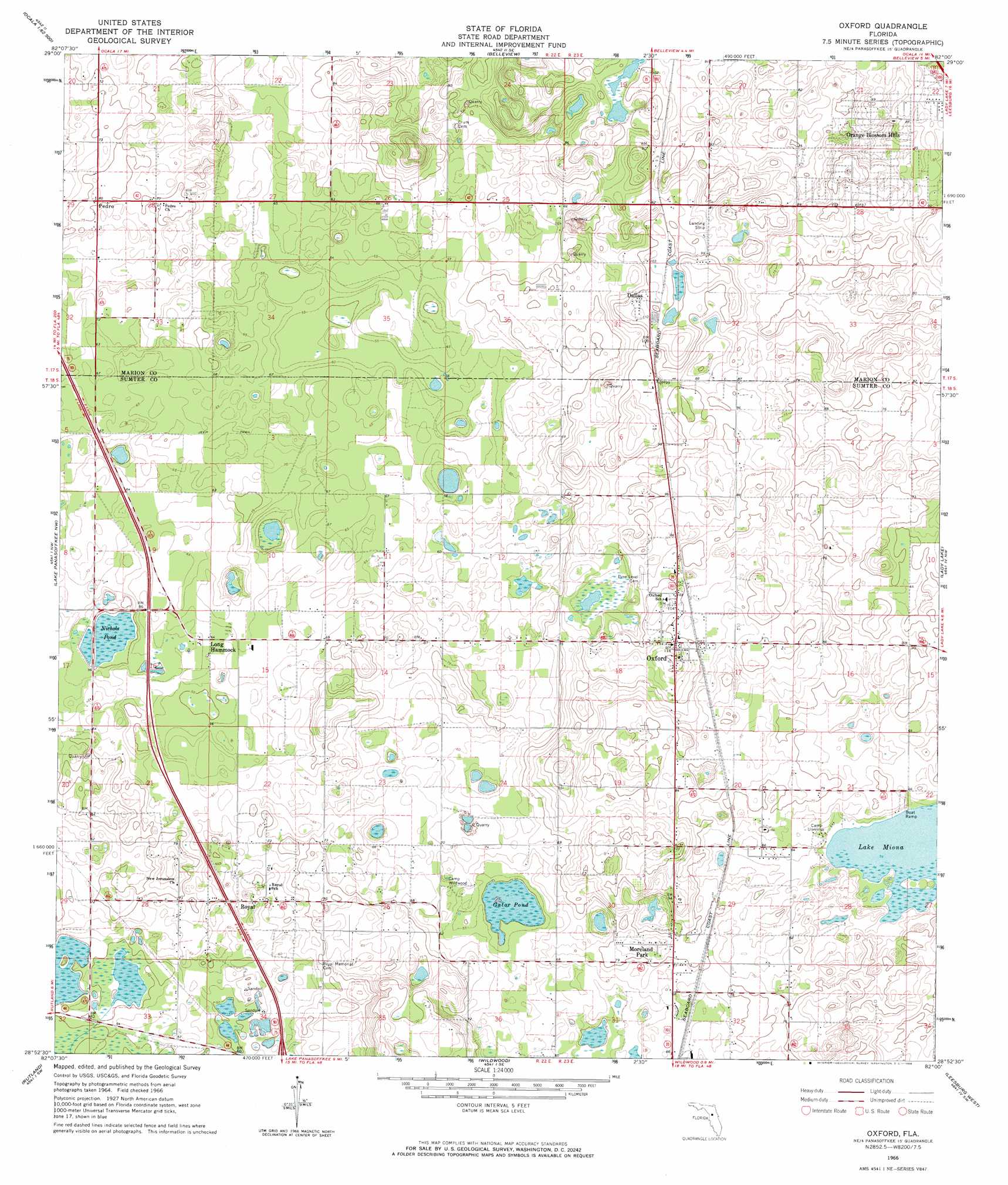
Oxford Topo Map Florida
To zoom in, hover over the map of Oxford
USGS Topo Quad 28082h1 - 1:24,000 scale
| Topo Map Name: | Oxford |
| USGS Topo Quad ID: | 28082h1 |
| Print Size: | ca. 21 1/4" wide x 27" high |
| Southeast Coordinates: | 28.875° N latitude / 82° W longitude |
| Map Center Coordinates: | 28.9375° N latitude / 82.0625° W longitude |
| U.S. State: | FL |
| Filename: | O28082H1.jpg |
| Download Map JPG Image: | Oxford topo map 1:24,000 scale |
| Map Type: | Topographic |
| Topo Series: | 7.5´ |
| Map Scale: | 1:24,000 |
| Source of Map Images: | United States Geological Survey (USGS) |
| Alternate Map Versions: |
Oxford FL 1966, updated 1968 Download PDF Buy paper map Oxford FL 2012 Download PDF Buy paper map Oxford FL 2015 Download PDF Buy paper map |
1:24,000 Topo Quads surrounding Oxford
Cotton Plant |
Ocala West |
Ocala East |
Lynne |
Halfmoon Lake |
Dunnellon Se |
Shady |
Belleview |
Lake Weir |
Lake Mary |
Stokes Ferry |
Lake Panasoffkee Nw |
Oxford |
Lady Lake |
Emeralda Island |
Inverness |
Rutland |
Wildwood |
Leesburg West |
Leesburg East |
Nobelton |
Wahoo |
Bushnell |
Center Hill |
Hewey In The Hills |
> Back to 28082e1 at 1:100,000 scale
> Back to 28082a1 at 1:250,000 scale
> Back to U.S. Topo Maps home
Oxford topo map: Gazetteer
Oxford: Airports
Dallas Airport elevation 27m 88′Oxford: Lakes
Lake Miona elevation 17m 55′Oxford: Populated Places
Dallas elevation 31m 101′Easy Living Estates Mobile Home Park elevation 26m 85′
Long Hammock elevation 19m 62′
Moreland Park elevation 26m 85′
Moreland Park Trailer Park elevation 26m 85′
Orange Blossom Hills elevation 27m 88′
Oxford elevation 31m 101′
Pedro elevation 24m 78′
Royal elevation 21m 68′
Oxford: Post Offices
Oxford Post Office elevation 33m 108′Oxford: Swamps
Gator Pond elevation 14m 45′Nichols Pond elevation 14m 45′
Oxford digital topo map on disk
Buy this Oxford topo map showing relief, roads, GPS coordinates and other geographical features, as a high-resolution digital map file on DVD: