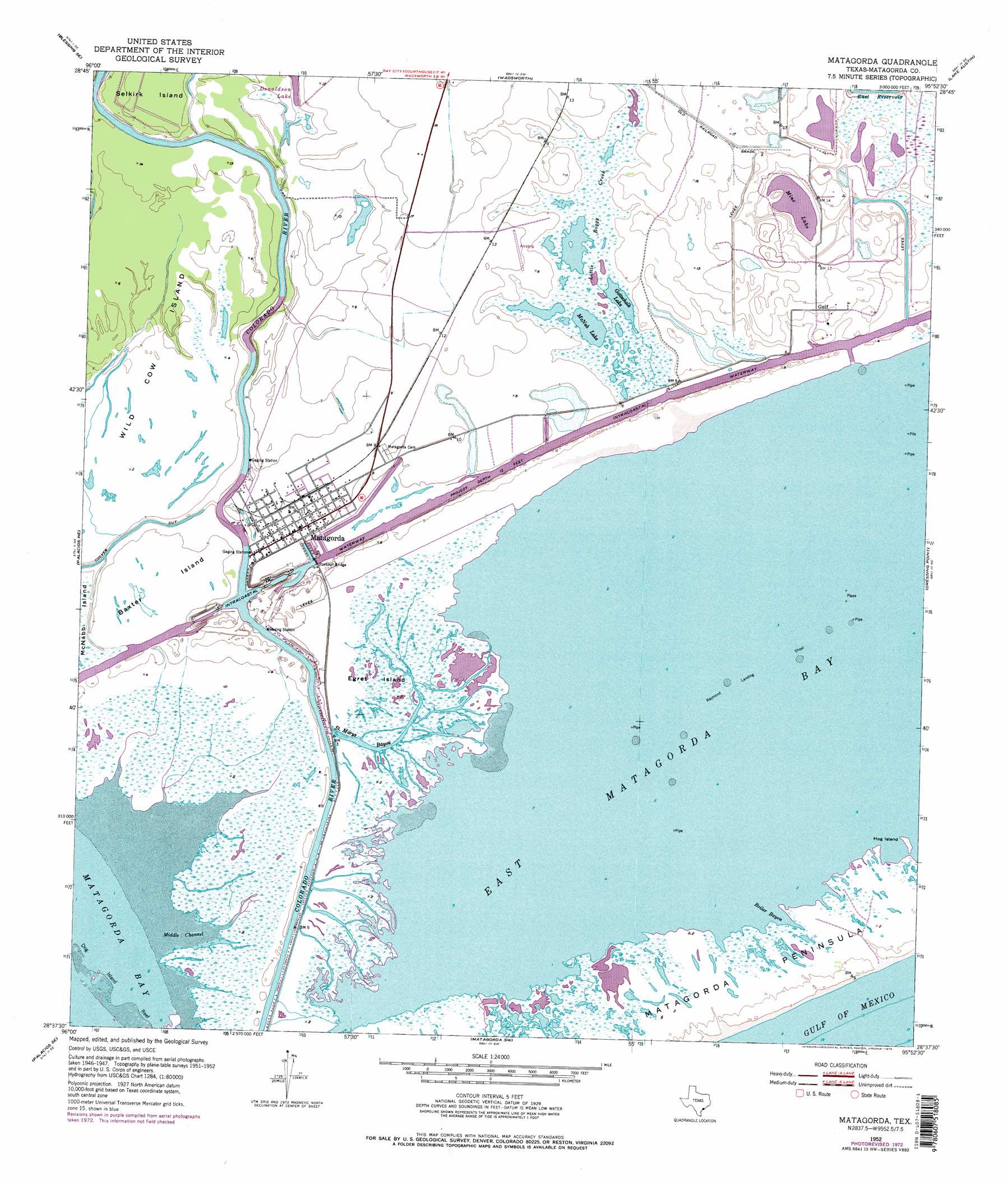
Matagorda Topo Map Texas
To zoom in, hover over the map of Matagorda
USGS Topo Quad 28095f8 - 1:24,000 scale
| Topo Map Name: | Matagorda |
| USGS Topo Quad ID: | 28095f8 |
| Print Size: | ca. 21 1/4" wide x 27" high |
| Southeast Coordinates: | 28.625° N latitude / 95.875° W longitude |
| Map Center Coordinates: | 28.6875° N latitude / 95.9375° W longitude |
| U.S. State: | TX |
| Filename: | o28095f8.jpg |
| Download Map JPG Image: | Matagorda topo map 1:24,000 scale |
| Map Type: | Topographic |
| Topo Series: | 7.5´ |
| Map Scale: | 1:24,000 |
| Source of Map Images: | United States Geological Survey (USGS) |
| Alternate Map Versions: |
Matagorda TX 1952, updated 1953 Download PDF Buy paper map Matagorda TX 1952, updated 1968 Download PDF Buy paper map Matagorda TX 1952, updated 1976 Download PDF Buy paper map Matagorda TX 1952, updated 1977 Download PDF Buy paper map Matagorda TX 2010 Download PDF Buy paper map Matagorda TX 2013 Download PDF Buy paper map Matagorda TX 2016 Download PDF Buy paper map |
1:24,000 Topo Quads surrounding Matagorda
Midfield |
Markham |
Bay City |
Bay City Ne |
Cedar Lane |
Blessing |
Blessing Se |
Wadsworth |
Lake Austin |
Sargent |
Palacios |
Palacios Ne |
Matagorda |
Dressing Point |
Brown Cedar Cut |
Palacios Point |
Palacios Se |
Matagorda Sw |
||
South Of Palacios Point |
> Back to 28095e1 at 1:100,000 scale
> Back to 28094a1 at 1:250,000 scale
> Back to U.S. Topo Maps home
Matagorda topo map: Gazetteer
Matagorda: Bars
Dog Island Reef elevation 0m 0′Raymond Landing Shoal elevation 0m 0′
Matagorda: Bays
Burkhart Cove elevation 0m 0′Spring Bayou Cove elevation 0m 0′
Matagorda: Bends
Devils Elbow elevation 1m 3′Matagorda: Channels
Middle Channel elevation 0m 0′Matagorda: Guts
Boiler Bayou elevation 0m 0′Saint Marys Bayou elevation 1m 3′
Matagorda: Islands
Baxter Island elevation 2m 6′Egret Island elevation 1m 3′
Hog Island elevation 0m 0′
Wild Cow Island elevation 1m 3′
Matagorda: Lakes
Gottschalk Lake elevation 1m 3′McNab Lake elevation 1m 3′
Mine Lake elevation 2m 6′
Matagorda: Populated Places
Gulf elevation 4m 13′Matagorda elevation 2m 6′
Matagorda: Reservoirs
East Reservoir elevation 2m 6′Matagorda: Streams
Little Boggy Creek elevation 1m 3′Matagorda digital topo map on disk
Buy this Matagorda topo map showing relief, roads, GPS coordinates and other geographical features, as a high-resolution digital map file on DVD: