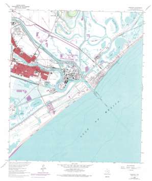
Freeport Topo Map Texas
To zoom in, hover over the map of Freeport
USGS Topo Quad 28095h3 - 1:24,000 scale
| Topo Map Name: | Freeport |
| USGS Topo Quad ID: | 28095h3 |
| Print Size: | ca. 21 1/4" wide x 27" high |
| Southeast Coordinates: | 28.875° N latitude / 95.25° W longitude |
| Map Center Coordinates: | 28.9375° N latitude / 95.3125° W longitude |
| U.S. State: | TX |
| Filename: | o28095h3.jpg |
| Download Map JPG Image: | Freeport topo map 1:24,000 scale |
| Map Type: | Topographic |
| Topo Series: | 7.5´ |
| Map Scale: | 1:24,000 |
| Source of Map Images: | United States Geological Survey (USGS) |
| Alternate Map Versions: |
Freeport TX 1943, updated 1958 Download PDF Buy paper map Freeport TX 1964, updated 1966 Download PDF Buy paper map Freeport TX 1964, updated 1975 Download PDF Buy paper map Freeport TX 1964, updated 1977 Download PDF Buy paper map Freeport TX 1964, updated 1984 Download PDF Buy paper map Freeport TX 1964, updated 1984 Download PDF Buy paper map Freeport TX 2010 Download PDF Buy paper map Freeport TX 2013 Download PDF Buy paper map Freeport TX 2016 Download PDF Buy paper map |
1:24,000 Topo Quads surrounding Freeport
East Columbia |
Angleton |
Danbury |
Hoskins Mound |
Sea Isle |
Brazoria |
Lake Jackson |
Oyster Creek |
Christmas Point |
San Luis Pass |
Cedar Lane Ne |
Jones Creek |
Freeport |
||
Cedar Lakes West |
Cedar Lakes East |
|||
> Back to 28095e1 at 1:100,000 scale
> Back to 28094a1 at 1:250,000 scale
> Back to U.S. Topo Maps home
Freeport topo map: Gazetteer
Freeport: Airports
Buccaneer Shore Facility Heliport elevation 2m 6′Hercules Offshore Heliport elevation 1m 3′
M-I Drilling Fluids Company Heliport elevation 2m 6′
Freeport: Basins
Mud Pit elevation 1m 3′Freeport: Bays
Brazos Harbor elevation 0m 0′East Union Bayou elevation 2m 6′
Old Brazos River elevation 1m 3′
Freeport: Beaches
Bryan Beach elevation 0m 0′Freeport: Bends
Big Bend elevation 2m 6′Freeport: Canals
Dow Barge Canal elevation 0m 0′Freeport: Channels
Bryan Cut elevation 1m 3′Freeport Harbor Channel elevation 0m 0′
Oyster Creek Cut elevation 1m 3′
Freeport: Guts
Essex Bayou elevation 1m 3′Freeport: Harbors
Brazosport Turning Basin elevation 0m 0′Stauffer Turning Basin elevation 0m 0′
Upper Turning Basin elevation 0m 0′
Freeport: Islands
Cone Island elevation 1m 3′Freeport: Lakes
Bryan Lake elevation 2m 6′Fresh Water Lake elevation 1m 3′
Horseshoe Lake elevation 1m 3′
Swan Lake elevation 1m 3′
Freeport: Parks
Arrington Park elevation 1m 3′Austin Park elevation 1m 3′
Hopper Stadium elevation 2m 6′
Peach Point Wildlife Management Area elevation 1m 3′
Riverside Park elevation 1m 3′
Freeport: Populated Places
Brazosport elevation 1m 3′Freeport elevation 1m 3′
Midway elevation 1m 3′
Quintana elevation 1m 3′
Quintana Beach elevation 0m 0′
Surfside elevation 2m 6′
Surfside Beach elevation 0m 0′
Velasco elevation 1m 3′
Velasco Heights elevation 1m 3′
Freeport: Reservoirs
Old Reservoir elevation 1m 3′Freeport: Streams
Oyster Creek elevation 0m 0′Freeport digital topo map on disk
Buy this Freeport topo map showing relief, roads, GPS coordinates and other geographical features, as a high-resolution digital map file on DVD:


