Cedar Lane Ne Topo Map Texas
To zoom in, hover over the map of Cedar Lane Ne
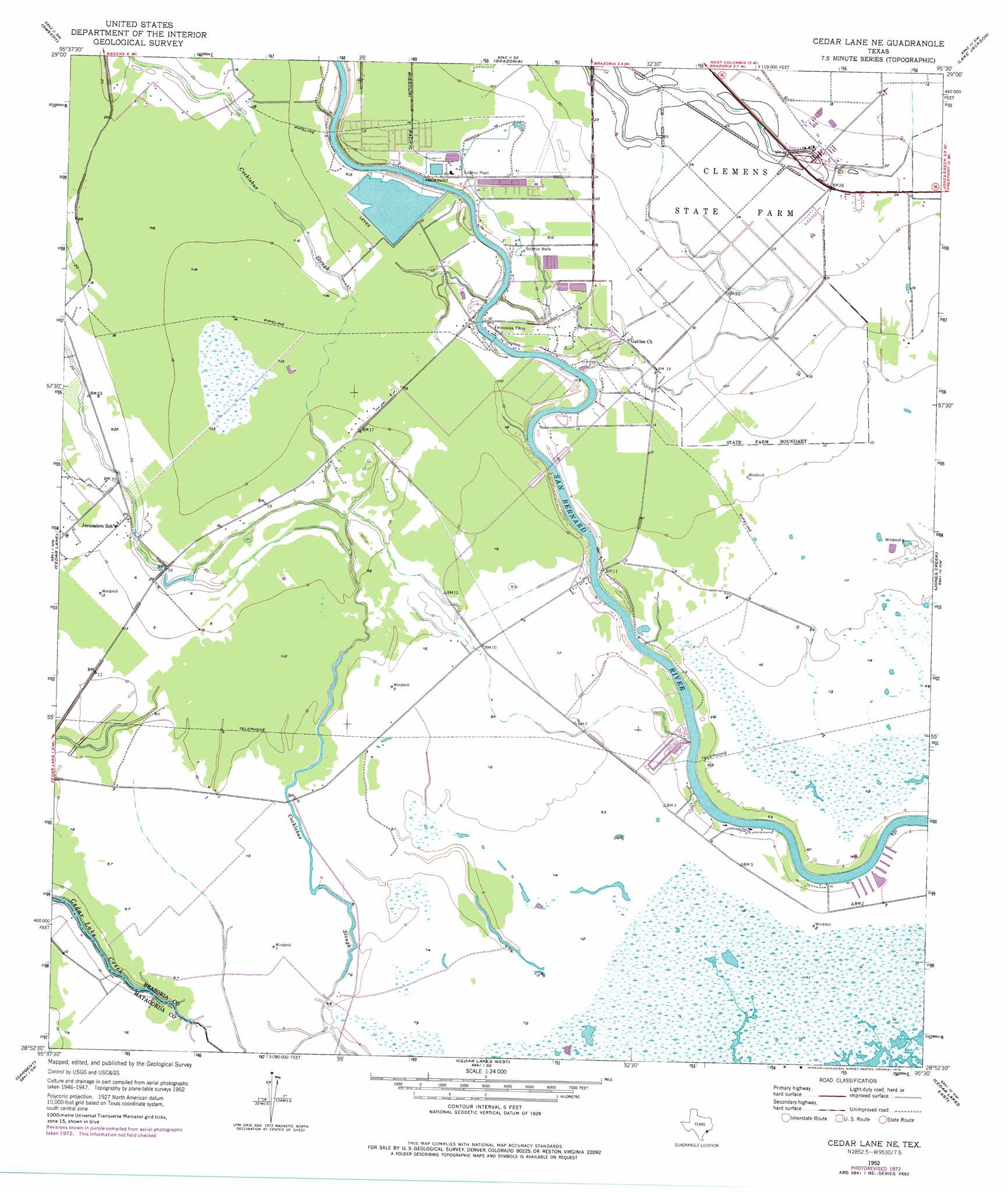
USGS Topo Quad 28095h5 - 1:24,000 scale
| Topo Map Name: | Cedar Lane Ne |
| USGS Topo Quad ID: | 28095h5 |
| Print Size: | ca. 21 1/4" wide x 27" high |
| Southeast Coordinates: | 28.875° N latitude / 95.5° W longitude |
| Map Center Coordinates: | 28.9375° N latitude / 95.5625° W longitude |
| U.S. State: | TX |
| Filename: | o28095h5.jpg |
| Download Map JPG Image: | Cedar Lane Ne topo map 1:24,000 scale |
| Map Type: | Topographic |
| Topo Series: | 7.5´ |
| Map Scale: | 1:24,000 |
| Source of Map Images: | United States Geological Survey (USGS) |
| Alternate Map Versions: |
Cedar Lane NE TX 1952, updated 1953 Download PDF Buy paper map Cedar Lane NE TX 1952, updated 1971 Download PDF Buy paper map Cedar Lane NE TX 1952, updated 1976 Download PDF Buy paper map Cedar Lane NE TX 2010 Download PDF Buy paper map Cedar Lane NE TX 2013 Download PDF Buy paper map Cedar Lane NE TX 2016 Download PDF Buy paper map |
1:24,000 Topo Quads surrounding Cedar Lane Ne
Danciger |
West Columbia |
East Columbia |
Angleton |
Danbury |
Ashwood |
Sweeny |
Brazoria |
Lake Jackson |
Oyster Creek |
Bay City Ne |
Cedar Lane |
Cedar Lane Ne |
Jones Creek |
Freeport |
Lake Austin |
Sargent |
Cedar Lakes West |
Cedar Lakes East |
|
Dressing Point |
Brown Cedar Cut |
> Back to 28095e1 at 1:100,000 scale
> Back to 28094a1 at 1:250,000 scale
> Back to U.S. Topo Maps home
Cedar Lane Ne topo map: Gazetteer
Cedar Lane Ne: Airports
Eagle Air Park elevation 3m 9′Cedar Lane Ne: Populated Places
Churchill elevation 2m 6′Hinkles Ferry elevation 3m 9′
Cedar Lane Ne digital topo map on disk
Buy this Cedar Lane Ne topo map showing relief, roads, GPS coordinates and other geographical features, as a high-resolution digital map file on DVD: