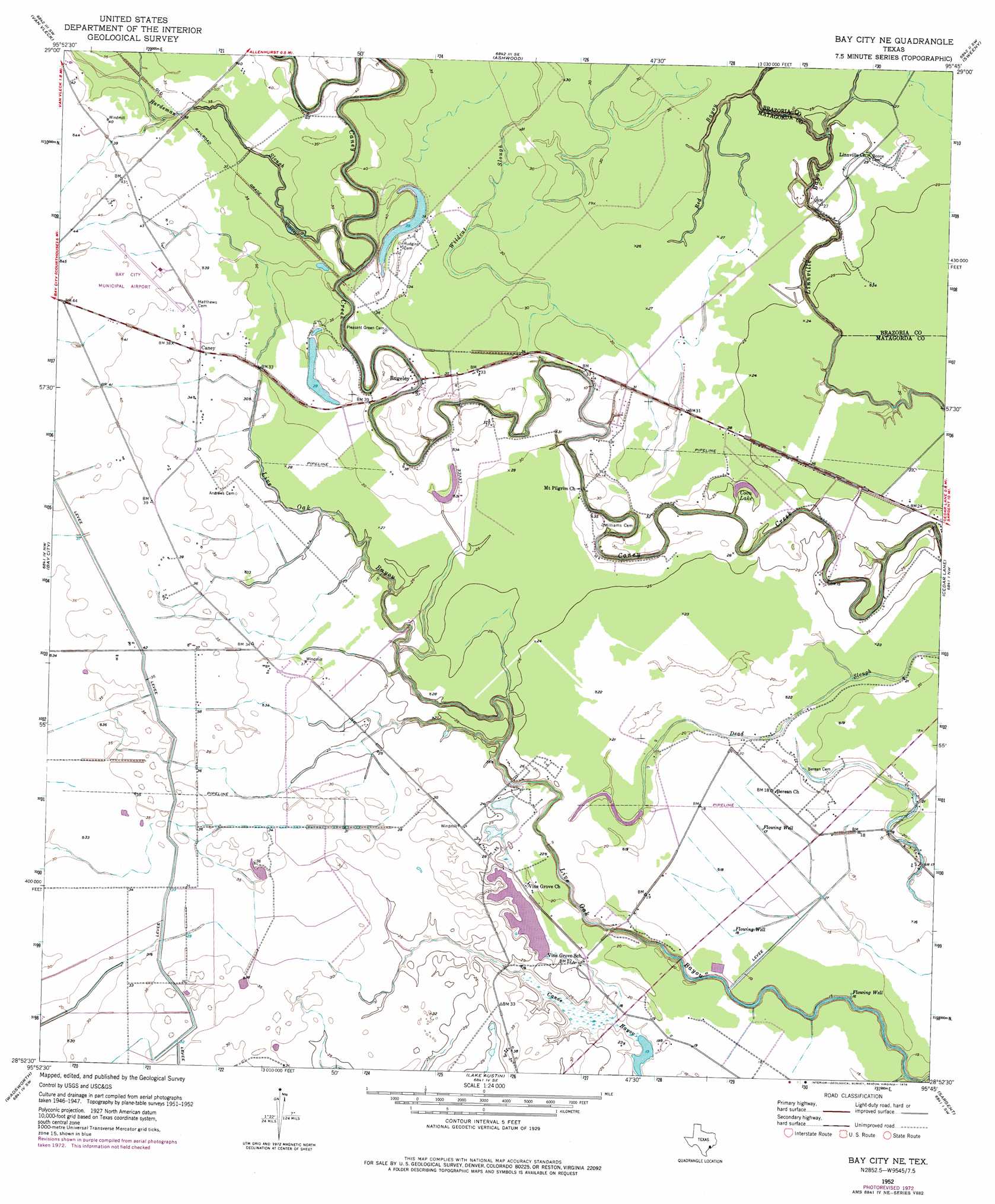
Bay City Ne Topo Map Texas
To zoom in, hover over the map of Bay City Ne
USGS Topo Quad 28095h7 - 1:24,000 scale
| Topo Map Name: | Bay City Ne |
| USGS Topo Quad ID: | 28095h7 |
| Print Size: | ca. 21 1/4" wide x 27" high |
| Southeast Coordinates: | 28.875° N latitude / 95.75° W longitude |
| Map Center Coordinates: | 28.9375° N latitude / 95.8125° W longitude |
| U.S. State: | TX |
| Filename: | o28095h7.jpg |
| Download Map JPG Image: | Bay City Ne topo map 1:24,000 scale |
| Map Type: | Topographic |
| Topo Series: | 7.5´ |
| Map Scale: | 1:24,000 |
| Source of Map Images: | United States Geological Survey (USGS) |
| Alternate Map Versions: |
Bay City NE TX 1952, updated 1953 Download PDF Buy paper map Bay City NE TX 1952, updated 1976 Download PDF Buy paper map Bay City NE TX 2010 Download PDF Buy paper map Bay City NE TX 2013 Download PDF Buy paper map Bay City NE TX 2016 Download PDF Buy paper map |
1:24,000 Topo Quads surrounding Bay City Ne
Lane City |
Pledger |
Danciger |
West Columbia |
East Columbia |
Lane City Se |
Van Vleck |
Ashwood |
Sweeny |
Brazoria |
Markham |
Bay City |
Bay City Ne |
Cedar Lane |
Cedar Lane Ne |
Blessing Se |
Wadsworth |
Lake Austin |
Sargent |
Cedar Lakes West |
Palacios Ne |
Matagorda |
Dressing Point |
Brown Cedar Cut |
> Back to 28095e1 at 1:100,000 scale
> Back to 28094a1 at 1:250,000 scale
> Back to U.S. Topo Maps home
Bay City Ne topo map: Gazetteer
Bay City Ne: Airports
Bay City Municipal Airport elevation 13m 42′Fay Ranch Airport elevation 7m 22′
Bay City Ne: Dams
Fay Ranch Dam elevation 9m 29′Hudgins Dam elevation 11m 36′
Bay City Ne: Lakes
Coon Lake elevation 7m 22′Bay City Ne: Populated Places
Caney elevation 11m 36′Rugeley elevation 11m 36′
Bay City Ne: Reservoirs
Fay Ranch Reservoir elevation 9m 29′Hudgins Reservoir elevation 11m 36′
Bay City Ne: Streams
Hardeman Slough elevation 11m 36′Red Bayou elevation 10m 32′
Wildcat Slough elevation 2m 6′
Bay City Ne digital topo map on disk
Buy this Bay City Ne topo map showing relief, roads, GPS coordinates and other geographical features, as a high-resolution digital map file on DVD: