Saint Charles Bay Se Topo Map Texas
To zoom in, hover over the map of Saint Charles Bay Se
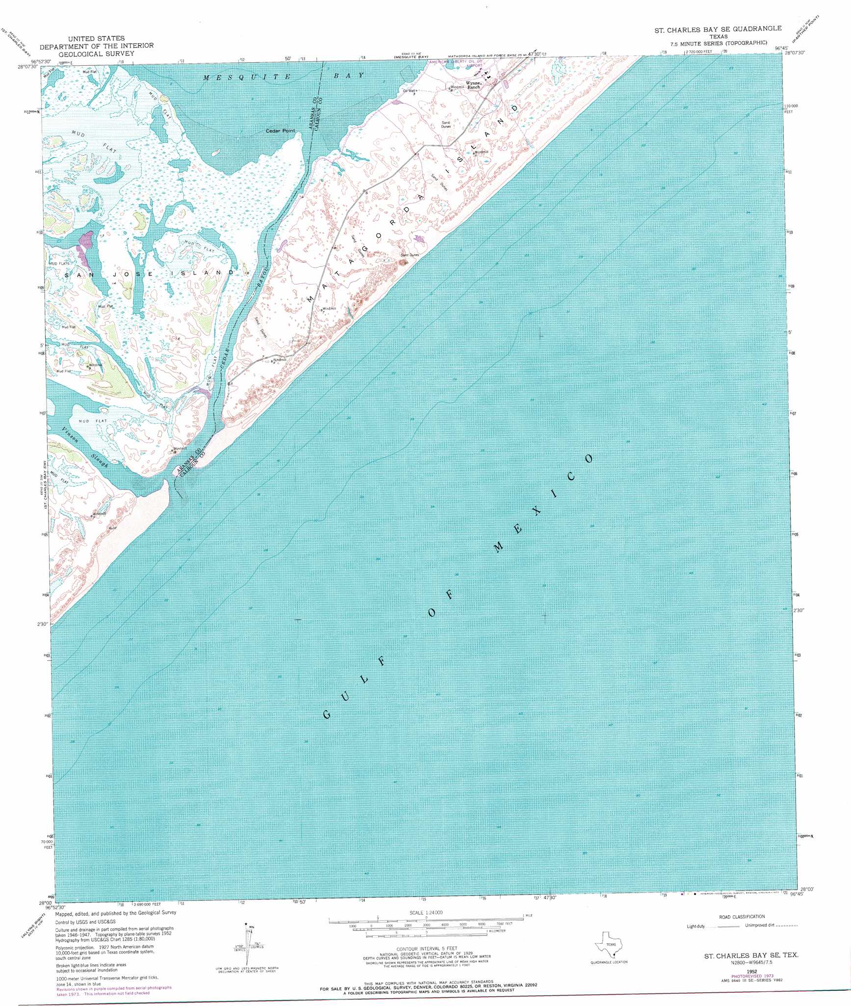
USGS Topo Quad 28096a7 - 1:24,000 scale
| Topo Map Name: | Saint Charles Bay Se |
| USGS Topo Quad ID: | 28096a7 |
| Print Size: | ca. 21 1/4" wide x 27" high |
| Southeast Coordinates: | 28° N latitude / 96.75° W longitude |
| Map Center Coordinates: | 28.0625° N latitude / 96.8125° W longitude |
| U.S. State: | TX |
| Filename: | o28096a7.jpg |
| Download Map JPG Image: | Saint Charles Bay Se topo map 1:24,000 scale |
| Map Type: | Topographic |
| Topo Series: | 7.5´ |
| Map Scale: | 1:24,000 |
| Source of Map Images: | United States Geological Survey (USGS) |
| Alternate Map Versions: |
St. Charles Bay SE TX 1952, updated 1954 Download PDF Buy paper map St. Charles Bay SE TX 1952, updated 1973 Download PDF Buy paper map St. Charles Bay SE TX 1952, updated 1976 Download PDF Buy paper map St. Charles Bay SE TX 1952, updated 1977 Download PDF Buy paper map Saint Charles Bay SE TX 2010 Download PDF Buy paper map Saint Charles Bay SE TX 2013 Download PDF Buy paper map Saint Charles Bay SE TX 2016 Download PDF Buy paper map |
1:24,000 Topo Quads surrounding Saint Charles Bay Se
Twin Mott Lake |
Tivoli Sw |
Tivoli Se |
Mosquito Point |
Long Island |
Lamar |
Saint Charles Bay |
Mesquite Bay |
Panther Point |
Panther Point Ne |
Rockport |
Saint Charles Bay Sw |
Saint Charles Bay Se |
||
Estes |
Allyns Bight |
|||
Port Aransas |
> Back to 28096a1 at 1:100,000 scale
> Back to 28096a1 at 1:250,000 scale
> Back to U.S. Topo Maps home
Saint Charles Bay Se topo map: Gazetteer
Saint Charles Bay Se: Airports
Aransas National Wildlife Refuge Airport elevation 1m 3′Saint Charles Bay Se: Streams
Cedar Bayou elevation 1m 3′Saint Charles Bay Se digital topo map on disk
Buy this Saint Charles Bay Se topo map showing relief, roads, GPS coordinates and other geographical features, as a high-resolution digital map file on DVD: