Turtle Bay Topo Map Texas
To zoom in, hover over the map of Turtle Bay
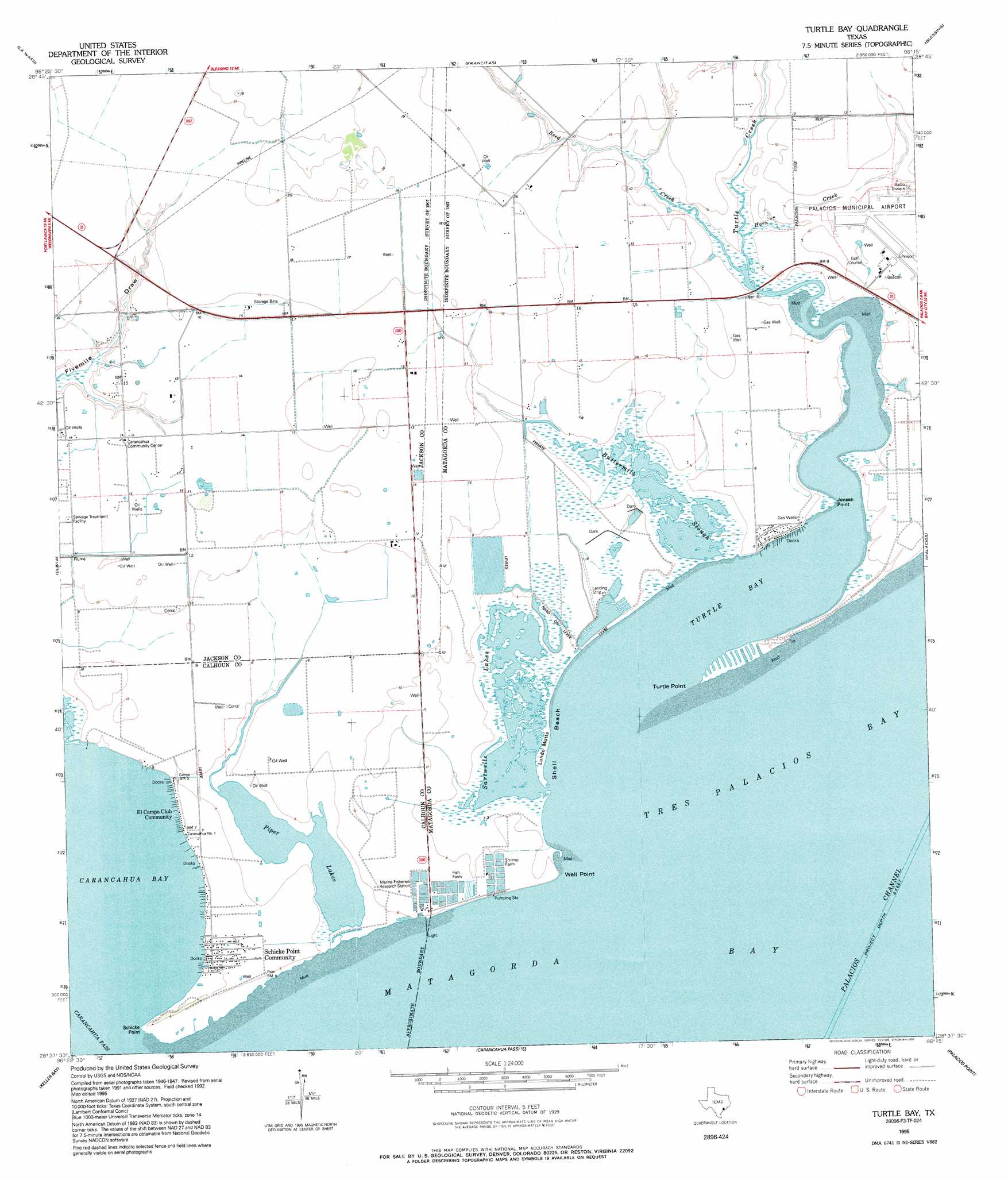
USGS Topo Quad 28096f3 - 1:24,000 scale
| Topo Map Name: | Turtle Bay |
| USGS Topo Quad ID: | 28096f3 |
| Print Size: | ca. 21 1/4" wide x 27" high |
| Southeast Coordinates: | 28.625° N latitude / 96.25° W longitude |
| Map Center Coordinates: | 28.6875° N latitude / 96.3125° W longitude |
| U.S. State: | TX |
| Filename: | o28096f3.jpg |
| Download Map JPG Image: | Turtle Bay topo map 1:24,000 scale |
| Map Type: | Topographic |
| Topo Series: | 7.5´ |
| Map Scale: | 1:24,000 |
| Source of Map Images: | United States Geological Survey (USGS) |
| Alternate Map Versions: |
Turtle Bay TX 1952, updated 1953 Download PDF Buy paper map Turtle Bay TX 1952, updated 1973 Download PDF Buy paper map Turtle Bay TX 1952, updated 1976 Download PDF Buy paper map Turtle Bay TX 1995, updated 1995 Download PDF Buy paper map Turtle Bay TX 2010 Download PDF Buy paper map Turtle Bay TX 2013 Download PDF Buy paper map Turtle Bay TX 2016 Download PDF Buy paper map |
1:24,000 Topo Quads surrounding Turtle Bay
Manson |
Francitas Nw |
Francitas Ne |
Midfield |
Markham |
Lolita |
La Ward |
Francitas |
Blessing |
Blessing Se |
Point Comfort |
Olivia |
Turtle Bay |
Palacios |
Palacios Ne |
Port Lavaca East |
Keller Bay |
Carancahua Pass |
Palacios Point |
Palacios Se |
Seadrift Ne |
Port O'Connor |
Decros Point |
South Of Palacios Point |
> Back to 28096e1 at 1:100,000 scale
> Back to 28096a1 at 1:250,000 scale
> Back to U.S. Topo Maps home
Turtle Bay topo map: Gazetteer
Turtle Bay: Airports
Palacios Municipal Airport elevation 3m 9′Sartwelle Ranch Airport elevation 3m 9′
Turtle Bay: Bays
Turtle Bay elevation 0m 0′Turtle Bay: Beaches
Shell Beach elevation 0m 0′Turtle Bay: Capes
Jensen Point elevation 5m 16′Lund Motte elevation 0m 0′
Schicke Point elevation 1m 3′
Schicke Point elevation 0m 0′
Turtle Point elevation 0m 0′
Well Point elevation 0m 0′
Turtle Bay: Channels
Carancahua Pass elevation 0m 0′Turtle Bay: Lakes
Sartwelle Lakes elevation 0m 0′Turtle Bay: Populated Places
El Campo Club Community elevation 1m 3′Schicke Point Community elevation 0m 0′
Turtle Bay: Streams
Buttermilk Slough elevation 0m 0′Horn Creek elevation 1m 3′
Reed Creek elevation 0m 0′
Turtle Creek elevation 0m 0′
Turtle Bay digital topo map on disk
Buy this Turtle Bay topo map showing relief, roads, GPS coordinates and other geographical features, as a high-resolution digital map file on DVD: