Bloomington Topo Map Texas
To zoom in, hover over the map of Bloomington
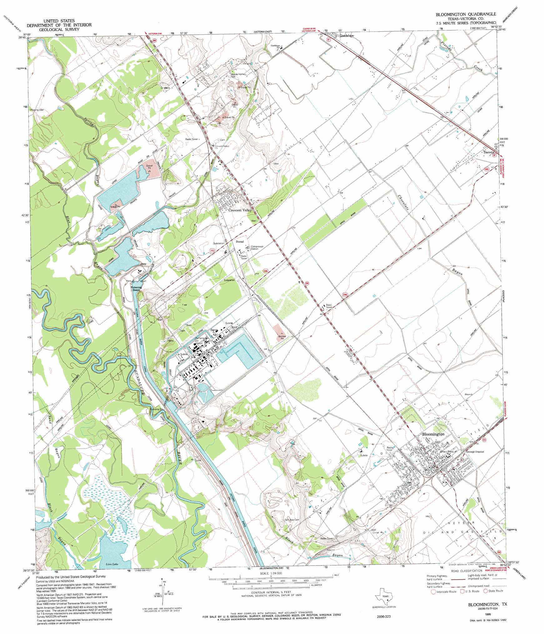
USGS Topo Quad 28096f8 - 1:24,000 scale
| Topo Map Name: | Bloomington |
| USGS Topo Quad ID: | 28096f8 |
| Print Size: | ca. 21 1/4" wide x 27" high |
| Southeast Coordinates: | 28.625° N latitude / 96.875° W longitude |
| Map Center Coordinates: | 28.6875° N latitude / 96.9375° W longitude |
| U.S. State: | TX |
| Filename: | o28096f8.jpg |
| Download Map JPG Image: | Bloomington topo map 1:24,000 scale |
| Map Type: | Topographic |
| Topo Series: | 7.5´ |
| Map Scale: | 1:24,000 |
| Source of Map Images: | United States Geological Survey (USGS) |
| Alternate Map Versions: |
Bloomington TX 1951, updated 1953 Download PDF Buy paper map Bloomington TX 1951, updated 1976 Download PDF Buy paper map Bloomington TX 1995, updated 1995 Download PDF Buy paper map Bloomington TX 2010 Download PDF Buy paper map Bloomington TX 2013 Download PDF Buy paper map Bloomington TX 2016 Download PDF Buy paper map |
1:24,000 Topo Quads surrounding Bloomington
Mission Valley |
Nursery |
Inez Nw |
Inez |
Edna |
Schroeder |
Victoria West |
Victoria East |
Marcado Creek |
La Salle |
Fannin |
Raisin |
Bloomington |
Placedo |
Kamey |
Lott Lake |
Mcfaddin |
Bloomington Sw |
Green Lake |
Port Lavaca West |
Vidaurri |
Lake Pasture |
Tivoli |
Austwell |
Seadrift |
> Back to 28096e1 at 1:100,000 scale
> Back to 28096a1 at 1:250,000 scale
> Back to U.S. Topo Maps home
Bloomington topo map: Gazetteer
Bloomington: Basins
Pickering Basin elevation 1m 3′Bloomington: Bridges
Dalton Bridge elevation 0m 0′Bloomington: Dams
Dupont Cooling Basin Dam elevation 21m 68′Lipscomb and Son Levee elevation 9m 29′
Bloomington: Lakes
Rupley Lake elevation 9m 29′Bloomington: Populated Places
Bloomington elevation 18m 59′Dernal elevation 21m 68′
Bloomington: Reservoirs
Dupont Cooling Basin elevation 21m 68′Lipscomb and Son Reservoir elevation 9m 29′
Bloomington: Streams
Blue Bayou elevation 2m 6′Spring Bayou elevation 7m 22′
Bloomington digital topo map on disk
Buy this Bloomington topo map showing relief, roads, GPS coordinates and other geographical features, as a high-resolution digital map file on DVD: