Blessing Se Topo Map Texas
To zoom in, hover over the map of Blessing Se
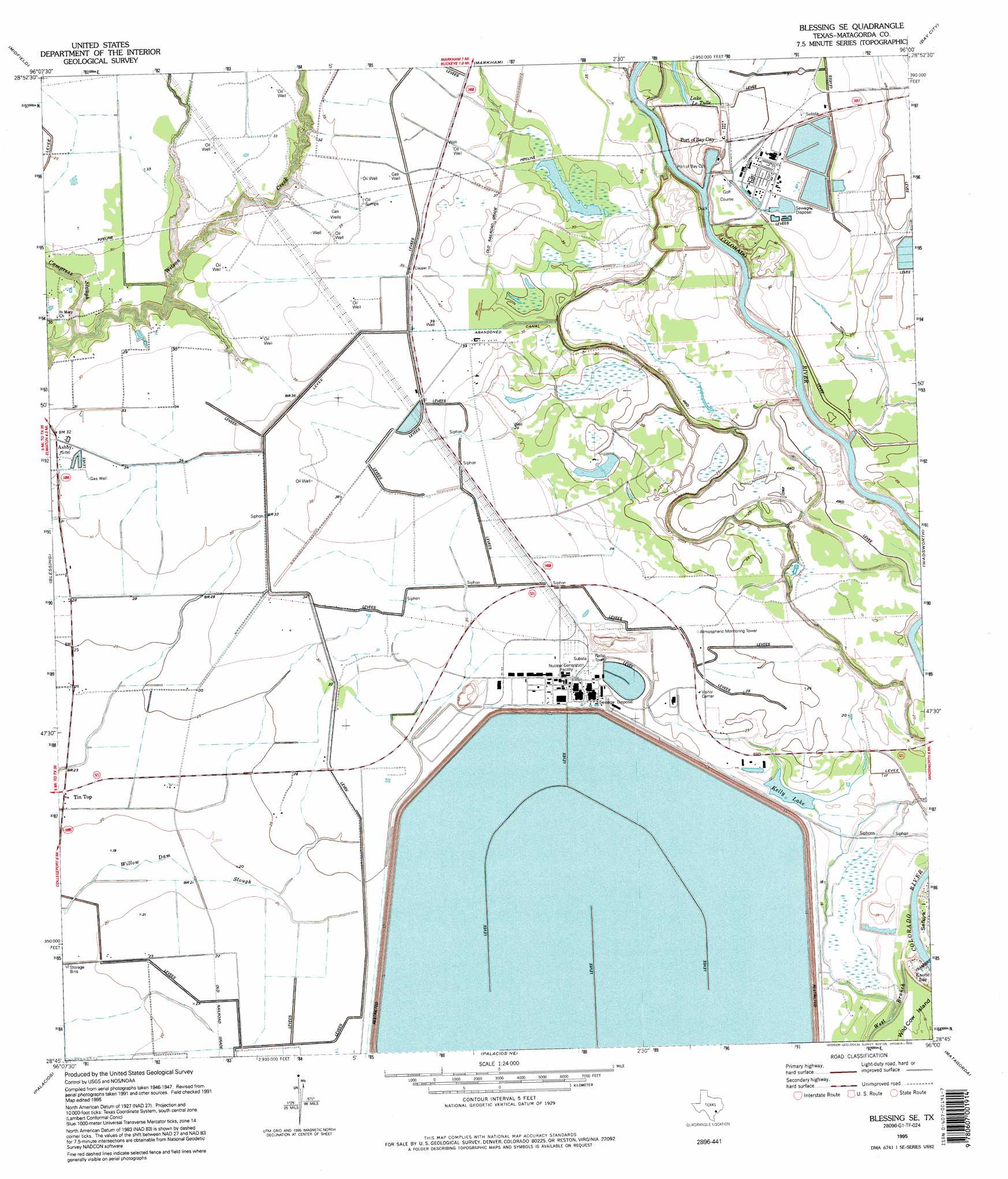
USGS Topo Quad 28096g1 - 1:24,000 scale
| Topo Map Name: | Blessing Se |
| USGS Topo Quad ID: | 28096g1 |
| Print Size: | ca. 21 1/4" wide x 27" high |
| Southeast Coordinates: | 28.75° N latitude / 96° W longitude |
| Map Center Coordinates: | 28.8125° N latitude / 96.0625° W longitude |
| U.S. State: | TX |
| Filename: | o28096g1.jpg |
| Download Map JPG Image: | Blessing Se topo map 1:24,000 scale |
| Map Type: | Topographic |
| Topo Series: | 7.5´ |
| Map Scale: | 1:24,000 |
| Source of Map Images: | United States Geological Survey (USGS) |
| Alternate Map Versions: |
Blessing SE TX 1952, updated 1953 Download PDF Buy paper map Blessing SE TX 1952, updated 1976 Download PDF Buy paper map Blessing SE TX 1995, updated 1995 Download PDF Buy paper map Blessing SE TX 2010 Download PDF Buy paper map Blessing SE TX 2013 Download PDF Buy paper map Blessing SE TX 2016 Download PDF Buy paper map |
1:24,000 Topo Quads surrounding Blessing Se
El Campo Se |
Danevang |
Lane City Se |
Van Vleck |
Ashwood |
Francitas Ne |
Midfield |
Markham |
Bay City |
Bay City Ne |
Francitas |
Blessing |
Blessing Se |
Wadsworth |
Lake Austin |
Turtle Bay |
Palacios |
Palacios Ne |
Matagorda |
Dressing Point |
Carancahua Pass |
Palacios Point |
Palacios Se |
Matagorda Sw |
> Back to 28096e1 at 1:100,000 scale
> Back to 28096a1 at 1:250,000 scale
> Back to U.S. Topo Maps home
Blessing Se topo map: Gazetteer
Blessing Se: Lakes
Kelly Lake elevation 3m 9′Blessing Se: Populated Places
Ashby elevation 9m 29′Simpsonville elevation 7m 22′
Tin Top elevation 7m 22′
Blessing Se: Streams
Compress Slough elevation 1m 3′West Branch Colorado River elevation 1m 3′
Blessing Se digital topo map on disk
Buy this Blessing Se topo map showing relief, roads, GPS coordinates and other geographical features, as a high-resolution digital map file on DVD: