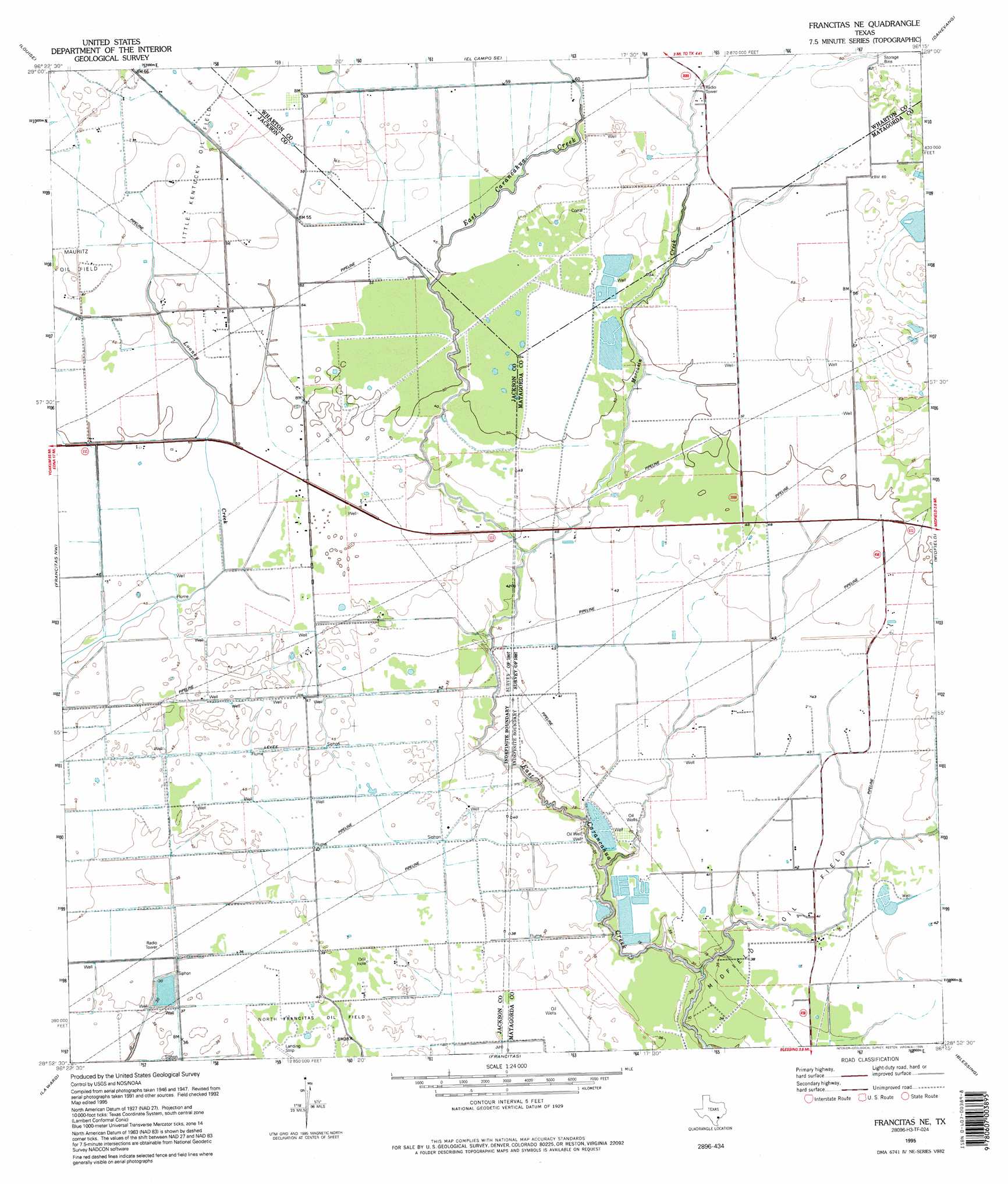
Francitas Ne Topo Map Texas
To zoom in, hover over the map of Francitas Ne
USGS Topo Quad 28096h3 - 1:24,000 scale
| Topo Map Name: | Francitas Ne |
| USGS Topo Quad ID: | 28096h3 |
| Print Size: | ca. 21 1/4" wide x 27" high |
| Southeast Coordinates: | 28.875° N latitude / 96.25° W longitude |
| Map Center Coordinates: | 28.9375° N latitude / 96.3125° W longitude |
| U.S. State: | TX |
| Filename: | o28096h3.jpg |
| Download Map JPG Image: | Francitas Ne topo map 1:24,000 scale |
| Map Type: | Topographic |
| Topo Series: | 7.5´ |
| Map Scale: | 1:24,000 |
| Source of Map Images: | United States Geological Survey (USGS) |
| Alternate Map Versions: |
Francitas NE TX 1952, updated 1953 Download PDF Buy paper map Francitas NE TX 1952, updated 1976 Download PDF Buy paper map Francitas NE TX 1995, updated 1995 Download PDF Buy paper map Francitas NE TX 2010 Download PDF Buy paper map Francitas NE TX 2013 Download PDF Buy paper map Francitas NE TX 2016 Download PDF Buy paper map |
1:24,000 Topo Quads surrounding Francitas Ne
Ganado Ne |
Gobbler Creek |
El Campo |
Pierce |
Lane City |
Ganado |
Louise |
El Campo Se |
Danevang |
Lane City Se |
Manson |
Francitas Nw |
Francitas Ne |
Midfield |
Markham |
Lolita |
La Ward |
Francitas |
Blessing |
Blessing Se |
Point Comfort |
Olivia |
Turtle Bay |
Palacios |
Palacios Ne |
> Back to 28096e1 at 1:100,000 scale
> Back to 28096a1 at 1:250,000 scale
> Back to U.S. Topo Maps home
Francitas Ne topo map: Gazetteer
Francitas Ne: Dams
Reservoir Number 4 Dam elevation 16m 52′Francitas Ne: Oilfields
Little Kentucky Oil Field elevation 18m 59′Midfield Oil Field elevation 12m 39′
North Francitas Oil Field elevation 12m 39′
Francitas Ne: Reservoirs
Reservoir Number 4 elevation 16m 52′Francitas Ne: Streams
Moccasin Creek elevation 12m 39′Francitas Ne digital topo map on disk
Buy this Francitas Ne topo map showing relief, roads, GPS coordinates and other geographical features, as a high-resolution digital map file on DVD: