Inez Nw Topo Map Texas
To zoom in, hover over the map of Inez Nw
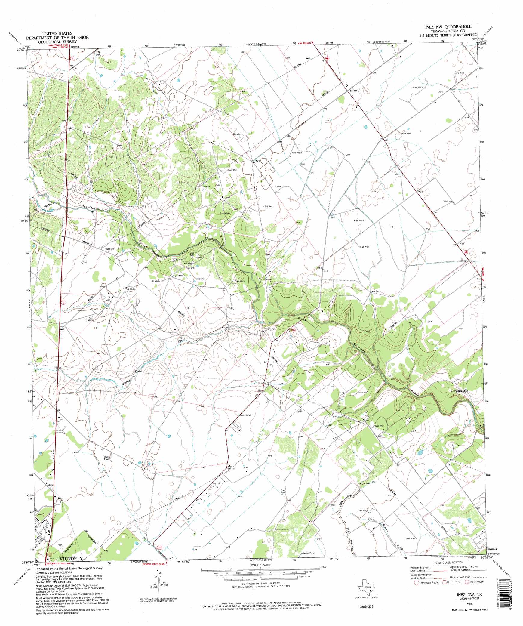
USGS Topo Quad 28096h8 - 1:24,000 scale
| Topo Map Name: | Inez Nw |
| USGS Topo Quad ID: | 28096h8 |
| Print Size: | ca. 21 1/4" wide x 27" high |
| Southeast Coordinates: | 28.875° N latitude / 96.875° W longitude |
| Map Center Coordinates: | 28.9375° N latitude / 96.9375° W longitude |
| U.S. State: | TX |
| Filename: | o28096h8.jpg |
| Download Map JPG Image: | Inez Nw topo map 1:24,000 scale |
| Map Type: | Topographic |
| Topo Series: | 7.5´ |
| Map Scale: | 1:24,000 |
| Source of Map Images: | United States Geological Survey (USGS) |
| Alternate Map Versions: |
Inez NW TX 1951, updated 1953 Download PDF Buy paper map Inez NW TX 1951, updated 1976 Download PDF Buy paper map Inez NW TX 1995, updated 1995 Download PDF Buy paper map Inez NW TX 2010 Download PDF Buy paper map Inez NW TX 2013 Download PDF Buy paper map Inez NW TX 2016 Download PDF Buy paper map |
1:24,000 Topo Quads surrounding Inez Nw
Edgar |
Terryville |
Hope |
Morales |
Cordele |
Verhelle |
Fordtran |
Peck Branch |
Navidad |
Mount Olive |
Mission Valley |
Nursery |
Inez Nw |
Inez |
Edna |
Schroeder |
Victoria West |
Victoria East |
Marcado Creek |
La Salle |
Fannin |
Raisin |
Bloomington |
Placedo |
Kamey |
> Back to 28096e1 at 1:100,000 scale
> Back to 28096a1 at 1:250,000 scale
> Back to U.S. Topo Maps home
Inez Nw topo map: Gazetteer
Inez Nw: Populated Places
Salem elevation 37m 121′Inez Nw: Streams
Willow Creek elevation 26m 85′Inez Nw digital topo map on disk
Buy this Inez Nw topo map showing relief, roads, GPS coordinates and other geographical features, as a high-resolution digital map file on DVD: