Sinton East Topo Map Texas
To zoom in, hover over the map of Sinton East
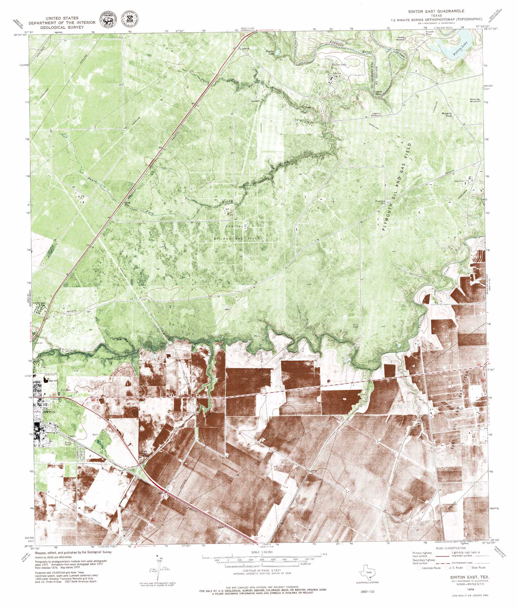
USGS Topo Quad 28097a4 - 1:24,000 scale
| Topo Map Name: | Sinton East |
| USGS Topo Quad ID: | 28097a4 |
| Print Size: | ca. 21 1/4" wide x 27" high |
| Southeast Coordinates: | 28° N latitude / 97.375° W longitude |
| Map Center Coordinates: | 28.0625° N latitude / 97.4375° W longitude |
| U.S. State: | TX |
| Filename: | o28097a4.jpg |
| Download Map JPG Image: | Sinton East topo map 1:24,000 scale |
| Map Type: | Topographic |
| Topo Series: | 7.5´ |
| Map Scale: | 1:24,000 |
| Source of Map Images: | United States Geological Survey (USGS) |
| Alternate Map Versions: |
Sinton East TX 1979, updated 1979 Download PDF Buy paper map Sinton East TX 1979, updated 1979 Download PDF Buy paper map Sinton East TX 2010 Download PDF Buy paper map Sinton East TX 2013 Download PDF Buy paper map Sinton East TX 2016 Download PDF Buy paper map |
1:24,000 Topo Quads surrounding Sinton East
Skidmore |
Burkes Ridge |
Refugio Sw |
Refugio |
Quintana |
Bullshead Creek |
Papalote |
Cranell |
Woodsboro |
Mission Bay |
West Sinton |
Sinton West |
Sinton East |
Rincon Bend |
Bayside |
Edroy |
Odem |
Taft |
Gregory |
Aransas Pass |
Robstown |
Annaville |
Corpus Christi |
Portland |
Port Ingleside |
> Back to 28097a1 at 1:100,000 scale
> Back to 28096a1 at 1:250,000 scale
> Back to U.S. Topo Maps home
Sinton East topo map: Gazetteer
Sinton East: Oilfields
Plymouth Oil Field elevation 14m 45′Sinton Oil Field elevation 14m 45′
Sinton East: Parks
Welder Wildlife Foundation Park elevation 14m 45′Sinton East: Populated Places
Buena Vista Colonia elevation 15m 49′Ewelder elevation 15m 49′
O'Farrell Acres Number 1 Colonia elevation 16m 52′
Rancho Chico elevation 15m 49′
Rancho Chico Addition Colonia elevation 15m 49′
Second Rancho Chico Additio Colonia elevation 15m 49′
Third Rancho Chico Addition Colonia elevation 15m 49′
Sinton East digital topo map on disk
Buy this Sinton East topo map showing relief, roads, GPS coordinates and other geographical features, as a high-resolution digital map file on DVD: