Mission Bay Topo Map Texas
To zoom in, hover over the map of Mission Bay
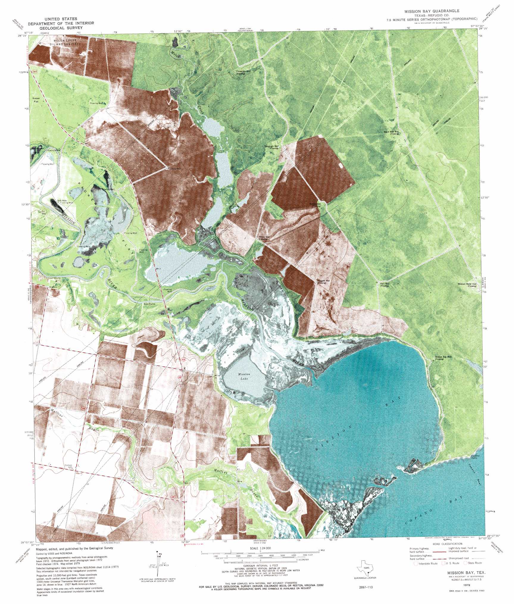
USGS Topo Quad 28097b2 - 1:24,000 scale
| Topo Map Name: | Mission Bay |
| USGS Topo Quad ID: | 28097b2 |
| Print Size: | ca. 21 1/4" wide x 27" high |
| Southeast Coordinates: | 28.125° N latitude / 97.125° W longitude |
| Map Center Coordinates: | 28.1875° N latitude / 97.1875° W longitude |
| U.S. State: | TX |
| Filename: | o28097b2.jpg |
| Download Map JPG Image: | Mission Bay topo map 1:24,000 scale |
| Map Type: | Topographic |
| Topo Series: | 7.5´ |
| Map Scale: | 1:24,000 |
| Source of Map Images: | United States Geological Survey (USGS) |
| Alternate Map Versions: |
Mission Bay TX 1979, updated 1979 Download PDF Buy paper map Mission Bay TX 2010 Download PDF Buy paper map Mission Bay TX 2013 Download PDF Buy paper map Mission Bay TX 2016 Download PDF Buy paper map |
1:24,000 Topo Quads surrounding Mission Bay
Blanconia |
Ryanville |
Vidaurri |
Lake Pasture |
Tivoli |
Refugio Sw |
Refugio |
Quintana |
Twin Mott Lake |
Tivoli Sw |
Cranell |
Woodsboro |
Mission Bay |
Lamar |
Saint Charles Bay |
Sinton East |
Rincon Bend |
Bayside |
Rockport |
Saint Charles Bay Sw |
Taft |
Gregory |
Aransas Pass |
Estes |
Allyns Bight |
> Back to 28097a1 at 1:100,000 scale
> Back to 28096a1 at 1:250,000 scale
> Back to U.S. Topo Maps home
Mission Bay topo map: Gazetteer
Mission Bay: Bays
Mission Bay elevation 0m 0′Mission Bay: Lakes
Mission Lake elevation 2m 6′Mission Bay: Springs
Hynes Springs elevation 1m 3′Mission Bay: Streams
Melon Creek elevation 1m 3′Mission River elevation 0m 0′
Mullens Bayou elevation 1m 3′
Mission Bay digital topo map on disk
Buy this Mission Bay topo map showing relief, roads, GPS coordinates and other geographical features, as a high-resolution digital map file on DVD: