Woodsboro Topo Map Texas
To zoom in, hover over the map of Woodsboro
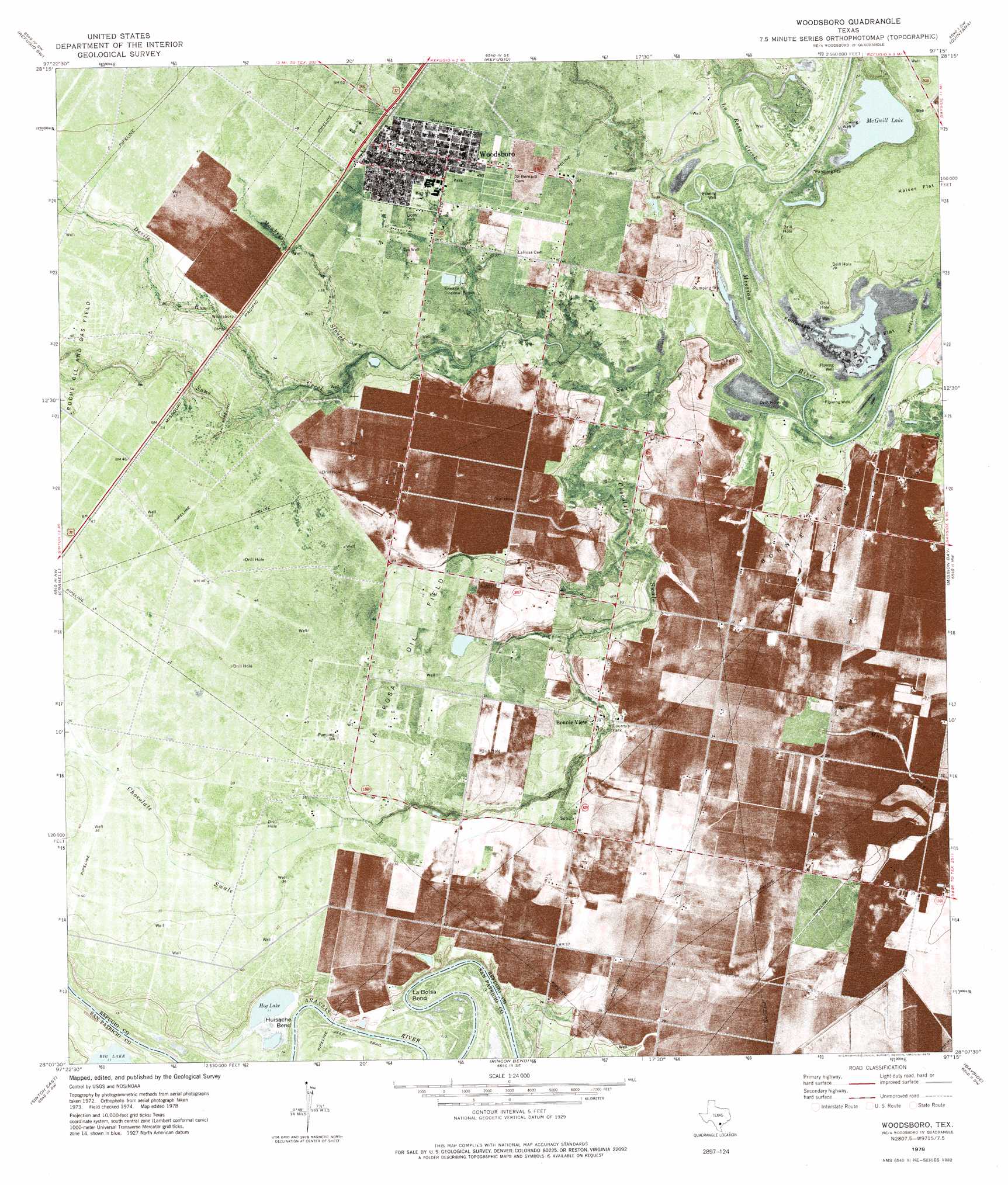
USGS Topo Quad 28097b3 - 1:24,000 scale
| Topo Map Name: | Woodsboro |
| USGS Topo Quad ID: | 28097b3 |
| Print Size: | ca. 21 1/4" wide x 27" high |
| Southeast Coordinates: | 28.125° N latitude / 97.25° W longitude |
| Map Center Coordinates: | 28.1875° N latitude / 97.3125° W longitude |
| U.S. State: | TX |
| Filename: | o28097b3.jpg |
| Download Map JPG Image: | Woodsboro topo map 1:24,000 scale |
| Map Type: | Topographic |
| Topo Series: | 7.5´ |
| Map Scale: | 1:24,000 |
| Source of Map Images: | United States Geological Survey (USGS) |
| Alternate Map Versions: |
Woodsboro TX 1978, updated 1978 Download PDF Buy paper map Woodsboro TX 2010 Download PDF Buy paper map Woodsboro TX 2013 Download PDF Buy paper map Woodsboro TX 2016 Download PDF Buy paper map |
1:24,000 Topo Quads surrounding Woodsboro
Skidmore Ne |
Blanconia |
Ryanville |
Vidaurri |
Lake Pasture |
Burkes Ridge |
Refugio Sw |
Refugio |
Quintana |
Twin Mott Lake |
Papalote |
Cranell |
Woodsboro |
Mission Bay |
Lamar |
Sinton West |
Sinton East |
Rincon Bend |
Bayside |
Rockport |
Odem |
Taft |
Gregory |
Aransas Pass |
Estes |
> Back to 28097a1 at 1:100,000 scale
> Back to 28096a1 at 1:250,000 scale
> Back to U.S. Topo Maps home
Woodsboro topo map: Gazetteer
Woodsboro: Bends
Huisache Bend elevation 4m 13′La Bolsa Bend elevation 4m 13′
Woodsboro: Flats
Fennessey Flat elevation 2m 6′Kaiser Flat elevation 10m 32′
Woodsboro: Lakes
Hog Lake elevation 4m 13′McGuill Lake elevation 2m 6′
Woodsboro: Oilfields
Bonnie View Oil Field elevation 10m 32′La Rosa Oil Field elevation 12m 39′
Woodsboro: Parks
Lions Park elevation 11m 36′Woodsboro: Populated Places
Bonnie View elevation 9m 29′Woodsboro elevation 12m 39′
Woodsboro: Streams
Chocolate Swale elevation 1m 3′Devils Run elevation 4m 13′
La Rosa Creek elevation 1m 3′
Monkey Slough elevation 2m 6′
Sous Creek elevation 2m 6′
Woodsboro digital topo map on disk
Buy this Woodsboro topo map showing relief, roads, GPS coordinates and other geographical features, as a high-resolution digital map file on DVD: