Dinero Topo Map Texas
To zoom in, hover over the map of Dinero
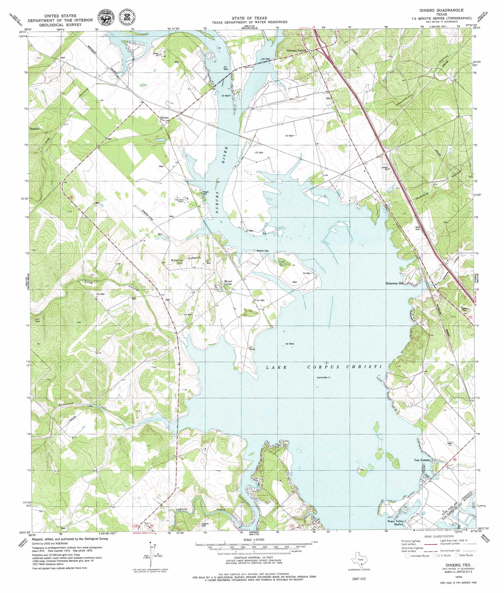
USGS Topo Quad 28097b8 - 1:24,000 scale
| Topo Map Name: | Dinero |
| USGS Topo Quad ID: | 28097b8 |
| Print Size: | ca. 21 1/4" wide x 27" high |
| Southeast Coordinates: | 28.125° N latitude / 97.875° W longitude |
| Map Center Coordinates: | 28.1875° N latitude / 97.9375° W longitude |
| U.S. State: | TX |
| Filename: | o28097b8.jpg |
| Download Map JPG Image: | Dinero topo map 1:24,000 scale |
| Map Type: | Topographic |
| Topo Series: | 7.5´ |
| Map Scale: | 1:24,000 |
| Source of Map Images: | United States Geological Survey (USGS) |
| Alternate Map Versions: |
Dinero TX 1979, updated 1979 Download PDF Buy paper map Dinero TX 2010 Download PDF Buy paper map Dinero TX 2013 Download PDF Buy paper map Dinero TX 2016 Download PDF Buy paper map |
1:24,000 Topo Quads surrounding Dinero
Three Rivers |
Oakville |
Cadiz |
Beeville West |
Beeville East |
Oakville Sw |
George West |
Mulos Hills |
Clareville |
Skidmore |
Elm Creek |
Crater Ridge |
Dinero |
Tynan |
Bullshead Creek |
Anna Rose |
Midway |
Sandia |
Mathis |
West Sinton |
Shaeffer Ranch |
San Diego Ne |
Orange Grove |
San Patricio |
Edroy |
> Back to 28097a1 at 1:100,000 scale
> Back to 28096a1 at 1:250,000 scale
> Back to U.S. Topo Maps home
Dinero topo map: Gazetteer
Dinero: Populated Places
Dinero elevation 34m 111′Hideaway Hill elevation 30m 98′
Lake Mathis Point Colonia elevation 29m 95′
Los Lomas elevation 29m 95′
Mount Lucas elevation 45m 147′
North Lakeshore Gardens Colonia elevation 28m 91′
Peace Valley Harbor elevation 29m 95′
Dinero: Streams
Lagarto Creek elevation 28m 91′Paisano Creek elevation 28m 91′
Ramirena Creek elevation 29m 95′
Dinero: Summits
Balania Hill elevation 64m 209′Dinero: Valleys
Hog Hollow elevation 28m 91′Long Hollow elevation 28m 91′
Mustang Hollow elevation 30m 98′
Rufe Williams Hollow elevation 30m 98′
Weathersby Hollow elevation 34m 111′
Dinero digital topo map on disk
Buy this Dinero topo map showing relief, roads, GPS coordinates and other geographical features, as a high-resolution digital map file on DVD: