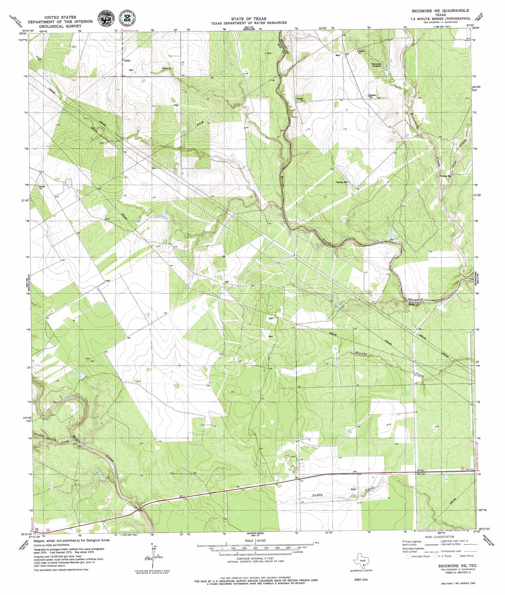
Skidmore Ne Topo Map Texas
To zoom in, hover over the map of Skidmore Ne
USGS Topo Quad 28097d5 - 1:24,000 scale
| Topo Map Name: | Skidmore Ne |
| USGS Topo Quad ID: | 28097d5 |
| Print Size: | ca. 21 1/4" wide x 27" high |
| Southeast Coordinates: | 28.375° N latitude / 97.5° W longitude |
| Map Center Coordinates: | 28.4375° N latitude / 97.5625° W longitude |
| U.S. State: | TX |
| Filename: | o28097d5.jpg |
| Download Map JPG Image: | Skidmore Ne topo map 1:24,000 scale |
| Map Type: | Topographic |
| Topo Series: | 7.5´ |
| Map Scale: | 1:24,000 |
| Source of Map Images: | United States Geological Survey (USGS) |
| Alternate Map Versions: |
Skidmore NE TX 1979, updated 1979 Download PDF Buy paper map Skidmore NE TX 2010 Download PDF Buy paper map Skidmore NE TX 2013 Download PDF Buy paper map Skidmore NE TX 2016 Download PDF Buy paper map |
1:24,000 Topo Quads surrounding Skidmore Ne
Tulsita |
Berclair Nw |
Charco |
Goliad |
Hensley Lake |
Tuleta |
Lazy F Ranch |
Berclair |
Melo |
Live Oak Lake |
Beeville West |
Beeville East |
Skidmore Ne |
Blanconia |
Ryanville |
Clareville |
Skidmore |
Burkes Ridge |
Refugio Sw |
Refugio |
Tynan |
Bullshead Creek |
Papalote |
Cranell |
Woodsboro |
> Back to 28097a1 at 1:100,000 scale
> Back to 28096a1 at 1:250,000 scale
> Back to U.S. Topo Maps home
Skidmore Ne topo map: Gazetteer
Skidmore Ne: Streams
Goat Creek elevation 30m 98′Parker Hollow Creek elevation 38m 124′
Skidmore Ne digital topo map on disk
Buy this Skidmore Ne topo map showing relief, roads, GPS coordinates and other geographical features, as a high-resolution digital map file on DVD: