Charco Topo Map Texas
To zoom in, hover over the map of Charco
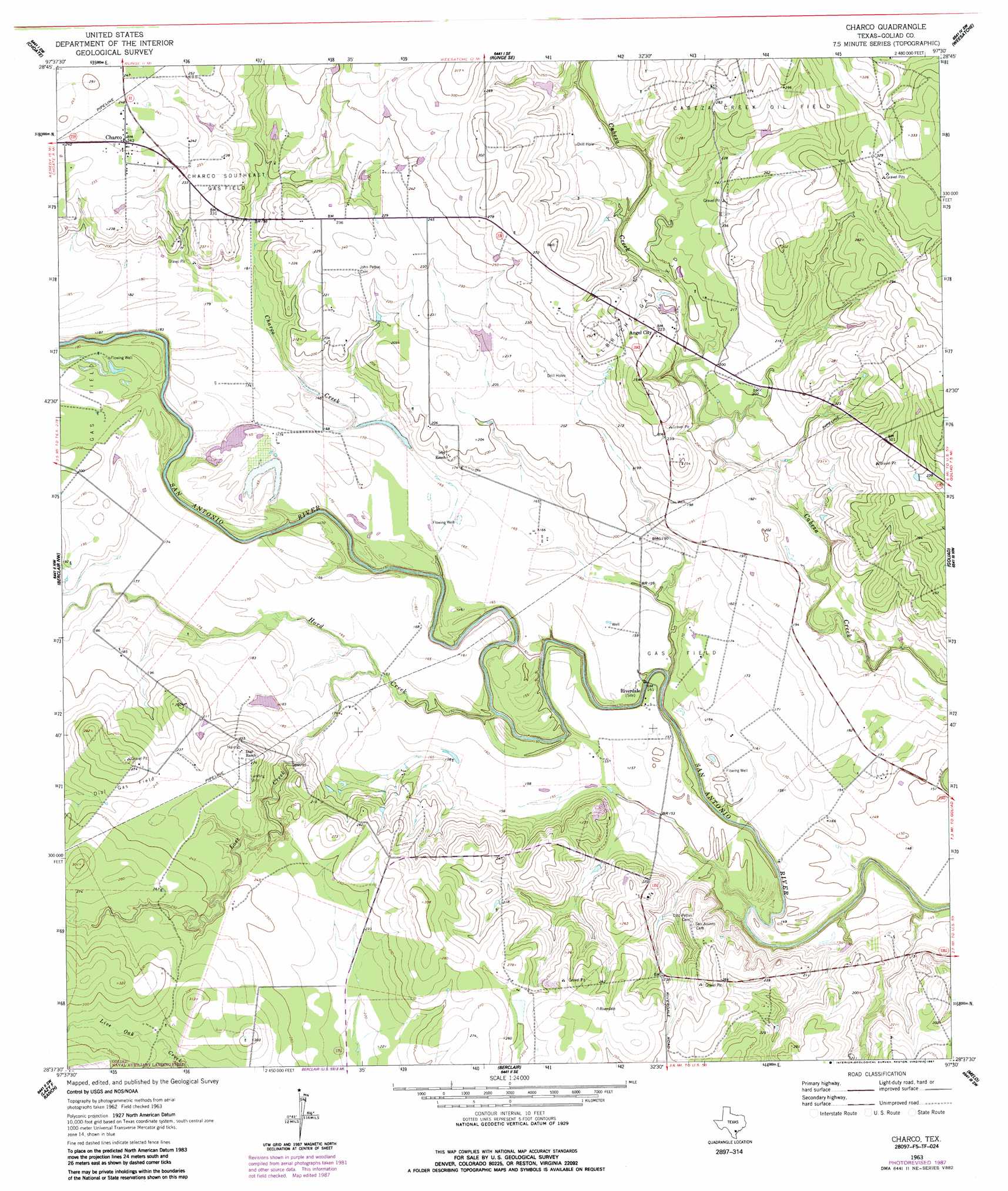
USGS Topo Quad 28097f5 - 1:24,000 scale
| Topo Map Name: | Charco |
| USGS Topo Quad ID: | 28097f5 |
| Print Size: | ca. 21 1/4" wide x 27" high |
| Southeast Coordinates: | 28.625° N latitude / 97.5° W longitude |
| Map Center Coordinates: | 28.6875° N latitude / 97.5625° W longitude |
| U.S. State: | TX |
| Filename: | o28097f5.jpg |
| Download Map JPG Image: | Charco topo map 1:24,000 scale |
| Map Type: | Topographic |
| Topo Series: | 7.5´ |
| Map Scale: | 1:24,000 |
| Source of Map Images: | United States Geological Survey (USGS) |
| Alternate Map Versions: |
Charco TX 1963, updated 1966 Download PDF Buy paper map Charco TX 1963, updated 1987 Download PDF Buy paper map Charco TX 2010 Download PDF Buy paper map Charco TX 2013 Download PDF Buy paper map Charco TX 2016 Download PDF Buy paper map |
1:24,000 Topo Quads surrounding Charco
Helena |
Runge |
Yorktown West |
Yorktown East |
Meyersville |
Kenedy |
Choate |
Runge Se |
Weesatche |
Ander |
Tulsita |
Berclair Nw |
Charco |
Goliad |
Hensley Lake |
Tuleta |
Lazy F Ranch |
Berclair |
Melo |
Live Oak Lake |
Beeville West |
Beeville East |
Skidmore Ne |
Blanconia |
Ryanville |
> Back to 28097e1 at 1:100,000 scale
> Back to 28096a1 at 1:250,000 scale
> Back to U.S. Topo Maps home
Charco topo map: Gazetteer
Charco: Oilfields
Albrecht Gas Field elevation 62m 203′Charco Southeast Gas Field elevation 71m 232′
Charco: Populated Places
Angel City elevation 68m 223′Charco elevation 74m 242′
Riverdale elevation 47m 154′
Charco: Streams
Charco Creek elevation 49m 160′Hord Creek elevation 41m 134′
Lost Creek elevation 48m 157′
Charco digital topo map on disk
Buy this Charco topo map showing relief, roads, GPS coordinates and other geographical features, as a high-resolution digital map file on DVD: