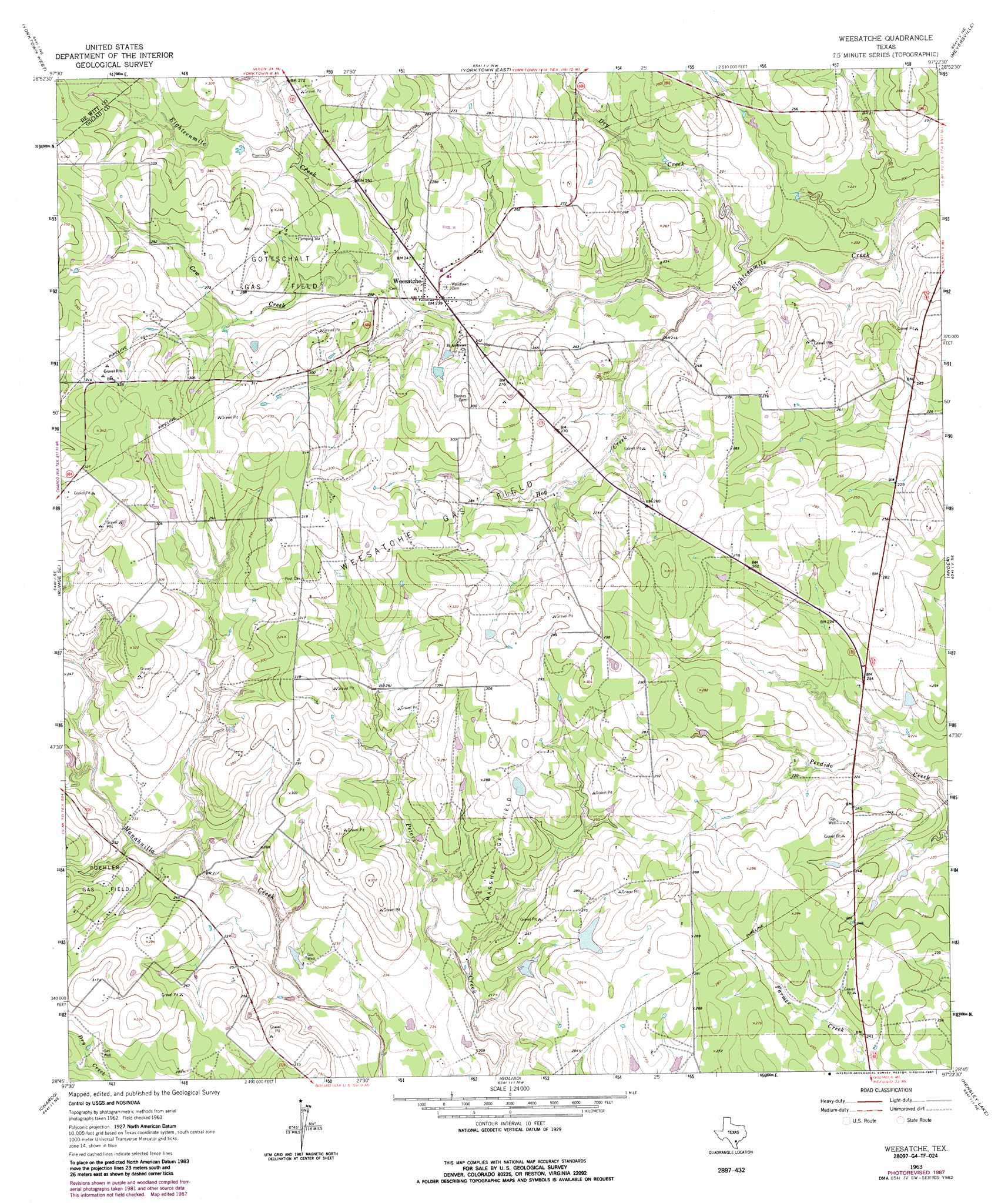
Weesatche Topo Map Texas
To zoom in, hover over the map of Weesatche
USGS Topo Quad 28097g4 - 1:24,000 scale
| Topo Map Name: | Weesatche |
| USGS Topo Quad ID: | 28097g4 |
| Print Size: | ca. 21 1/4" wide x 27" high |
| Southeast Coordinates: | 28.75° N latitude / 97.375° W longitude |
| Map Center Coordinates: | 28.8125° N latitude / 97.4375° W longitude |
| U.S. State: | TX |
| Filename: | o28097g4.jpg |
| Download Map JPG Image: | Weesatche topo map 1:24,000 scale |
| Map Type: | Topographic |
| Topo Series: | 7.5´ |
| Map Scale: | 1:24,000 |
| Source of Map Images: | United States Geological Survey (USGS) |
| Alternate Map Versions: |
Weesatche TX 1963, updated 1965 Download PDF Buy paper map Weesatche TX 1963, updated 1987 Download PDF Buy paper map Weesatche TX 2010 Download PDF Buy paper map Weesatche TX 2013 Download PDF Buy paper map Weesatche TX 2016 Download PDF Buy paper map |
1:24,000 Topo Quads surrounding Weesatche
Garfield |
New Davy |
Blackwell Lake |
Cuero |
Verhelle |
Runge |
Yorktown West |
Yorktown East |
Meyersville |
Mission Valley |
Choate |
Runge Se |
Weesatche |
Ander |
Schroeder |
Berclair Nw |
Charco |
Goliad |
Hensley Lake |
Fannin |
Lazy F Ranch |
Berclair |
Melo |
Live Oak Lake |
Lott Lake |
> Back to 28097e1 at 1:100,000 scale
> Back to 28096a1 at 1:250,000 scale
> Back to U.S. Topo Maps home
Weesatche topo map: Gazetteer
Weesatche: Dams
Dye Lake Dam elevation 78m 255′Weesatche: Oilfields
Gottschalt Gas Field elevation 83m 272′Marshall Gas Field elevation 86m 282′
Poehler Gas Field elevation 87m 285′
Weesatche Gas Field elevation 88m 288′
Weesatche: Populated Places
Weesatche elevation 71m 232′Weesatche: Reservoirs
Dye Lake elevation 78m 255′Weesatche: Streams
Cow Creek elevation 70m 229′Dry Creek elevation 58m 190′
Hog Creek elevation 60m 196′
Weesatche digital topo map on disk
Buy this Weesatche topo map showing relief, roads, GPS coordinates and other geographical features, as a high-resolution digital map file on DVD: