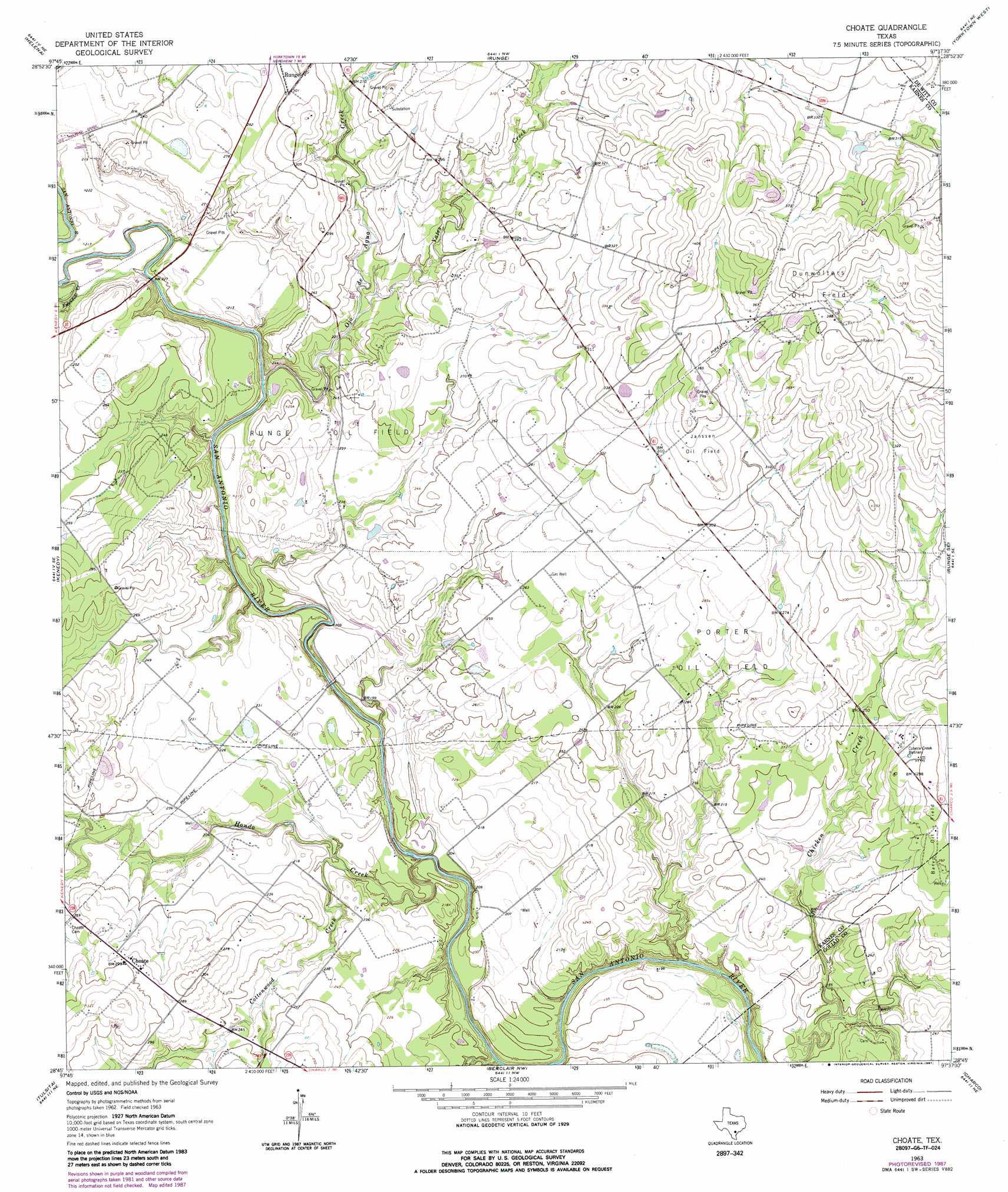
Choate Topo Map Texas
To zoom in, hover over the map of Choate
USGS Topo Quad 28097g6 - 1:24,000 scale
| Topo Map Name: | Choate |
| USGS Topo Quad ID: | 28097g6 |
| Print Size: | ca. 21 1/4" wide x 27" high |
| Southeast Coordinates: | 28.75° N latitude / 97.625° W longitude |
| Map Center Coordinates: | 28.8125° N latitude / 97.6875° W longitude |
| U.S. State: | TX |
| Filename: | o28097g6.jpg |
| Download Map JPG Image: | Choate topo map 1:24,000 scale |
| Map Type: | Topographic |
| Topo Series: | 7.5´ |
| Map Scale: | 1:24,000 |
| Source of Map Images: | United States Geological Survey (USGS) |
| Alternate Map Versions: |
Choate TX 1963, updated 1965 Download PDF Buy paper map Choate TX 1963, updated 1987 Download PDF Buy paper map Choate TX 2010 Download PDF Buy paper map Choate TX 2013 Download PDF Buy paper map Choate TX 2016 Download PDF Buy paper map |
1:24,000 Topo Quads surrounding Choate
Kosciusko |
Ecleto |
Garfield |
New Davy |
Blackwell Lake |
Karnes City |
Helena |
Runge |
Yorktown West |
Yorktown East |
Lenz |
Kenedy |
Choate |
Runge Se |
Weesatche |
Monteola |
Tulsita |
Berclair Nw |
Charco |
Goliad |
Mineral |
Tuleta |
Lazy F Ranch |
Berclair |
Melo |
> Back to 28097e1 at 1:100,000 scale
> Back to 28096a1 at 1:250,000 scale
> Back to U.S. Topo Maps home
Choate topo map: Gazetteer
Choate: Oilfields
Dunwolters Oil Field elevation 120m 393′Janssen Oil Field elevation 103m 337′
Porter Oil Field elevation 83m 272′
Runge Oil Field elevation 70m 229′
Choate: Populated Places
Choate elevation 87m 285′Couch elevation 80m 262′
Choate: Streams
Cottonwood Creek elevation 61m 200′Escondido Creek elevation 59m 193′
Hondo Creek elevation 58m 190′
Ojo de Agua Creek elevation 64m 209′
Yates Creek elevation 69m 226′
Choate digital topo map on disk
Buy this Choate topo map showing relief, roads, GPS coordinates and other geographical features, as a high-resolution digital map file on DVD: