Yorktown West Topo Map Texas
To zoom in, hover over the map of Yorktown West
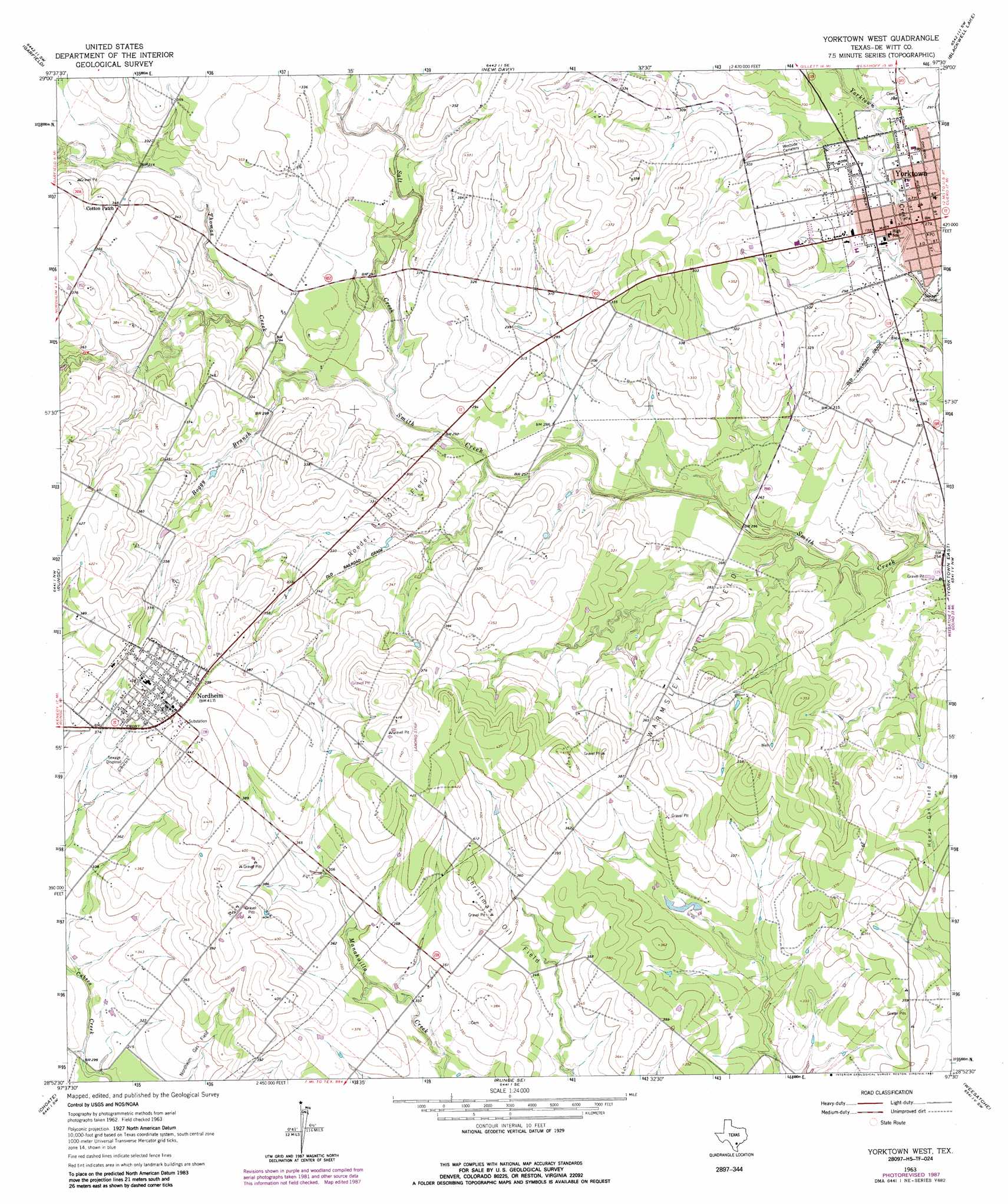
USGS Topo Quad 28097h5 - 1:24,000 scale
| Topo Map Name: | Yorktown West |
| USGS Topo Quad ID: | 28097h5 |
| Print Size: | ca. 21 1/4" wide x 27" high |
| Southeast Coordinates: | 28.875° N latitude / 97.5° W longitude |
| Map Center Coordinates: | 28.9375° N latitude / 97.5625° W longitude |
| U.S. State: | TX |
| Filename: | o28097h5.jpg |
| Download Map JPG Image: | Yorktown West topo map 1:24,000 scale |
| Map Type: | Topographic |
| Topo Series: | 7.5´ |
| Map Scale: | 1:24,000 |
| Source of Map Images: | United States Geological Survey (USGS) |
| Alternate Map Versions: |
Yorktown West TX 1963, updated 1965 Download PDF Buy paper map Yorktown West TX 1963, updated 1982 Download PDF Buy paper map Yorktown West TX 1963, updated 1987 Download PDF Buy paper map Yorktown West TX 2010 Download PDF Buy paper map Yorktown West TX 2013 Download PDF Buy paper map Yorktown West TX 2016 Download PDF Buy paper map |
1:24,000 Topo Quads surrounding Yorktown West
Gillett |
Bald Mound |
Sample |
Westhoff |
Concrete |
Ecleto |
Garfield |
New Davy |
Blackwell Lake |
Cuero |
Helena |
Runge |
Yorktown West |
Yorktown East |
Meyersville |
Kenedy |
Choate |
Runge Se |
Weesatche |
Ander |
Tulsita |
Berclair Nw |
Charco |
Goliad |
Hensley Lake |
> Back to 28097e1 at 1:100,000 scale
> Back to 28096a1 at 1:250,000 scale
> Back to U.S. Topo Maps home
Yorktown West topo map: Gazetteer
Yorktown West: Oilfields
Christmas Oil Field elevation 110m 360′Roeder Oil Field elevation 96m 314′
Warmsley Oil Field elevation 90m 295′
Yorktown West: Populated Places
Cotton Patch elevation 106m 347′Nordheim elevation 123m 403′
Yorktown elevation 84m 275′
Yorktown West: Streams
Boggy Branch elevation 87m 285′Butler Creek elevation 98m 321′
Salt Creek elevation 83m 272′
Thomas Creek elevation 87m 285′
Yorktown West digital topo map on disk
Buy this Yorktown West topo map showing relief, roads, GPS coordinates and other geographical features, as a high-resolution digital map file on DVD: