Mirasol Creek Topo Map Texas
To zoom in, hover over the map of Mirasol Creek
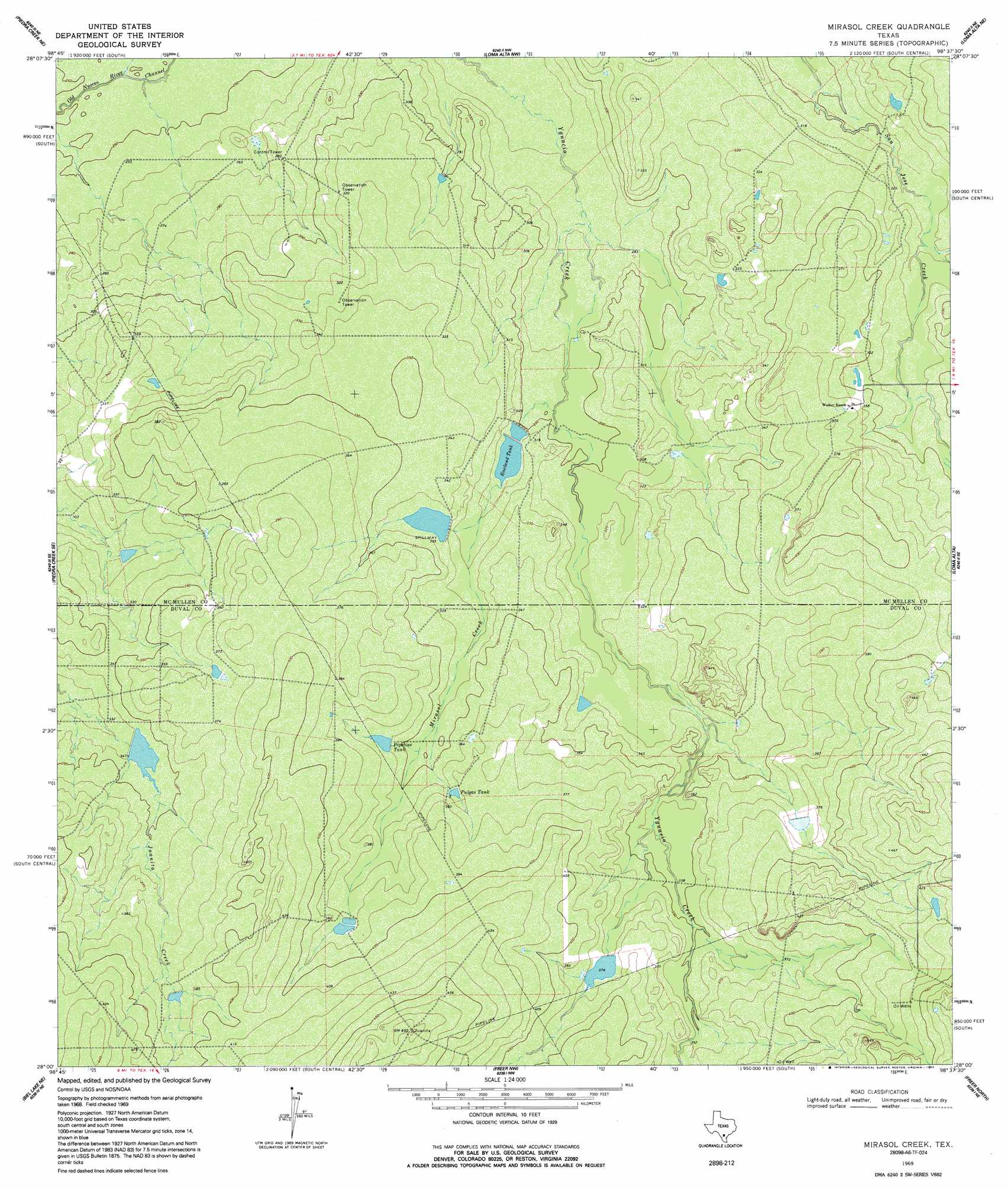
USGS Topo Quad 28098a6 - 1:24,000 scale
| Topo Map Name: | Mirasol Creek |
| USGS Topo Quad ID: | 28098a6 |
| Print Size: | ca. 21 1/4" wide x 27" high |
| Southeast Coordinates: | 28° N latitude / 98.625° W longitude |
| Map Center Coordinates: | 28.0625° N latitude / 98.6875° W longitude |
| U.S. State: | TX |
| Filename: | o28098a6.jpg |
| Download Map JPG Image: | Mirasol Creek topo map 1:24,000 scale |
| Map Type: | Topographic |
| Topo Series: | 7.5´ |
| Map Scale: | 1:24,000 |
| Source of Map Images: | United States Geological Survey (USGS) |
| Alternate Map Versions: |
Mirasol Creek TX 1969, updated 1972 Download PDF Buy paper map Mirasol Creek TX 1969, updated 1992 Download PDF Buy paper map Mirasol Creek TX 2010 Download PDF Buy paper map Mirasol Creek TX 2012 Download PDF Buy paper map Mirasol Creek TX 2016 Download PDF Buy paper map |
1:24,000 Topo Quads surrounding Mirasol Creek
The White Kitchen |
Briscoe Ranch |
Mule Creek |
Fitzpatrick Hollow |
San Caja Hill |
Piedra Creek Nw |
Piedra Creek Ne |
Loma Alta Nw |
Loma Alta Ne |
La Chusa Hill |
Piedra Creek Sw |
Piedra Creek Se |
Mirasol Creek |
Loma Alta |
Clegg Sw |
Biel Lake North |
Biel Lake Ne |
Freer Nw |
Freer North |
Rosita Nw |
Biel Lake South |
Biel Lake Se |
Sarnosa Hill |
Freer South |
Rosita |
> Back to 28098a1 at 1:100,000 scale
> Back to 28098a1 at 1:250,000 scale
> Back to U.S. Topo Maps home
Mirasol Creek topo map: Gazetteer
Mirasol Creek: Dams
Duval County Ranch Lake Number 1 Dam elevation 103m 337′Duval County Ranch Lake Number 2 Dam elevation 115m 377′
Jessie May Lake Number 2 Dam elevation 102m 334′
Rowland Tank Number 1 Dam elevation 91m 298′
Mirasol Creek: Reservoirs
Duval County Ranch Lake Number 1 elevation 103m 337′Duval County Ranch Lake Number 2 elevation 115m 377′
Jessie May Lake Number 2 elevation 102m 334′
Pipeline Tank elevation 110m 360′
Pulgas Tank elevation 111m 364′
Rowland Tank elevation 95m 311′
Rowland Tank Number 1 elevation 91m 298′
Mirasol Creek: Streams
Mirasol Creek elevation 88m 288′Mirasol Creek digital topo map on disk
Buy this Mirasol Creek topo map showing relief, roads, GPS coordinates and other geographical features, as a high-resolution digital map file on DVD: