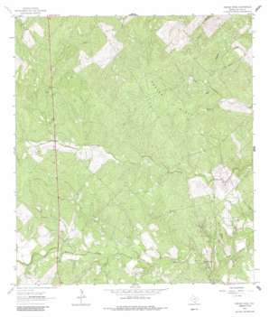
Crater Ridge Topo Map Texas
To zoom in, hover over the map of Crater Ridge
USGS Topo Quad 28098b1 - 1:24,000 scale
| Topo Map Name: | Crater Ridge |
| USGS Topo Quad ID: | 28098b1 |
| Print Size: | ca. 21 1/4" wide x 27" high |
| Southeast Coordinates: | 28.125° N latitude / 98° W longitude |
| Map Center Coordinates: | 28.1875° N latitude / 98.0625° W longitude |
| U.S. State: | TX |
| Filename: | o28098b1.jpg |
| Download Map JPG Image: | Crater Ridge topo map 1:24,000 scale |
| Map Type: | Topographic |
| Topo Series: | 7.5´ |
| Map Scale: | 1:24,000 |
| Source of Map Images: | United States Geological Survey (USGS) |
| Alternate Map Versions: |
Crater Ridge TX 1963, updated 1964 Download PDF Buy paper map Crater Ridge TX 1963, updated 1964 Download PDF Buy paper map Crater Ridge TX 2010 Download PDF Buy paper map Crater Ridge TX 2012 Download PDF Buy paper map Crater Ridge TX 2016 Download PDF Buy paper map |
1:24,000 Topo Quads surrounding Crater Ridge
> Back to 28098a1 at 1:100,000 scale
> Back to 28098a1 at 1:250,000 scale
> Back to U.S. Topo Maps home
Crater Ridge topo map: Gazetteer
Crater Ridge: Oilfields
Burnett Oil and Gas Field elevation 47m 154′Hall Ranch Oil Field elevation 62m 203′
Hinnant Oil Field elevation 84m 275′
McNeil Oil Field elevation 87m 285′
McNeil South Oil Field elevation 65m 213′
Piasano Oil Field elevation 62m 203′
Crater Ridge: Reservoirs
Huisache Tank elevation 68m 223′Jacobs Tank elevation 61m 200′
Crater Ridge: Ridges
Buck Ridge elevation 62m 203′Crater Ridge elevation 84m 275′
Crater Ridge digital topo map on disk
Buy this Crater Ridge topo map showing relief, roads, GPS coordinates and other geographical features, as a high-resolution digital map file on DVD:


