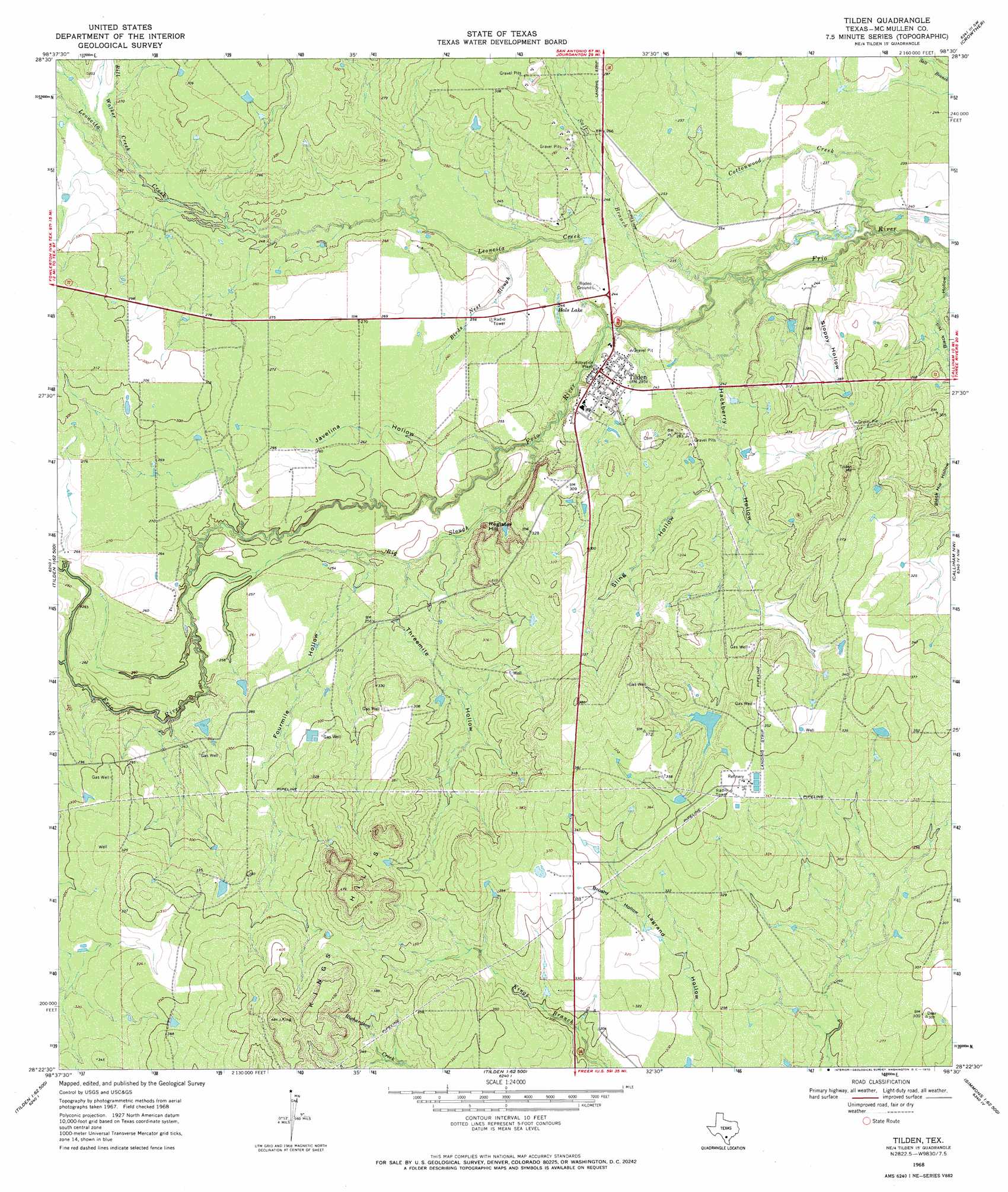
Tilden Topo Map Texas
To zoom in, hover over the map of Tilden
USGS Topo Quad 28098d5 - 1:24,000 scale
| Topo Map Name: | Tilden |
| USGS Topo Quad ID: | 28098d5 |
| Print Size: | ca. 21 1/4" wide x 27" high |
| Southeast Coordinates: | 28.375° N latitude / 98.5° W longitude |
| Map Center Coordinates: | 28.4375° N latitude / 98.5625° W longitude |
| U.S. State: | TX |
| Filename: | o28098d5.jpg |
| Download Map JPG Image: | Tilden topo map 1:24,000 scale |
| Map Type: | Topographic |
| Topo Series: | 7.5´ |
| Map Scale: | 1:24,000 |
| Source of Map Images: | United States Geological Survey (USGS) |
| Alternate Map Versions: |
Tilden TX 1968, updated 1970 Download PDF Buy paper map Tilden TX 2010 Download PDF Buy paper map Tilden TX 2012 Download PDF Buy paper map Tilden TX 2016 Download PDF Buy paper map |
1:24,000 Topo Quads surrounding Tilden
Hindes |
San Miguel Ranch |
Cross Ne |
Caballos Creek |
Whitsett |
Zella |
Pertle Creek |
Cross |
Crowther |
Willow Hollow Tank |
Fowlerton |
Rockaway Creek |
Tilden |
Calliham Nw |
Calliham |
Briscoe Ranch |
Mule Creek |
Fitzpatrick Hollow |
San Caja Hill |
Live Oak Hollow |
Piedra Creek Ne |
Loma Alta Nw |
Loma Alta Ne |
La Chusa Hill |
Clegg Ne |
> Back to 28098a1 at 1:100,000 scale
> Back to 28098a1 at 1:250,000 scale
> Back to U.S. Topo Maps home
Tilden topo map: Gazetteer
Tilden: Dams
Dickenson Ranch Lake Dam elevation 95m 311′Tilden: Lakes
Hals Lake elevation 73m 239′Tilden: Populated Places
Tilden elevation 76m 249′Tilden: Reservoirs
Dickenson Ranch Lake elevation 95m 311′Tilden: Streams
Big Slough elevation 70m 229′Bill Walker Creek elevation 77m 252′
Birds Nest Slough elevation 72m 236′
Cottonwood Creek elevation 64m 209′
Leoncita Creek elevation 68m 223′
Pertle Creek elevation 79m 259′
Salt Branch elevation 67m 219′
Tilden: Summits
Register Hill elevation 88m 288′Tilden: Valleys
Black Hill Hollow elevation 65m 213′Brushy Hollow elevation 96m 314′
Fourmile Hollow elevation 74m 242′
Hackberry Hollow elevation 70m 229′
Javelina Hollow elevation 75m 246′
Sling Hollow elevation 75m 246′
Sloppy Hollow elevation 66m 216′
Threemile Hollow elevation 73m 239′
Tilden digital topo map on disk
Buy this Tilden topo map showing relief, roads, GPS coordinates and other geographical features, as a high-resolution digital map file on DVD: