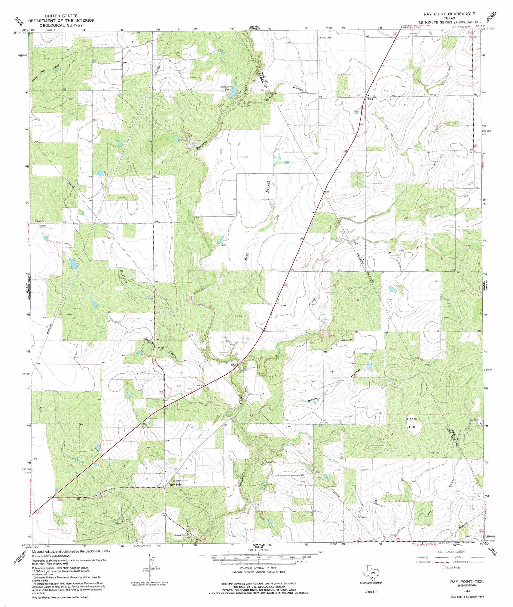
Ray Point Topo Map Texas
To zoom in, hover over the map of Ray Point
USGS Topo Quad 28098e1 - 1:24,000 scale
| Topo Map Name: | Ray Point |
| USGS Topo Quad ID: | 28098e1 |
| Print Size: | ca. 21 1/4" wide x 27" high |
| Southeast Coordinates: | 28.5° N latitude / 98° W longitude |
| Map Center Coordinates: | 28.5625° N latitude / 98.0625° W longitude |
| U.S. State: | TX |
| Filename: | o28098e1.jpg |
| Download Map JPG Image: | Ray Point topo map 1:24,000 scale |
| Map Type: | Topographic |
| Topo Series: | 7.5´ |
| Map Scale: | 1:24,000 |
| Source of Map Images: | United States Geological Survey (USGS) |
| Alternate Map Versions: |
Ray Point TX 1965, updated 1969 Download PDF Buy paper map Ray Point TX 1965, updated 1992 Download PDF Buy paper map Ray Point TX 2010 Download PDF Buy paper map Ray Point TX 2012 Download PDF Buy paper map Ray Point TX 2016 Download PDF Buy paper map |
1:24,000 Topo Quads surrounding Ray Point
Mccoy |
Fashing |
Coy City |
Lenz |
Kenedy |
Whitsett |
Peggy |
Pawnee |
Monteola |
Tulsita |
Willow Hollow Tank |
Comanche Hills |
Ray Point |
Mineral |
Tuleta |
Calliham |
Three Rivers |
Oakville |
Cadiz |
Beeville West |
Live Oak Hollow |
Oakville Sw |
George West |
Mulos Hills |
Clareville |
> Back to 28098e1 at 1:100,000 scale
> Back to 28098a1 at 1:250,000 scale
> Back to U.S. Topo Maps home
Ray Point topo map: Gazetteer
Ray Point: Dams
Susquehanna Western Lake Dam elevation 73m 239′Ray Point: Populated Places
Oaks elevation 108m 354′Ray Point elevation 71m 232′
Ray Point: Reservoirs
Sulphur Tank elevation 79m 259′Susquehanna Western Lake elevation 73m 239′
Ray Point: Streams
Best Branch elevation 58m 190′East Fork Salt Creek elevation 73m 239′
Hot Well Creek elevation 66m 216′
Mustang Creek elevation 55m 180′
Salt Creek elevation 57m 187′
Ray Point: Summits
Odom Hill elevation 110m 360′Ray Point: Valleys
Odom Hollow elevation 59m 193′Scuffle Hollow elevation 76m 249′
Ray Point digital topo map on disk
Buy this Ray Point topo map showing relief, roads, GPS coordinates and other geographical features, as a high-resolution digital map file on DVD: