Cross Topo Map Texas
To zoom in, hover over the map of Cross
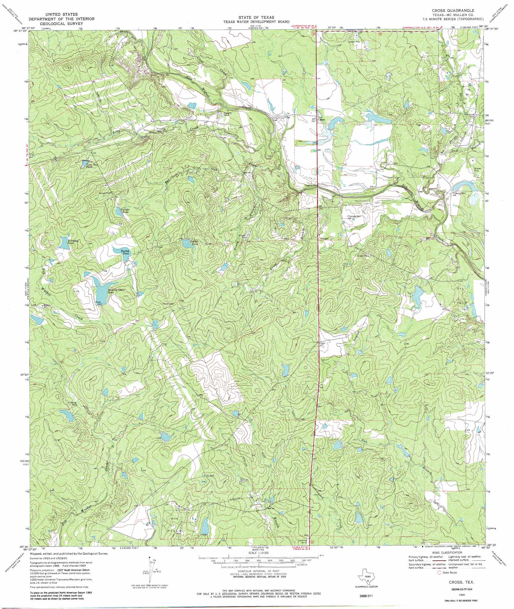
USGS Topo Quad 28098e5 - 1:24,000 scale
| Topo Map Name: | Cross |
| USGS Topo Quad ID: | 28098e5 |
| Print Size: | ca. 21 1/4" wide x 27" high |
| Southeast Coordinates: | 28.5° N latitude / 98.5° W longitude |
| Map Center Coordinates: | 28.5625° N latitude / 98.5625° W longitude |
| U.S. State: | TX |
| Filename: | o28098e5.jpg |
| Download Map JPG Image: | Cross topo map 1:24,000 scale |
| Map Type: | Topographic |
| Topo Series: | 7.5´ |
| Map Scale: | 1:24,000 |
| Source of Map Images: | United States Geological Survey (USGS) |
| Alternate Map Versions: |
Cross TX 1969, updated 1972 Download PDF Buy paper map Cross TX 1969, updated 1984 Download PDF Buy paper map Cross TX 2010 Download PDF Buy paper map Cross TX 2013 Download PDF Buy paper map Cross TX 2016 Download PDF Buy paper map |
1:24,000 Topo Quads surrounding Cross
Goldfinch |
Charlotte |
Christine West |
Christine East |
Mccoy |
Hindes |
San Miguel Ranch |
Cross Ne |
Caballos Creek |
Whitsett |
Zella |
Pertle Creek |
Cross |
Crowther |
Willow Hollow Tank |
Fowlerton |
Rockaway Creek |
Tilden |
Calliham Nw |
Calliham |
Briscoe Ranch |
Mule Creek |
Fitzpatrick Hollow |
San Caja Hill |
Live Oak Hollow |
> Back to 28098e1 at 1:100,000 scale
> Back to 28098a1 at 1:250,000 scale
> Back to U.S. Topo Maps home
Cross topo map: Gazetteer
Cross: Dams
Beulah Tank Dam elevation 107m 351′Gubel Trust Lake Number 1 Dam elevation 82m 269′
Indian Tank Dam elevation 108m 354′
Kamp Lake Dam elevation 85m 278′
Rocking Chair Tank Dam elevation 101m 331′
Wheeler Lake Number 1 Dam elevation 93m 305′
Wheeler Lake Number 2 Dam elevation 82m 269′
Cross: Populated Places
Cross elevation 86m 282′Cross: Reservoirs
Beulah Tank elevation 107m 351′Birthday Tank elevation 113m 370′
Calishe Tank elevation 104m 341′
Gubel Trust Lake Number 1 elevation 82m 269′
Indian Tank elevation 108m 354′
Kamp Lake elevation 85m 278′
Lone Star Tank elevation 105m 344′
Rocking Chair Tank elevation 101m 331′
Wheeler Lake Number 1 elevation 93m 305′
Wheeler Lake Number 2 elevation 82m 269′
Cross: Streams
Bruce Branch elevation 76m 249′Clear Creek elevation 79m 259′
Far Live Oak Creek elevation 78m 255′
La Jarita Creek elevation 73m 239′
Live Oak Creek elevation 83m 272′
Salt Branch elevation 79m 259′
Cross: Valleys
Drake Hollow elevation 82m 269′Cross digital topo map on disk
Buy this Cross topo map showing relief, roads, GPS coordinates and other geographical features, as a high-resolution digital map file on DVD: