Cayman Lake Topo Map Texas
To zoom in, hover over the map of Cayman Lake
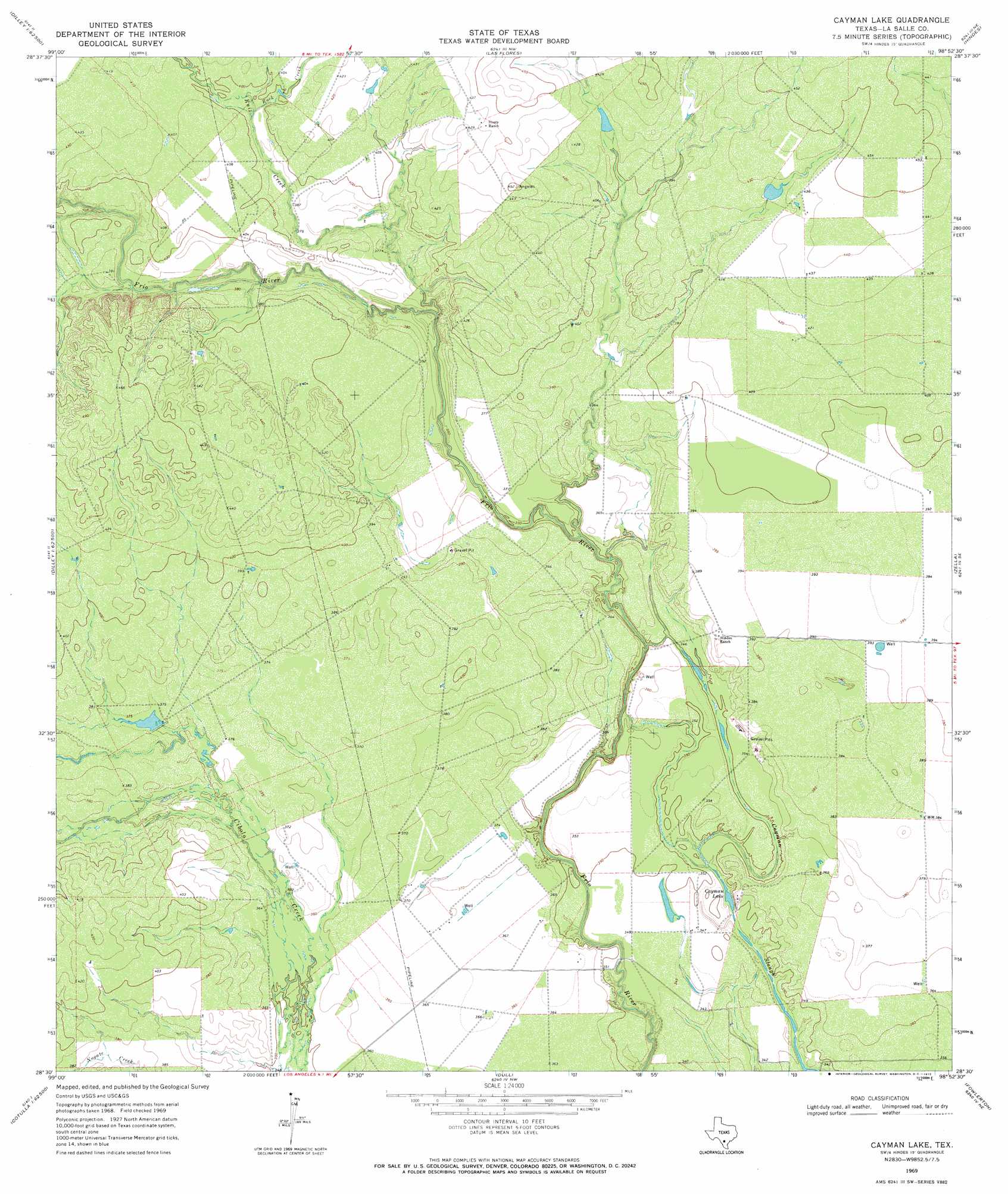
USGS Topo Quad 28098e8 - 1:24,000 scale
| Topo Map Name: | Cayman Lake |
| USGS Topo Quad ID: | 28098e8 |
| Print Size: | ca. 21 1/4" wide x 27" high |
| Southeast Coordinates: | 28.5° N latitude / 98.875° W longitude |
| Map Center Coordinates: | 28.5625° N latitude / 98.9375° W longitude |
| U.S. State: | TX |
| Filename: | o28098e8.jpg |
| Download Map JPG Image: | Cayman Lake topo map 1:24,000 scale |
| Map Type: | Topographic |
| Topo Series: | 7.5´ |
| Map Scale: | 1:24,000 |
| Source of Map Images: | United States Geological Survey (USGS) |
| Alternate Map Versions: |
Cayman Lake TX 1969, updated 1972 Download PDF Buy paper map Cayman Lake TX 2010 Download PDF Buy paper map Cayman Lake TX 2012 Download PDF Buy paper map Cayman Lake TX 2016 Download PDF Buy paper map |
1:24,000 Topo Quads surrounding Cayman Lake
Derby |
Pearsall South |
Keystone Ranch |
Goldfinch |
Charlotte |
Dilley |
Dilley Ne |
Las Flores |
Hindes |
San Miguel Ranch |
Millett |
Burns Ranch |
Cayman Lake |
Zella |
Pertle Creek |
Cotulla |
Los Angeles |
Dull |
Fowlerton |
Rockaway Creek |
Holland Dam |
Charco Marrano Creek |
The White Kitchen |
Briscoe Ranch |
Mule Creek |
> Back to 28098e1 at 1:100,000 scale
> Back to 28098a1 at 1:250,000 scale
> Back to U.S. Topo Maps home
Cayman Lake topo map: Gazetteer
Cayman Lake: Lakes
Cayman Lake elevation 103m 337′Cayman Lake: Streams
Rock Creek elevation 119m 390′Ruiz Creek elevation 106m 347′
Cayman Lake digital topo map on disk
Buy this Cayman Lake topo map showing relief, roads, GPS coordinates and other geographical features, as a high-resolution digital map file on DVD: