Caballos Creek Topo Map Texas
To zoom in, hover over the map of Caballos Creek
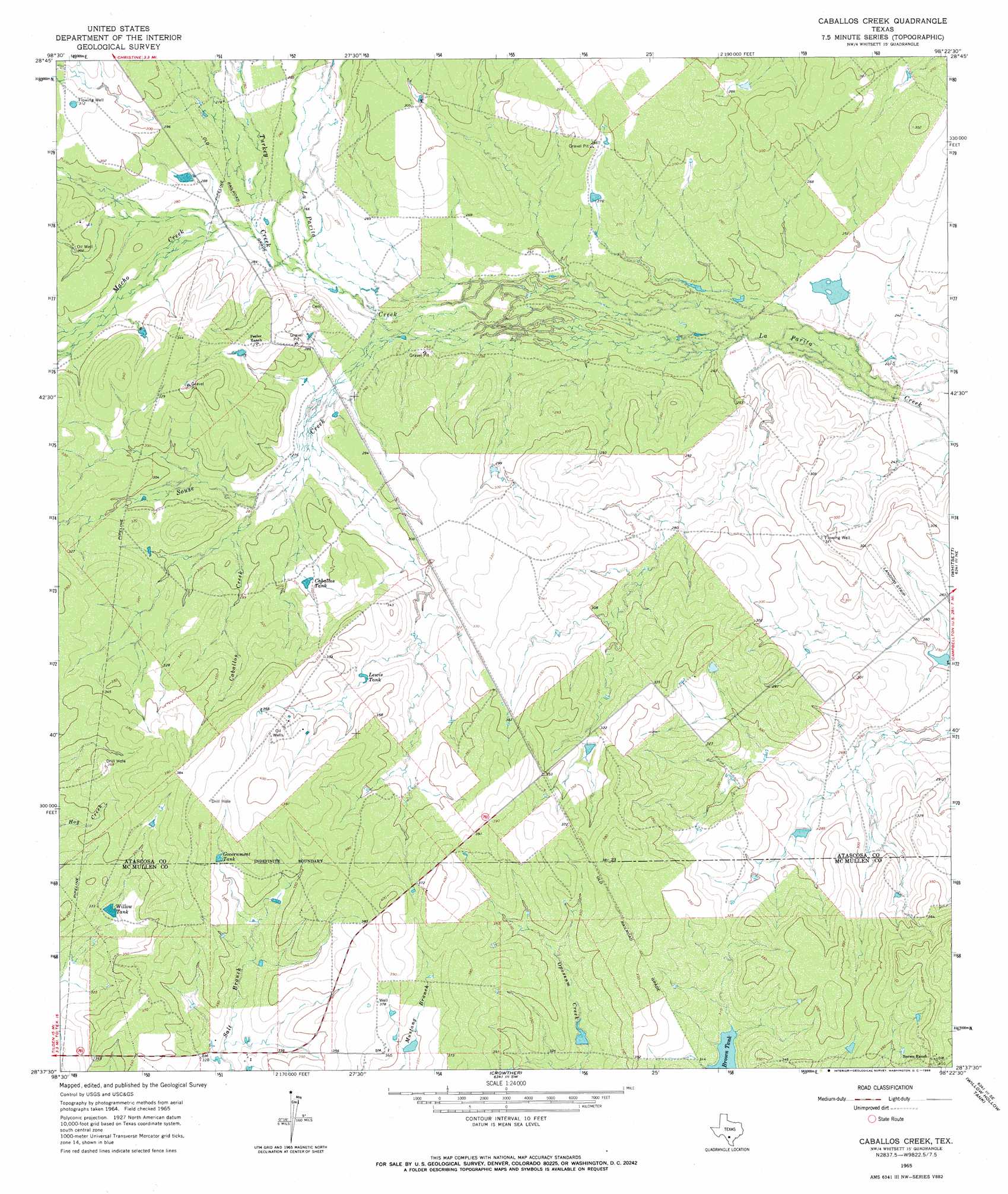
USGS Topo Quad 28098f4 - 1:24,000 scale
| Topo Map Name: | Caballos Creek |
| USGS Topo Quad ID: | 28098f4 |
| Print Size: | ca. 21 1/4" wide x 27" high |
| Southeast Coordinates: | 28.625° N latitude / 98.375° W longitude |
| Map Center Coordinates: | 28.6875° N latitude / 98.4375° W longitude |
| U.S. State: | TX |
| Filename: | o28098f4.jpg |
| Download Map JPG Image: | Caballos Creek topo map 1:24,000 scale |
| Map Type: | Topographic |
| Topo Series: | 7.5´ |
| Map Scale: | 1:24,000 |
| Source of Map Images: | United States Geological Survey (USGS) |
| Alternate Map Versions: |
Caballos Creek TX 1965, updated 1966 Download PDF Buy paper map Caballos Creek TX 2010 Download PDF Buy paper map Caballos Creek TX 2013 Download PDF Buy paper map Caballos Creek TX 2016 Download PDF Buy paper map |
1:24,000 Topo Quads surrounding Caballos Creek
Dobrowolski |
Jourdanton |
Pleasanton |
Leal |
Three Oaks |
Charlotte |
Christine West |
Christine East |
Mccoy |
Fashing |
San Miguel Ranch |
Cross Ne |
Caballos Creek |
Whitsett |
Peggy |
Pertle Creek |
Cross |
Crowther |
Willow Hollow Tank |
Comanche Hills |
Rockaway Creek |
Tilden |
Calliham Nw |
Calliham |
Three Rivers |
> Back to 28098e1 at 1:100,000 scale
> Back to 28098a1 at 1:250,000 scale
> Back to U.S. Topo Maps home
Caballos Creek topo map: Gazetteer
Caballos Creek: Dams
74 Ranch Dam Number 1 elevation 73m 239′74 Ranch Dam Number 2 elevation 85m 278′
Peeler Dam elevation 89m 291′
Caballos Creek: Reservoirs
Caballos Tank elevation 90m 295′Government Tank elevation 110m 360′
Lake Number 1 elevation 73m 239′
Lake Number 2 elevation 85m 278′
Lewis Tank elevation 99m 324′
Peeler Lake elevation 89m 291′
Willow Tank elevation 100m 328′
Caballos Creek: Streams
Caballos Creek elevation 84m 275′Macho Creek elevation 82m 269′
Souse Creek elevation 84m 275′
Turkey Creek elevation 79m 259′
Caballos Creek digital topo map on disk
Buy this Caballos Creek topo map showing relief, roads, GPS coordinates and other geographical features, as a high-resolution digital map file on DVD: