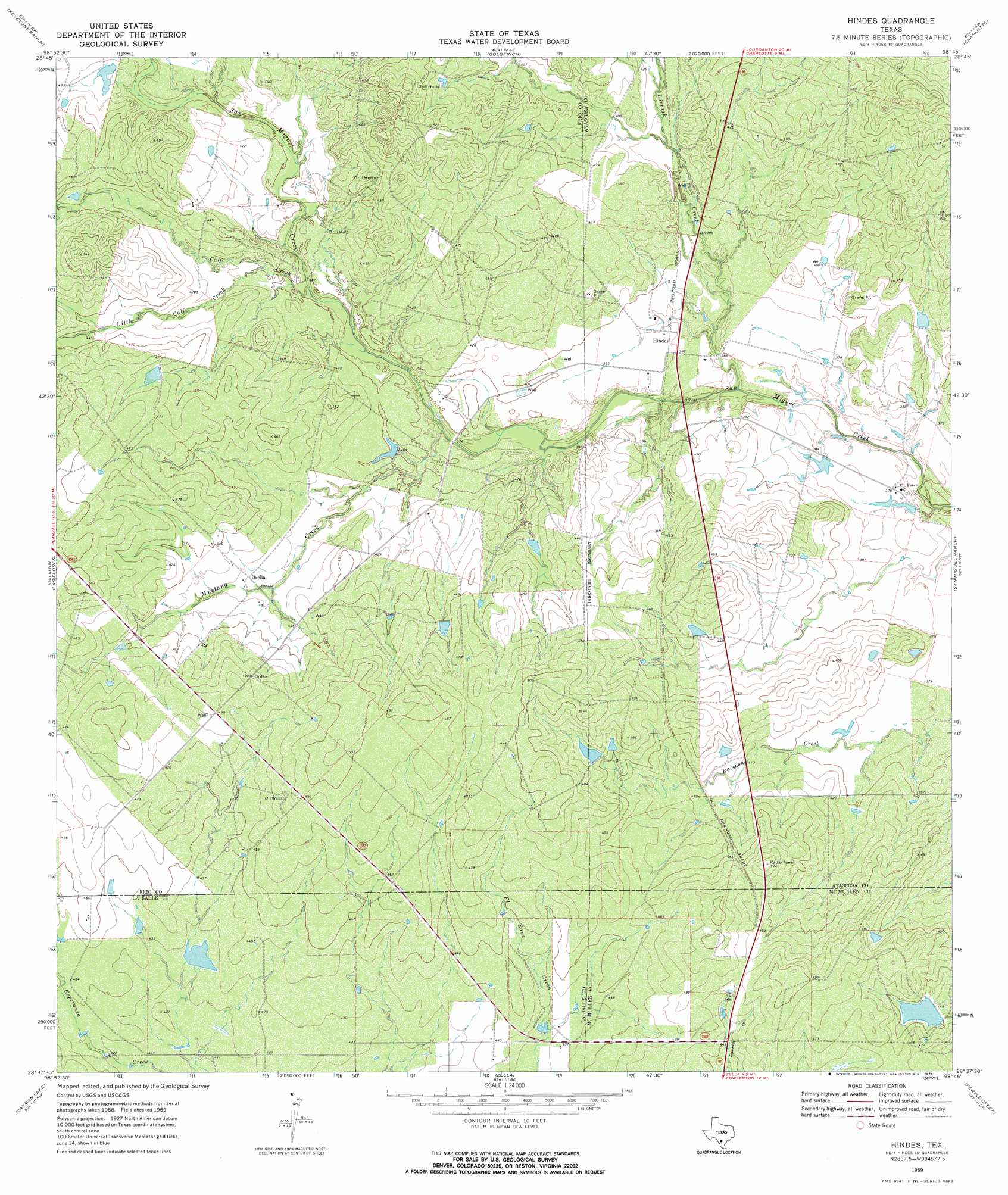
Hindes Topo Map Texas
To zoom in, hover over the map of Hindes
USGS Topo Quad 28098f7 - 1:24,000 scale
| Topo Map Name: | Hindes |
| USGS Topo Quad ID: | 28098f7 |
| Print Size: | ca. 21 1/4" wide x 27" high |
| Southeast Coordinates: | 28.625° N latitude / 98.75° W longitude |
| Map Center Coordinates: | 28.6875° N latitude / 98.8125° W longitude |
| U.S. State: | TX |
| Filename: | o28098f7.jpg |
| Download Map JPG Image: | Hindes topo map 1:24,000 scale |
| Map Type: | Topographic |
| Topo Series: | 7.5´ |
| Map Scale: | 1:24,000 |
| Source of Map Images: | United States Geological Survey (USGS) |
| Alternate Map Versions: |
Hindes TX 1969, updated 1971 Download PDF Buy paper map Hindes TX 2010 Download PDF Buy paper map Hindes TX 2013 Download PDF Buy paper map Hindes TX 2016 Download PDF Buy paper map |
1:24,000 Topo Quads surrounding Hindes
Pearsall North |
Schattel Nw |
Schattel |
Dobrowolski |
Jourdanton |
Pearsall South |
Keystone Ranch |
Goldfinch |
Charlotte |
Christine West |
Dilley Ne |
Las Flores |
Hindes |
San Miguel Ranch |
Cross Ne |
Burns Ranch |
Cayman Lake |
Zella |
Pertle Creek |
Cross |
Los Angeles |
Dull |
Fowlerton |
Rockaway Creek |
Tilden |
> Back to 28098e1 at 1:100,000 scale
> Back to 28098a1 at 1:250,000 scale
> Back to U.S. Topo Maps home
Hindes topo map: Gazetteer
Hindes: Dams
Jess McNeel Lake Number 3 Dam elevation 135m 442′McNeel Lake Dam elevation 129m 423′
Hindes: Populated Places
Hindes elevation 119m 390′Orelia elevation 130m 426′
Hindes: Reservoirs
Jess McNeel Lake Number 3 elevation 135m 442′McNeel Lake elevation 129m 423′
Hindes: Streams
Calf Creek elevation 119m 390′Little Calf Creek elevation 121m 396′
Liveoak Creek elevation 111m 364′
Mustang Creek elevation 115m 377′
Hindes digital topo map on disk
Buy this Hindes topo map showing relief, roads, GPS coordinates and other geographical features, as a high-resolution digital map file on DVD: