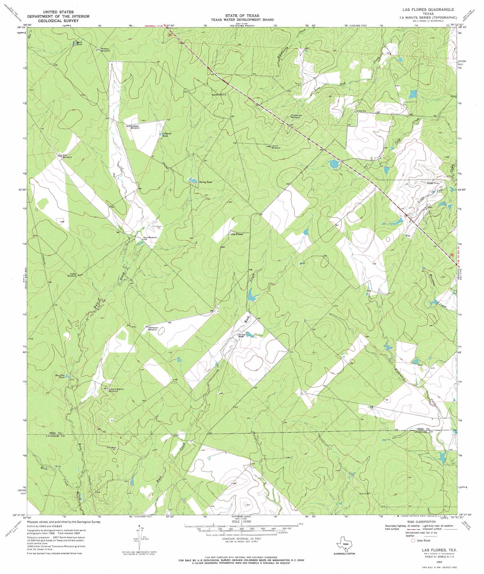
Las Flores Topo Map Texas
To zoom in, hover over the map of Las Flores
USGS Topo Quad 28098f8 - 1:24,000 scale
| Topo Map Name: | Las Flores |
| USGS Topo Quad ID: | 28098f8 |
| Print Size: | ca. 21 1/4" wide x 27" high |
| Southeast Coordinates: | 28.625° N latitude / 98.875° W longitude |
| Map Center Coordinates: | 28.6875° N latitude / 98.9375° W longitude |
| U.S. State: | TX |
| Filename: | o28098f8.jpg |
| Download Map JPG Image: | Las Flores topo map 1:24,000 scale |
| Map Type: | Topographic |
| Topo Series: | 7.5´ |
| Map Scale: | 1:24,000 |
| Source of Map Images: | United States Geological Survey (USGS) |
| Alternate Map Versions: |
Las Flores TX 1969, updated 1971 Download PDF Buy paper map Las Flores TX 2010 Download PDF Buy paper map Las Flores TX 2013 Download PDF Buy paper map Las Flores TX 2016 Download PDF Buy paper map |
1:24,000 Topo Quads surrounding Las Flores
Halff Ranch |
Pearsall North |
Schattel Nw |
Schattel |
Dobrowolski |
Derby |
Pearsall South |
Keystone Ranch |
Goldfinch |
Charlotte |
Dilley |
Dilley Ne |
Las Flores |
Hindes |
San Miguel Ranch |
Millett |
Burns Ranch |
Cayman Lake |
Zella |
Pertle Creek |
Cotulla |
Los Angeles |
Dull |
Fowlerton |
Rockaway Creek |
> Back to 28098e1 at 1:100,000 scale
> Back to 28098a1 at 1:250,000 scale
> Back to U.S. Topo Maps home
Las Flores topo map: Gazetteer
Las Flores: Populated Places
Las Flores elevation 165m 541′Las Flores: Reservoirs
Bar-One Tank elevation 133m 436′Buck Tank elevation 168m 551′
Caldwell Tank elevation 156m 511′
Harry Tank elevation 154m 505′
Las Flores: Streams
Mule Creek elevation 125m 410′Las Flores digital topo map on disk
Buy this Las Flores topo map showing relief, roads, GPS coordinates and other geographical features, as a high-resolution digital map file on DVD: