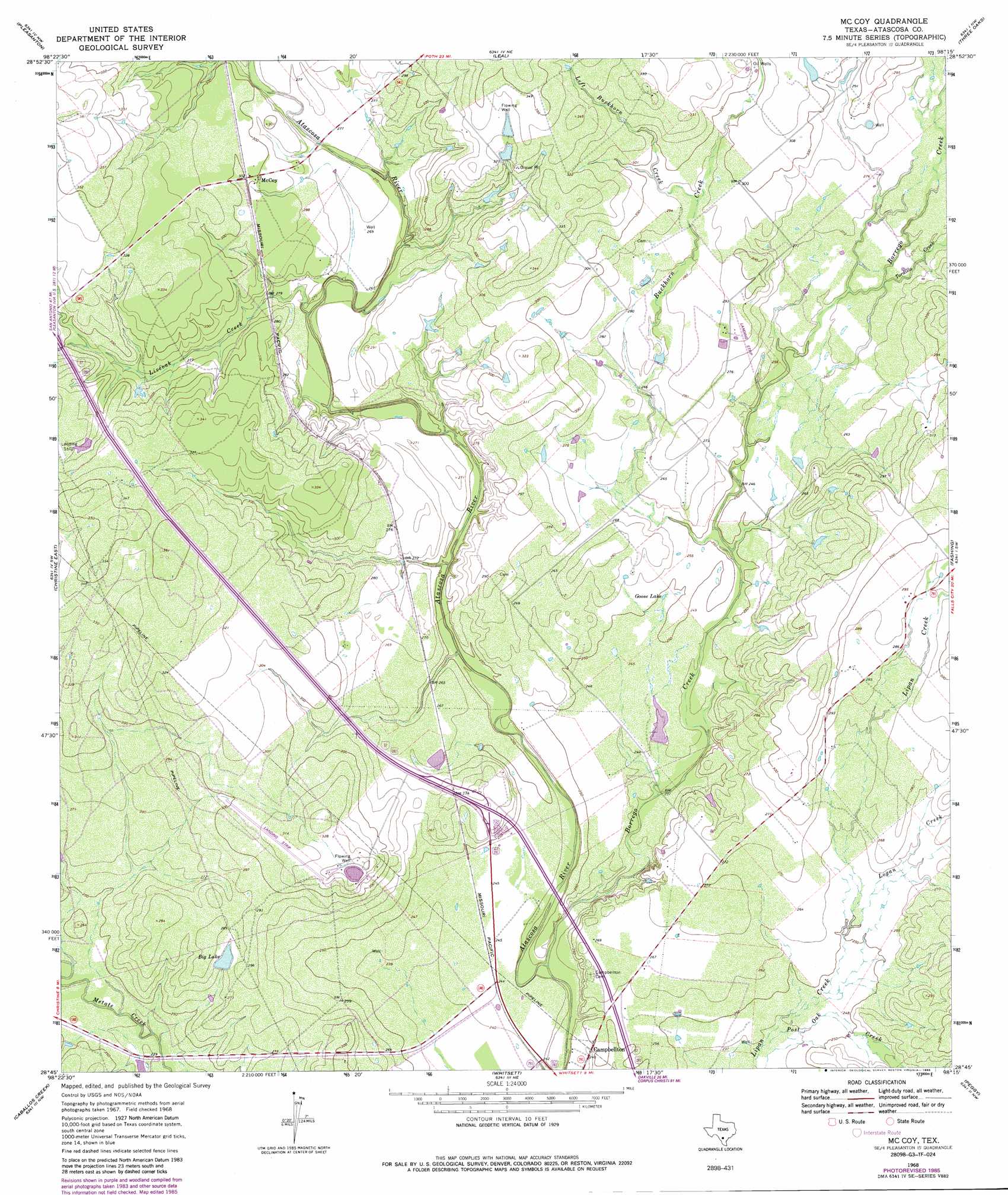
Mccoy Topo Map Texas
To zoom in, hover over the map of Mccoy
USGS Topo Quad 28098g3 - 1:24,000 scale
| Topo Map Name: | Mccoy |
| USGS Topo Quad ID: | 28098g3 |
| Print Size: | ca. 21 1/4" wide x 27" high |
| Southeast Coordinates: | 28.75° N latitude / 98.25° W longitude |
| Map Center Coordinates: | 28.8125° N latitude / 98.3125° W longitude |
| U.S. State: | TX |
| Filename: | o28098g3.jpg |
| Download Map JPG Image: | Mccoy topo map 1:24,000 scale |
| Map Type: | Topographic |
| Topo Series: | 7.5´ |
| Map Scale: | 1:24,000 |
| Source of Map Images: | United States Geological Survey (USGS) |
| Alternate Map Versions: |
McCoy TX 1968, updated 1971 Download PDF Buy paper map McCoy TX 1968, updated 1982 Download PDF Buy paper map McCoy TX 1968, updated 1986 Download PDF Buy paper map McCoy TX 2010 Download PDF Buy paper map McCoy TX 2012 Download PDF Buy paper map McCoy TX 2016 Download PDF Buy paper map |
1:24,000 Topo Quads surrounding Mccoy
Poteet |
Leming |
Saspamco Se |
Dewees |
Poth |
Jourdanton |
Pleasanton |
Leal |
Three Oaks |
Falls City |
Christine West |
Christine East |
Mccoy |
Fashing |
Coy City |
Cross Ne |
Caballos Creek |
Whitsett |
Peggy |
Pawnee |
Cross |
Crowther |
Willow Hollow Tank |
Comanche Hills |
Ray Point |
> Back to 28098e1 at 1:100,000 scale
> Back to 28098a1 at 1:250,000 scale
> Back to U.S. Topo Maps home
Mccoy topo map: Gazetteer
Mccoy: Airports
Arrow 'S' Ranch Airport elevation 85m 278′Mccoy: Dams
Big Lake Dam elevation 84m 275′Mccoy: Lakes
Goose Lake elevation 76m 249′Mccoy: Populated Places
McCoy elevation 92m 301′Mccoy: Reservoirs
Big Lake elevation 85m 278′Mccoy: Streams
Borrego Creek elevation 67m 219′Buckhorn Creek elevation 74m 242′
Left Buckhorn Creek elevation 88m 288′
Liveoak Creek elevation 81m 265′
Logan Creek elevation 76m 249′
Post Oak Creek elevation 73m 239′
Tordillo Creek elevation 79m 259′
Mccoy digital topo map on disk
Buy this Mccoy topo map showing relief, roads, GPS coordinates and other geographical features, as a high-resolution digital map file on DVD: