Christine West Topo Map Texas
To zoom in, hover over the map of Christine West
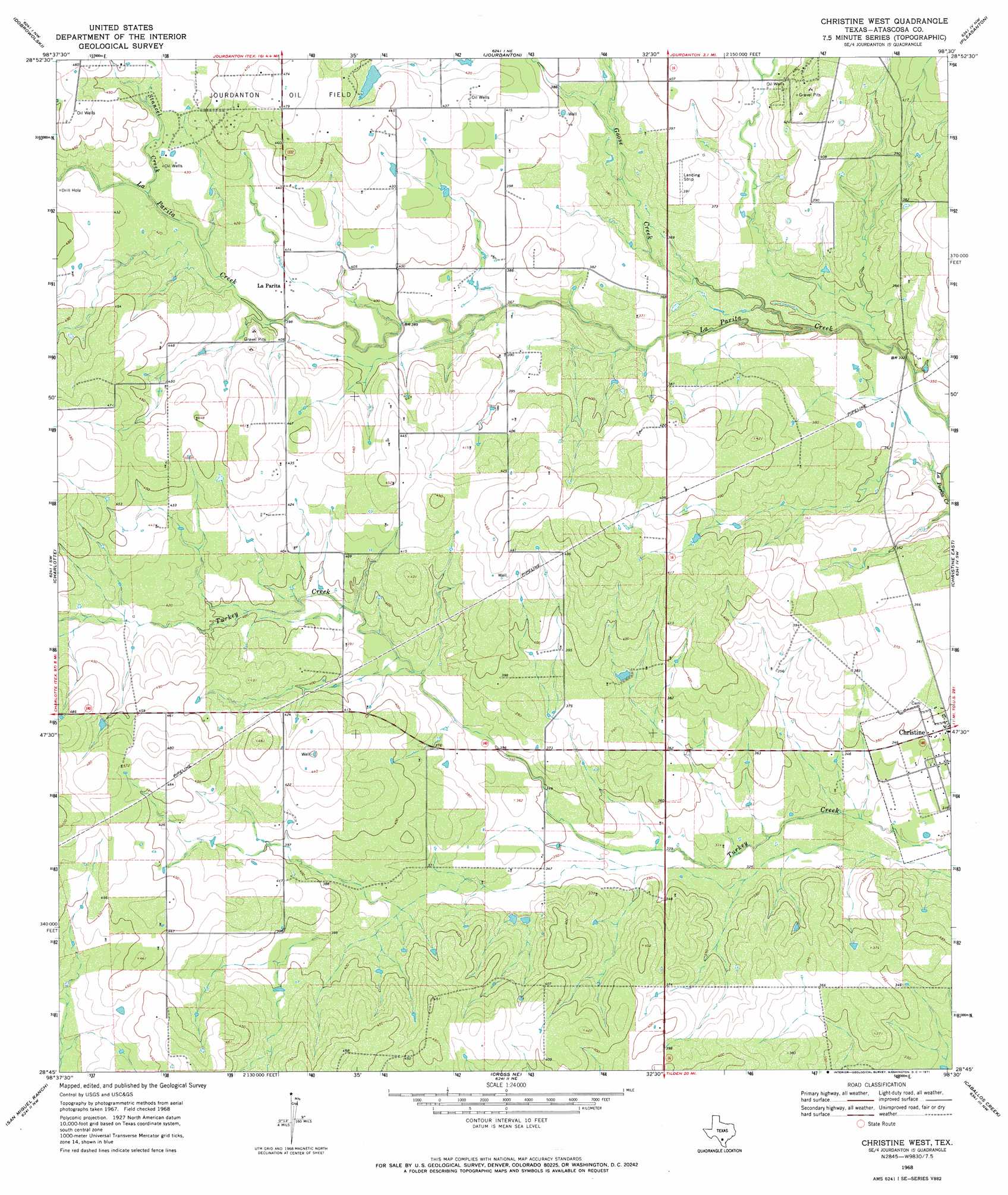
USGS Topo Quad 28098g5 - 1:24,000 scale
| Topo Map Name: | Christine West |
| USGS Topo Quad ID: | 28098g5 |
| Print Size: | ca. 21 1/4" wide x 27" high |
| Southeast Coordinates: | 28.75° N latitude / 98.5° W longitude |
| Map Center Coordinates: | 28.8125° N latitude / 98.5625° W longitude |
| U.S. State: | TX |
| Filename: | o28098g5.jpg |
| Download Map JPG Image: | Christine West topo map 1:24,000 scale |
| Map Type: | Topographic |
| Topo Series: | 7.5´ |
| Map Scale: | 1:24,000 |
| Source of Map Images: | United States Geological Survey (USGS) |
| Alternate Map Versions: |
Christine West TX 1968, updated 1971 Download PDF Buy paper map Christine West TX 2010 Download PDF Buy paper map Christine West TX 2013 Download PDF Buy paper map Christine West TX 2016 Download PDF Buy paper map |
1:24,000 Topo Quads surrounding Christine West
Bigfoot |
Rossville |
Poteet |
Leming |
Saspamco Se |
Schattel |
Dobrowolski |
Jourdanton |
Pleasanton |
Leal |
Goldfinch |
Charlotte |
Christine West |
Christine East |
Mccoy |
Hindes |
San Miguel Ranch |
Cross Ne |
Caballos Creek |
Whitsett |
Zella |
Pertle Creek |
Cross |
Crowther |
Willow Hollow Tank |
> Back to 28098e1 at 1:100,000 scale
> Back to 28098a1 at 1:250,000 scale
> Back to U.S. Topo Maps home
Christine West topo map: Gazetteer
Christine West: Dams
Schorsch Dam elevation 134m 439′Christine West: Oilfields
Jourdanton Oil Field elevation 133m 436′Christine West: Populated Places
La Parita elevation 123m 403′Christine West: Reservoirs
Schorsch Lake elevation 134m 439′Christine West: Streams
Goose Creek elevation 99m 324′Stancel Creek elevation 126m 413′
Christine West digital topo map on disk
Buy this Christine West topo map showing relief, roads, GPS coordinates and other geographical features, as a high-resolution digital map file on DVD: