Holland Dam Topo Map Texas
To zoom in, hover over the map of Holland Dam
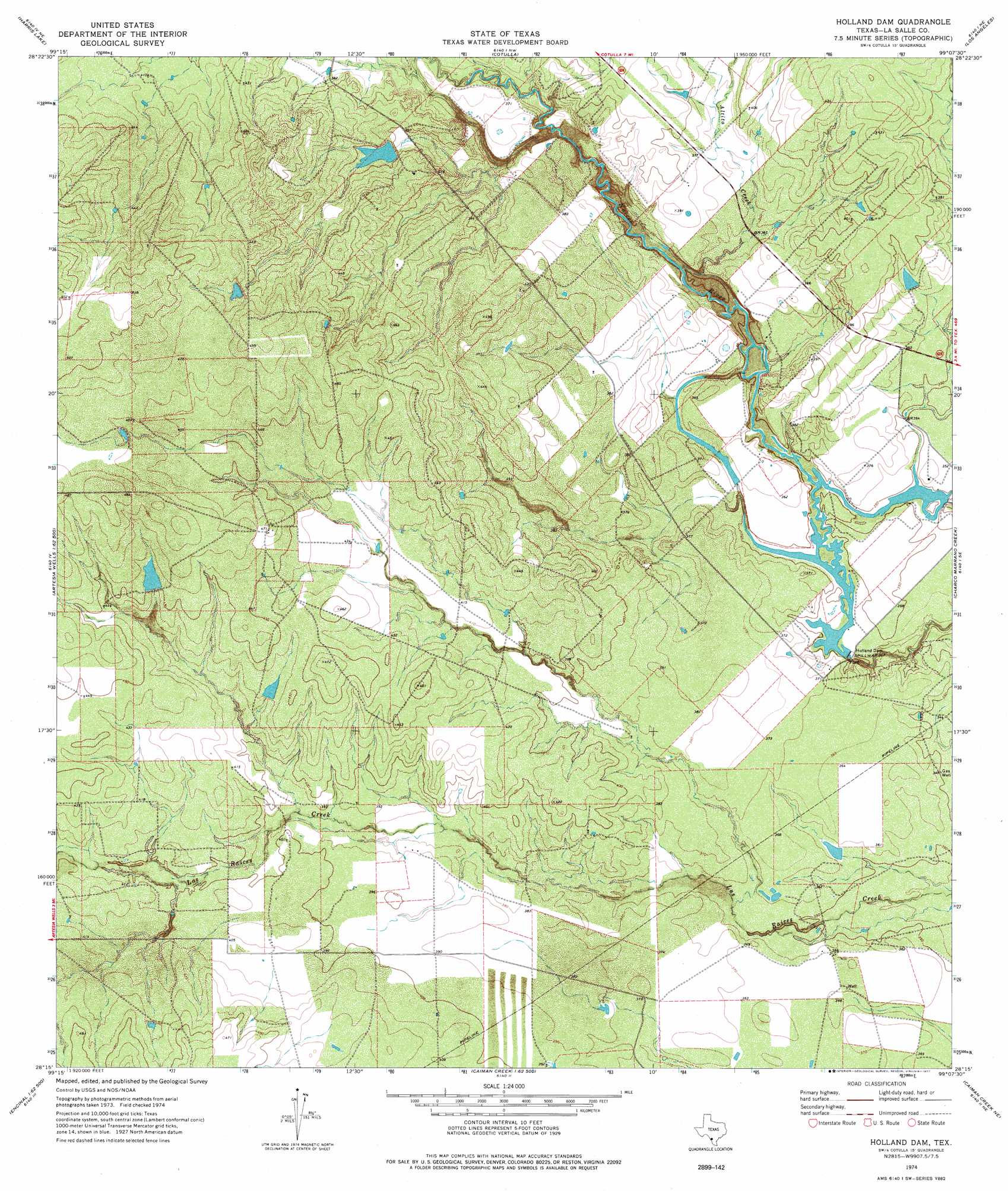
USGS Topo Quad 28099c2 - 1:24,000 scale
| Topo Map Name: | Holland Dam |
| USGS Topo Quad ID: | 28099c2 |
| Print Size: | ca. 21 1/4" wide x 27" high |
| Southeast Coordinates: | 28.25° N latitude / 99.125° W longitude |
| Map Center Coordinates: | 28.3125° N latitude / 99.1875° W longitude |
| U.S. State: | TX |
| Filename: | o28099c2.jpg |
| Download Map JPG Image: | Holland Dam topo map 1:24,000 scale |
| Map Type: | Topographic |
| Topo Series: | 7.5´ |
| Map Scale: | 1:24,000 |
| Source of Map Images: | United States Geological Survey (USGS) |
| Alternate Map Versions: |
Holland Dam TX 1974, updated 1977 Download PDF Buy paper map Holland Dam TX 2010 Download PDF Buy paper map Holland Dam TX 2013 Download PDF Buy paper map Holland Dam TX 2016 Download PDF Buy paper map |
1:24,000 Topo Quads surrounding Holland Dam
Las Vegas |
Woodward |
Millett |
Burns Ranch |
Cayman Lake |
Flying W Ranch |
Harris Lake |
Cotulla |
Los Angeles |
Dull |
Blocker Tank |
Artesia Wells |
Holland Dam |
Charco Marrano Creek |
The White Kitchen |
Mesteno Creek North |
Atlee |
Caiman Creek Nw |
Caiman Creek Ne |
Piedra Creek Nw |
Mesteno Creek South |
Encinal |
Live Oak Creek |
Caiman Creek Se |
Piedra Creek Sw |
> Back to 28099a1 at 1:100,000 scale
> Back to 28098a1 at 1:250,000 scale
> Back to U.S. Topo Maps home
Holland Dam topo map: Gazetteer
Holland Dam: Dams
Davis Dam elevation 110m 360′Holland Dam elevation 104m 341′
Holland Dam Site Number 1 elevation 109m 357′
Holland Dam Site Number 2 elevation 105m 344′
Martin Lake Number 3 Dam elevation 109m 357′
Holland Dam: Reservoirs
Davis Reservoir elevation 110m 360′Holland Reservoir Site Number 1 elevation 109m 357′
Holland Reservoir Site Number 2 elevation 105m 344′
Martin Lake Number 3 elevation 109m 357′
Holland Dam: Streams
Altita Creek elevation 105m 344′Holland Dam digital topo map on disk
Buy this Holland Dam topo map showing relief, roads, GPS coordinates and other geographical features, as a high-resolution digital map file on DVD: