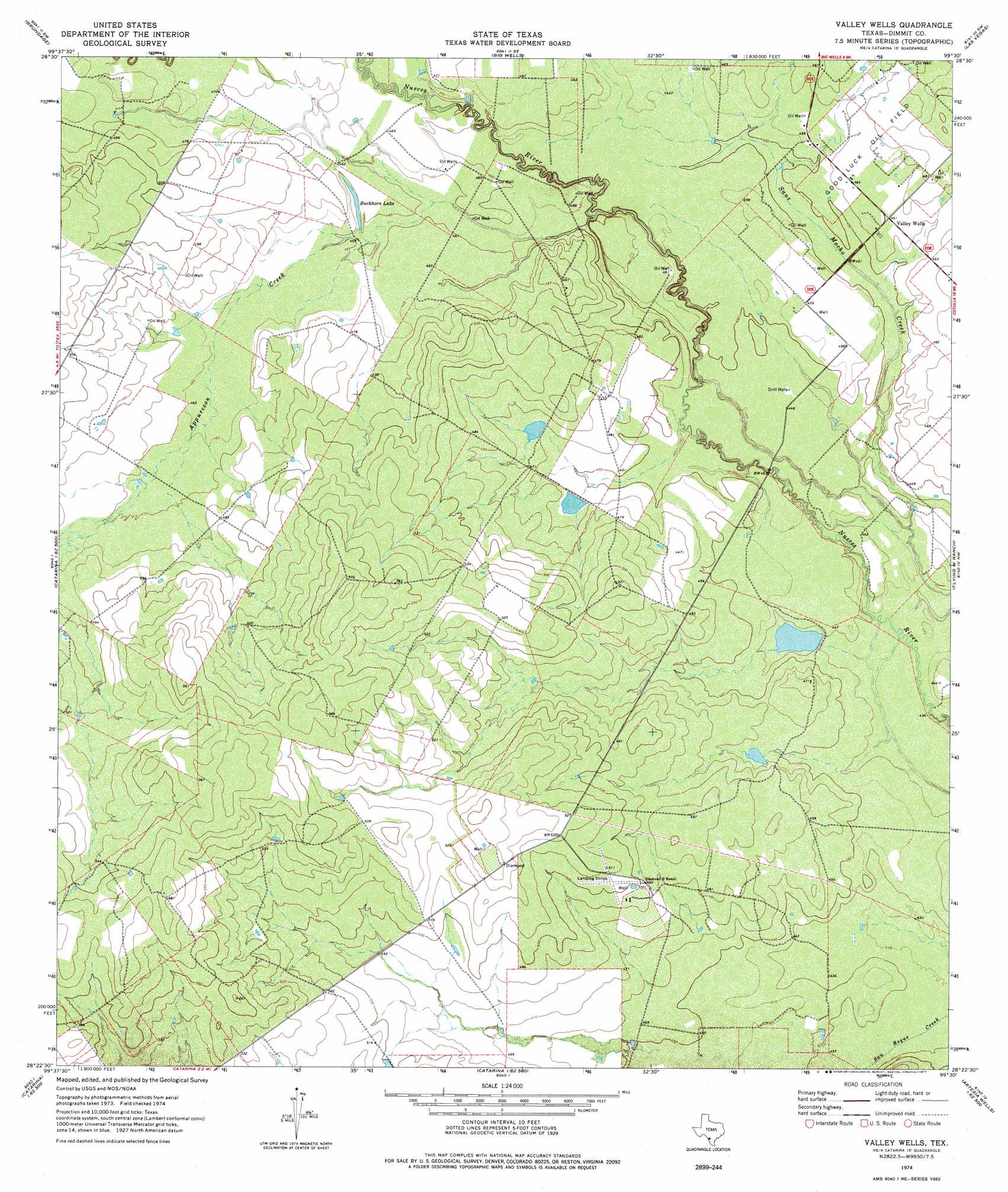
Valley Wells Topo Map Texas
To zoom in, hover over the map of Valley Wells
USGS Topo Quad 28099d5 - 1:24,000 scale
| Topo Map Name: | Valley Wells |
| USGS Topo Quad ID: | 28099d5 |
| Print Size: | ca. 21 1/4" wide x 27" high |
| Southeast Coordinates: | 28.375° N latitude / 99.5° W longitude |
| Map Center Coordinates: | 28.4375° N latitude / 99.5625° W longitude |
| U.S. State: | TX |
| Filename: | o28099d5.jpg |
| Download Map JPG Image: | Valley Wells topo map 1:24,000 scale |
| Map Type: | Topographic |
| Topo Series: | 7.5´ |
| Map Scale: | 1:24,000 |
| Source of Map Images: | United States Geological Survey (USGS) |
| Alternate Map Versions: |
Valley Wells TX 1974, updated 1977 Download PDF Buy paper map Valley Wells TX 2010 Download PDF Buy paper map Valley Wells TX 2013 Download PDF Buy paper map Valley Wells TX 2016 Download PDF Buy paper map |
1:24,000 Topo Quads surrounding Valley Wells
Crystal City |
Woodard Lake |
Sugar Creek |
Snake Creek |
Woodward Ne |
Carrizo Springs East |
Brundage |
Big Wells |
Las Vegas |
Woodward |
Asherton |
Macdonald Lake |
Valley Wells |
Flying W Ranch |
Harris Lake |
Farias Tank |
Dabney Tank |
Catarina |
Blocker Tank |
Artesia Wells |
Landrum Tank |
Velenzuela Creek |
Piloncillo Hill |
Mesteno Creek North |
Atlee |
> Back to 28099a1 at 1:100,000 scale
> Back to 28098a1 at 1:250,000 scale
> Back to U.S. Topo Maps home
Valley Wells topo map: Gazetteer
Valley Wells: Airports
Diamond H Ranch Airport elevation 156m 511′Valley Wells: Dams
Chip Briscoe Lake Dam elevation 133m 436′Kone Lake Dam elevation 140m 459′
Valley Wells: Lakes
Buckhorn Lake elevation 139m 456′Valley Wells: Oilfields
Good Luck Oil Field elevation 142m 465′Valley Wells: Populated Places
Valley Wells elevation 141m 462′Valley Wells: Reservoirs
Chip Briscoe Lake elevation 133m 436′Kone Lake elevation 140m 459′
Valley Wells: Streams
Appurceon Creek elevation 137m 449′Valley Wells digital topo map on disk
Buy this Valley Wells topo map showing relief, roads, GPS coordinates and other geographical features, as a high-resolution digital map file on DVD: