Dilley Ne Topo Map Texas
To zoom in, hover over the map of Dilley Ne
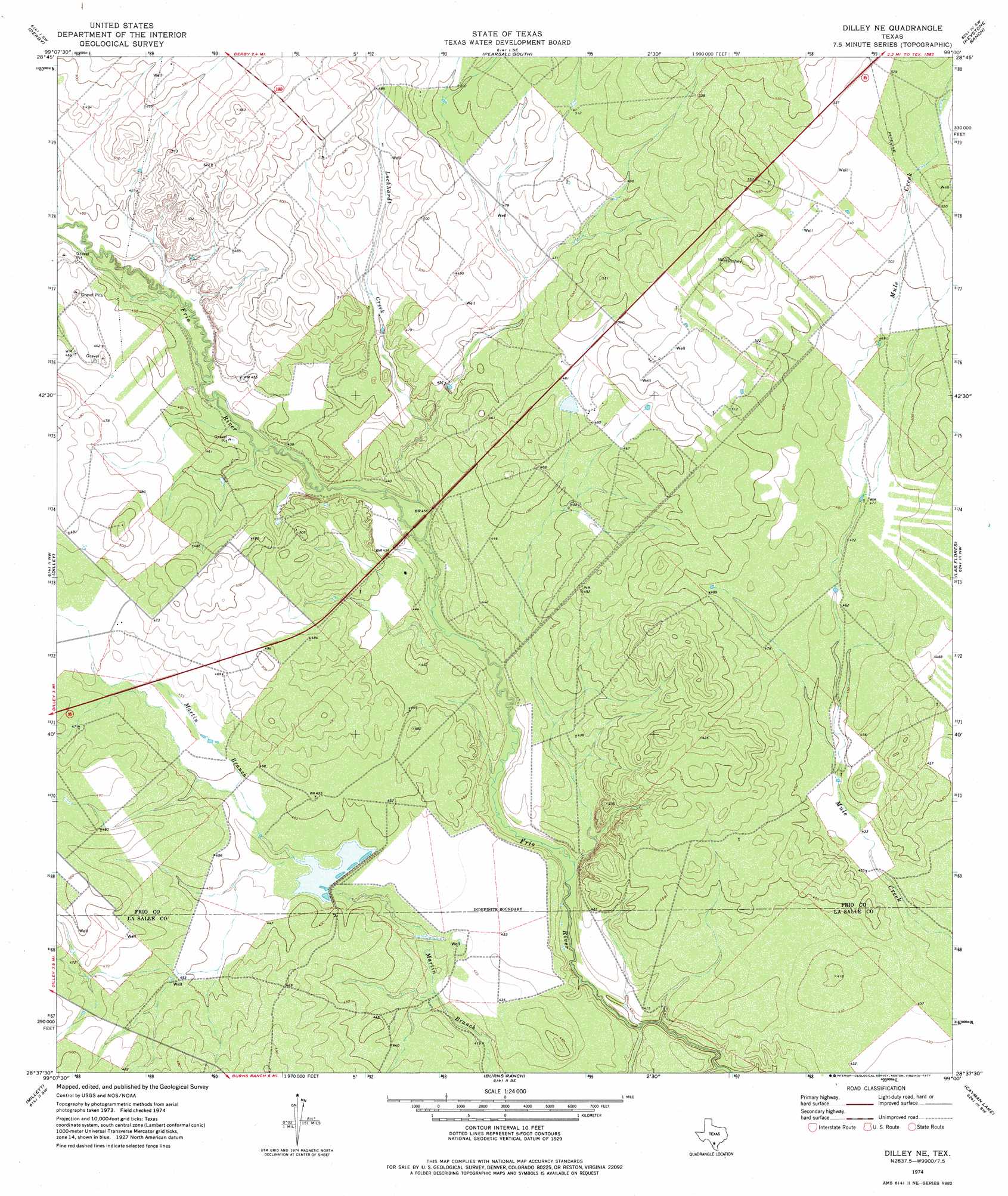
USGS Topo Quad 28099f1 - 1:24,000 scale
| Topo Map Name: | Dilley Ne |
| USGS Topo Quad ID: | 28099f1 |
| Print Size: | ca. 21 1/4" wide x 27" high |
| Southeast Coordinates: | 28.625° N latitude / 99° W longitude |
| Map Center Coordinates: | 28.6875° N latitude / 99.0625° W longitude |
| U.S. State: | TX |
| Filename: | o28099f1.jpg |
| Download Map JPG Image: | Dilley Ne topo map 1:24,000 scale |
| Map Type: | Topographic |
| Topo Series: | 7.5´ |
| Map Scale: | 1:24,000 |
| Source of Map Images: | United States Geological Survey (USGS) |
| Alternate Map Versions: |
Dilley NE TX 1974, updated 1977 Download PDF Buy paper map Dilley NE TX 2010 Download PDF Buy paper map Dilley NE TX 2013 Download PDF Buy paper map Dilley NE TX 2016 Download PDF Buy paper map |
1:24,000 Topo Quads surrounding Dilley Ne
Holcomb Reservoir |
Halff Ranch |
Pearsall North |
Schattel Nw |
Schattel |
Divot |
Derby |
Pearsall South |
Keystone Ranch |
Goldfinch |
Woodward Ne |
Dilley |
Dilley Ne |
Las Flores |
Hindes |
Woodward |
Millett |
Burns Ranch |
Cayman Lake |
Zella |
Harris Lake |
Cotulla |
Los Angeles |
Dull |
Fowlerton |
> Back to 28099e1 at 1:100,000 scale
> Back to 28098a1 at 1:250,000 scale
> Back to U.S. Topo Maps home
Dilley Ne topo map: Gazetteer
Dilley Ne: Dams
Burns Reservoir Dam elevation 132m 433′Burns Reservoir Dam elevation 133m 436′
Thompson Lake Dam elevation 138m 452′
Dilley Ne: Reservoirs
Burns Reservoir elevation 132m 433′Burns Reservoir elevation 133m 436′
Thompson Lake elevation 138m 452′
Dilley Ne: Streams
Lockhardt Creek elevation 128m 419′Dilley Ne digital topo map on disk
Buy this Dilley Ne topo map showing relief, roads, GPS coordinates and other geographical features, as a high-resolution digital map file on DVD: