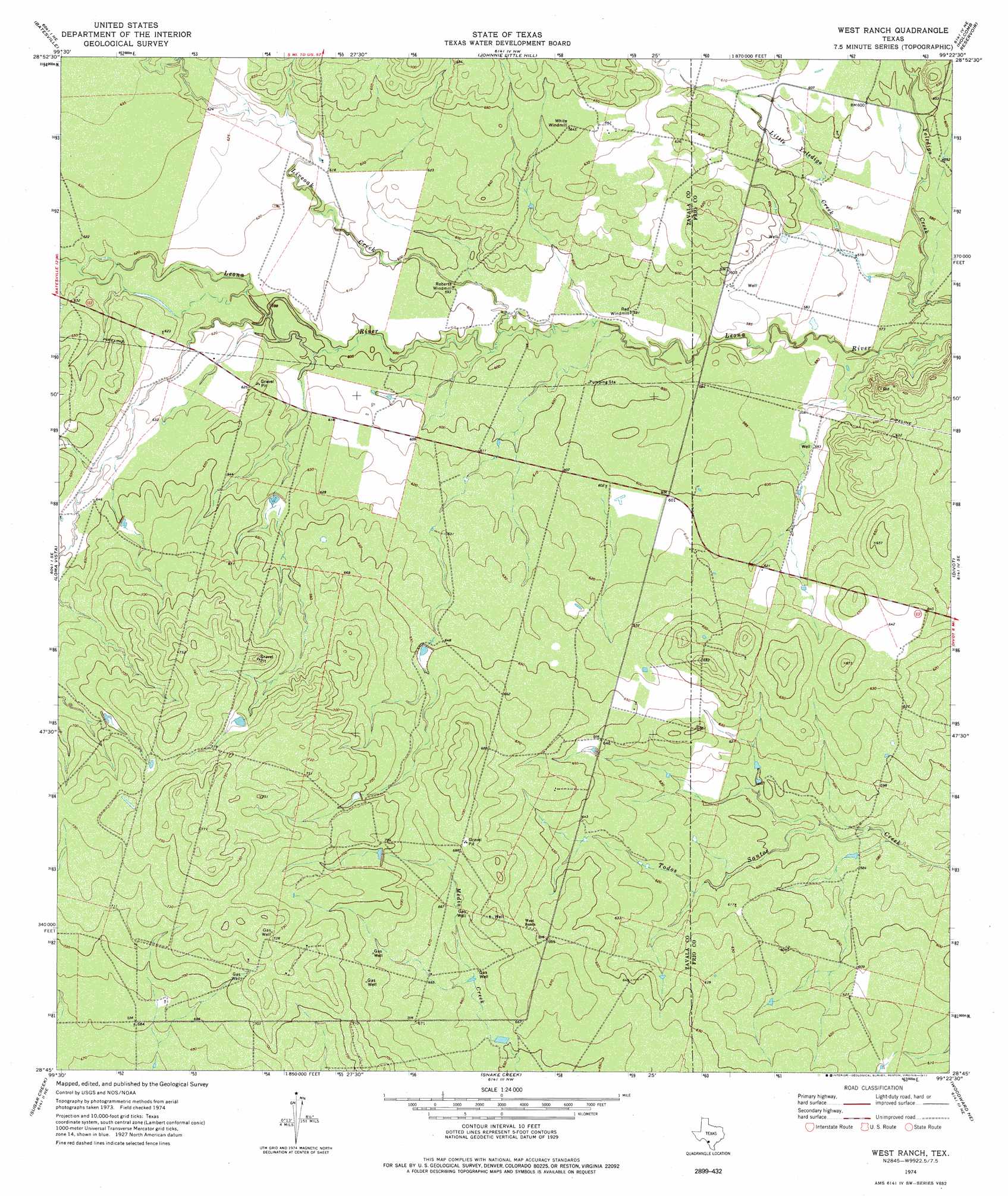
West Ranch Topo Map Texas
To zoom in, hover over the map of West Ranch
USGS Topo Quad 28099g4 - 1:24,000 scale
| Topo Map Name: | West Ranch |
| USGS Topo Quad ID: | 28099g4 |
| Print Size: | ca. 21 1/4" wide x 27" high |
| Southeast Coordinates: | 28.75° N latitude / 99.375° W longitude |
| Map Center Coordinates: | 28.8125° N latitude / 99.4375° W longitude |
| U.S. State: | TX |
| Filename: | o28099g4.jpg |
| Download Map JPG Image: | West Ranch topo map 1:24,000 scale |
| Map Type: | Topographic |
| Topo Series: | 7.5´ |
| Map Scale: | 1:24,000 |
| Source of Map Images: | United States Geological Survey (USGS) |
| Alternate Map Versions: |
West Ranch TX 1974, updated 1977 Download PDF Buy paper map West Ranch TX 2010 Download PDF Buy paper map West Ranch TX 2013 Download PDF Buy paper map West Ranch TX 2016 Download PDF Buy paper map |
1:24,000 Topo Quads surrounding West Ranch
Batesville Hill |
Lone Tree Hill |
Gross Tank |
Frio Town |
Wilson Ranch |
Batesville Nw |
Batesville |
Johnnie Little Hill |
Holcomb Reservoir |
Halff Ranch |
Batesville Sw |
Loma Vista |
West Ranch |
Divot |
Derby |
Woodard Lake |
Sugar Creek |
Snake Creek |
Woodward Ne |
Dilley |
Brundage |
Big Wells |
Las Vegas |
Woodward |
Millett |
> Back to 28099e1 at 1:100,000 scale
> Back to 28098a1 at 1:250,000 scale
> Back to U.S. Topo Maps home
West Ranch topo map: Gazetteer
West Ranch: Streams
Little Yoledigo Creek elevation 174m 570′Liveoak Creek elevation 179m 587′
West Ranch digital topo map on disk
Buy this West Ranch topo map showing relief, roads, GPS coordinates and other geographical features, as a high-resolution digital map file on DVD: