Cometa Topo Map Texas
To zoom in, hover over the map of Cometa
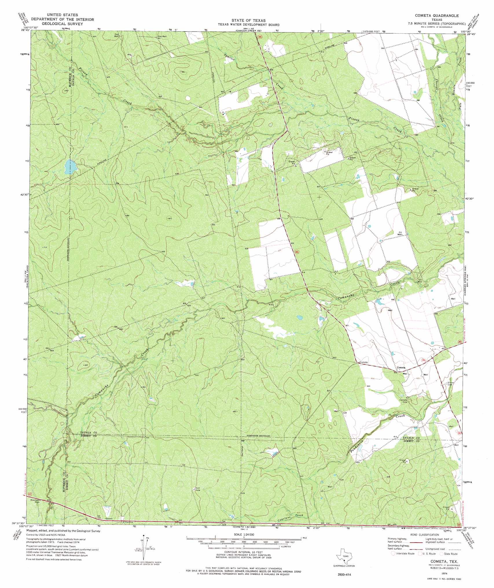
USGS Topo Quad 28100f1 - 1:24,000 scale
| Topo Map Name: | Cometa |
| USGS Topo Quad ID: | 28100f1 |
| Print Size: | ca. 21 1/4" wide x 27" high |
| Southeast Coordinates: | 28.625° N latitude / 100° W longitude |
| Map Center Coordinates: | 28.6875° N latitude / 100.0625° W longitude |
| U.S. State: | TX |
| Filename: | o28100f1.jpg |
| Download Map JPG Image: | Cometa topo map 1:24,000 scale |
| Map Type: | Topographic |
| Topo Series: | 7.5´ |
| Map Scale: | 1:24,000 |
| Source of Map Images: | United States Geological Survey (USGS) |
| Alternate Map Versions: |
Cometa TX 1974, updated 1977 Download PDF Buy paper map Cometa TX 2010 Download PDF Buy paper map Cometa TX 2012 Download PDF Buy paper map Cometa TX 2016 Download PDF Buy paper map |
1:24,000 Topo Quads surrounding Cometa
Trosado Tank |
Chacon Creek Nw |
Chacon Creek Ne |
La Pryor Nw |
La Pryor |
Indian Tank |
Chacon Creek Sw |
Chacon Creek Se |
Beef Hollow Creek |
La Pryor Se |
Eagle Pass Ne |
Sacatosa Tank |
Cometa |
Carrizo Springs Nw |
Crystal City |
El Indio |
Farias Ranch |
Cayetano Creek |
Carrizo Springs West |
Carrizo Springs East |
Indio Creek |
Indio Tank |
Palo Blanco Tank |
Asherton Nw |
Asherton |
> Back to 28100e1 at 1:100,000 scale
> Back to 28100a1 at 1:250,000 scale
> Back to U.S. Topo Maps home
Cometa topo map: Gazetteer
Cometa: Airports
Chacon Creek Ranch Airport elevation 180m 590′Picosa Ranch Airport elevation 185m 606′
Cometa: Dams
Farias Ranch Lake Number 1 Dam elevation 218m 715′Cometa: Populated Places
Cometa elevation 193m 633′Cometa: Reservoirs
Farias Ranch Lake Number 1 elevation 218m 715′Cometa: Streams
Cayetano Creek elevation 191m 626′Chacon Creek elevation 174m 570′
Spurler Creek elevation 178m 583′
Cometa digital topo map on disk
Buy this Cometa topo map showing relief, roads, GPS coordinates and other geographical features, as a high-resolution digital map file on DVD: