Chacon Creek Nw Topo Map Texas
To zoom in, hover over the map of Chacon Creek Nw
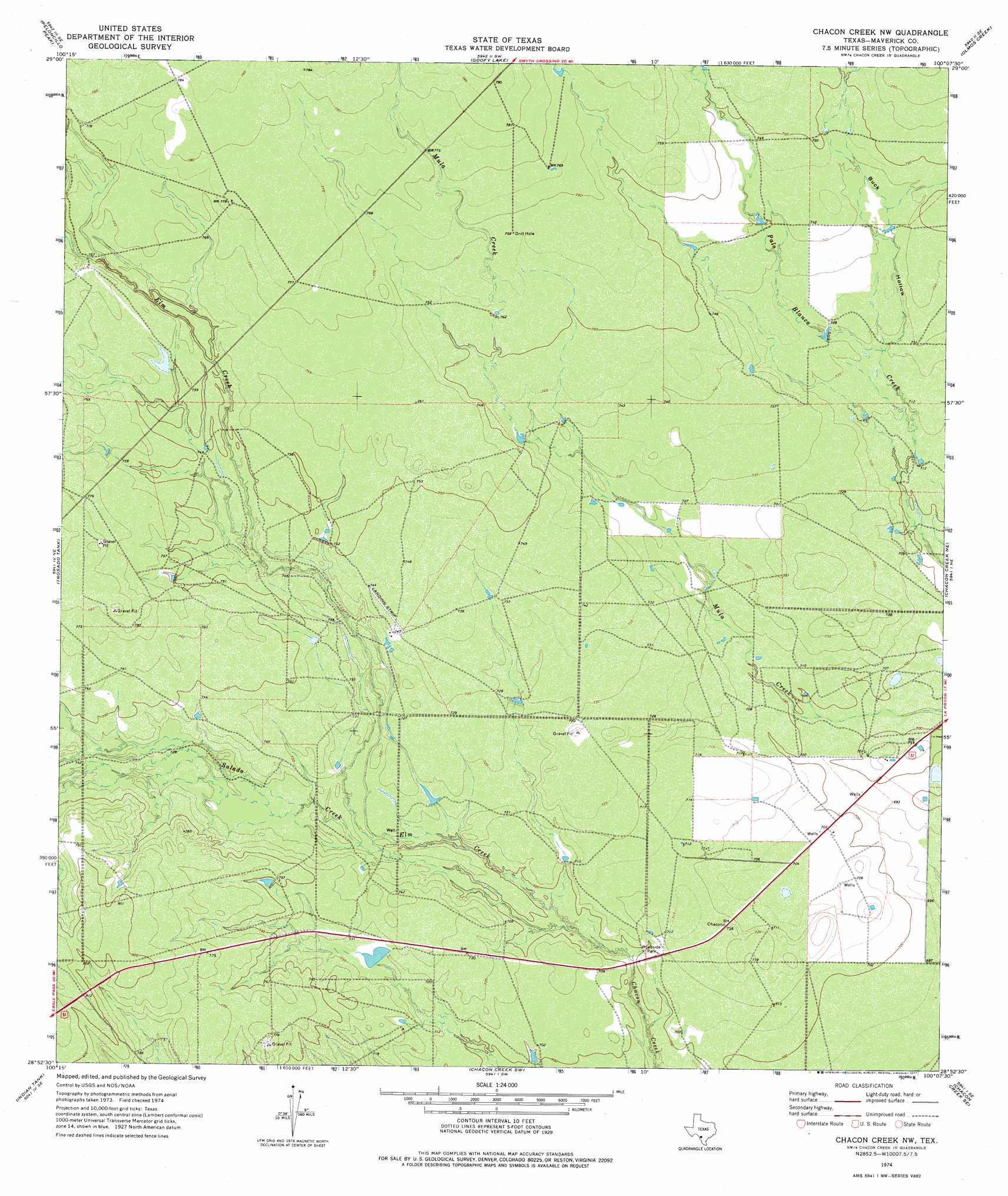
USGS Topo Quad 28100h2 - 1:24,000 scale
| Topo Map Name: | Chacon Creek Nw |
| USGS Topo Quad ID: | 28100h2 |
| Print Size: | ca. 21 1/4" wide x 27" high |
| Southeast Coordinates: | 28.875° N latitude / 100.125° W longitude |
| Map Center Coordinates: | 28.9375° N latitude / 100.1875° W longitude |
| U.S. State: | TX |
| Filename: | o28100h2.jpg |
| Download Map JPG Image: | Chacon Creek Nw topo map 1:24,000 scale |
| Map Type: | Topographic |
| Topo Series: | 7.5´ |
| Map Scale: | 1:24,000 |
| Source of Map Images: | United States Geological Survey (USGS) |
| Alternate Map Versions: |
Chacon Creek NW TX 1974, updated 1977 Download PDF Buy paper map Chacon Creek NW TX 2010 Download PDF Buy paper map Chacon Creek NW TX 2012 Download PDF Buy paper map Chacon Creek NW TX 2016 Download PDF Buy paper map |
1:24,000 Topo Quads surrounding Chacon Creek Nw
Spofford |
Anacacho |
Odlaw |
Cline |
Hacienda |
Imperialist Tank |
Peloncillo Peak |
Goofy Lake |
Olmos Creek |
Sand Mountain |
Paloma |
Trosado Tank |
Chacon Creek Nw |
Chacon Creek Ne |
La Pryor Nw |
Deadmans Hill |
Indian Tank |
Chacon Creek Sw |
Chacon Creek Se |
Beef Hollow Creek |
Eagle Pass East |
Eagle Pass Ne |
Sacatosa Tank |
Cometa |
Carrizo Springs Nw |
> Back to 28100e1 at 1:100,000 scale
> Back to 28100a1 at 1:250,000 scale
> Back to U.S. Topo Maps home
Chacon Creek Nw topo map: Gazetteer
Chacon Creek Nw: Streams
Elm Creek elevation 210m 688′Salado Creek elevation 210m 688′
Chacon Creek Nw: Valleys
Buck Hollow elevation 220m 721′Chacon Creek Nw digital topo map on disk
Buy this Chacon Creek Nw topo map showing relief, roads, GPS coordinates and other geographical features, as a high-resolution digital map file on DVD: