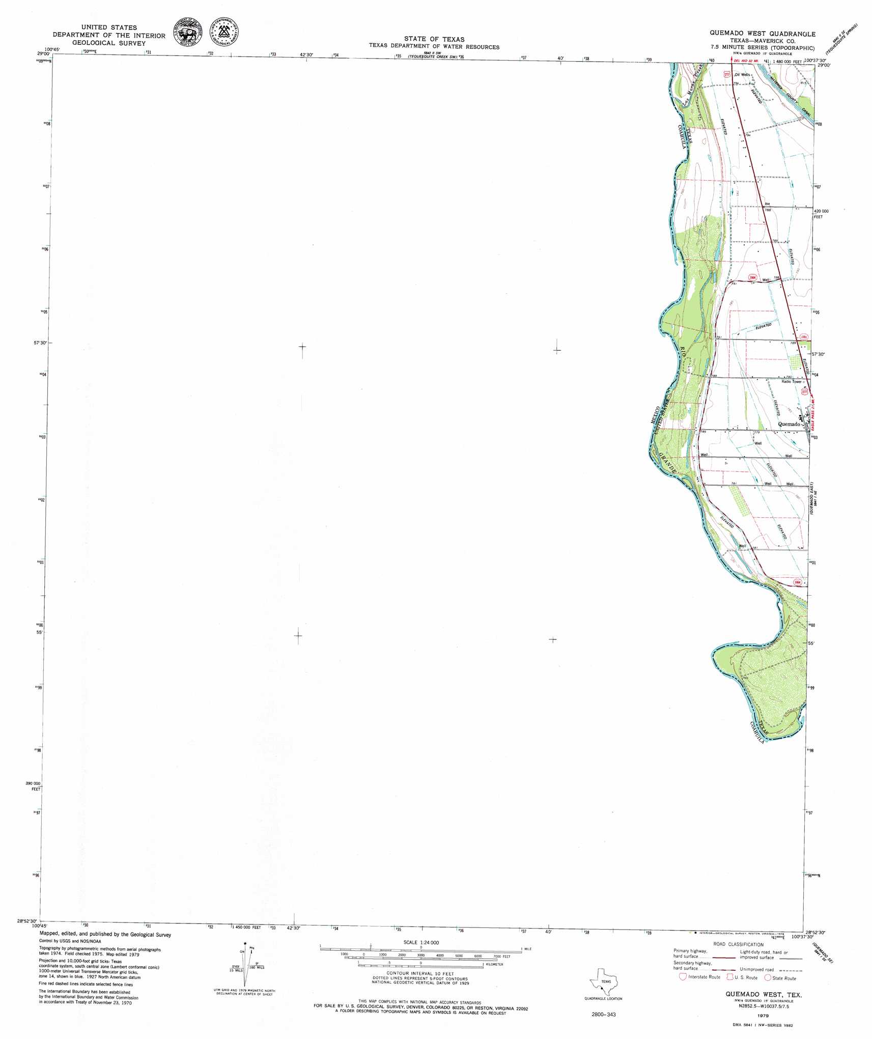
Quemado West Topo Map Texas
To zoom in, hover over the map of Quemado West
USGS Topo Quad 28100h6 - 1:24,000 scale
| Topo Map Name: | Quemado West |
| USGS Topo Quad ID: | 28100h6 |
| Print Size: | ca. 21 1/4" wide x 27" high |
| Southeast Coordinates: | 28.875° N latitude / 100.625° W longitude |
| Map Center Coordinates: | 28.9375° N latitude / 100.6875° W longitude |
| U.S. State: | TX |
| Filename: | o28100h6.jpg |
| Download Map JPG Image: | Quemado West topo map 1:24,000 scale |
| Map Type: | Topographic |
| Topo Series: | 7.5´ |
| Map Scale: | 1:24,000 |
| Source of Map Images: | United States Geological Survey (USGS) |
| Alternate Map Versions: |
Quemado West TX 1979, updated 1979 Download PDF Buy paper map Quemado West TX 2010 Download PDF Buy paper map Quemado West TX 2012 Download PDF Buy paper map Quemado West TX 2016 Download PDF Buy paper map |
1:24,000 Topo Quads surrounding Quemado West
Maverick Dam |
Cow Creek Tank |
Tequesquite Creek Ne |
Spofford |
|
Tequesquite Creek Sw |
Tequesquite Spring |
Imperialist Tank |
||
Quemado West |
Quemado East |
Paloma |
||
Quemado Se |
Deadmans Hill |
|||
Eagle Pass West |
Eagle Pass East |
> Back to 28100e1 at 1:100,000 scale
> Back to 28100a1 at 1:250,000 scale
> Back to U.S. Topo Maps home
Quemado West digital topo map on disk
Buy this Quemado West topo map showing relief, roads, GPS coordinates and other geographical features, as a high-resolution digital map file on DVD: